Indy tied a record from 1896 on Wednesday, with a high of 89. Same high temp in Lafayette, Muncie, and Kokomo. The high hit 90 in Bloomington and the Haute.
The biggest difference today? Less humid air is filtering in from the east.
The humidity will be up just a bit tomorrow, but not as muggy as it was earlier this week.
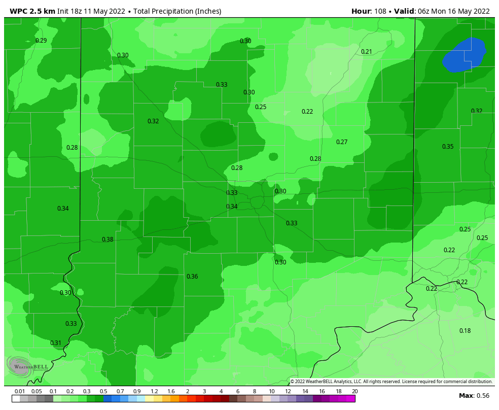
The next best chance of rain and storms is this weekend, in both the afternoons and evenings. The big ridge above us will break down, as an upper level low to our southeast retrogrades to the northwest. That low will combine with a weak cold front at the surface to bring back unsettled weather. Severe weather chances are pretty low, with not a lot of upper level winds. That may contribute to the threat of slow moving rain and storms that could cause isolated flooding. Otherwise, rain totals should generally stay around a third of an inch.
Never miss me! Subscribe for free. My Huge Radar has real-time weather tracking, current temperatures, and severe weather watches and warnings. Get detailed Indiana conditions by clicking here. Click here to see my central Indiana 7-Day Forecast. Follow these links to get my forecasts for Lafayette, Muncie, Hendricks County, and Hamilton County. Need a second opinion? Click here for central Indiana National Weather Service forecasts. (Some charts via WeatherBELL.)
INDY SEVEN DAY FORECAST
Today: Mostly sunny. Not as humid. High 87.
Tonight: Clear. Low 62.
Friday: Mostly sunny. High 86.
Friday Night: Mostly clear. Low 62.
Saturday: Partly to mostly cloudy. Scattered showers and storms, mainly in the afternoon. High 83.
Saturday Night: Partly cloudy. Scattered showers and storms. Low 62.
Sunday: Partly sunny. Scattered showers and storms in the afternoon. High 81.
Sunday Night: Partly cloudy. Scattered showers and storms. Low 56.
Monday: Mostly sunny. High 76.
Monday Night: Mostly clear. Low 55.
Tuesday: Partly sunny. High 75.
Tuesday Night: Spotty showers. Low 55.
Wednesday: Partly sunny. Periods of showers. High 74.

Never miss me! Subscribe for free. My Huge Radar has real-time weather tracking, current temperatures, and severe weather watches and warnings. Get detailed Indiana conditions by clicking here. Click here to see my central Indiana 7-Day Forecast. Follow these links to get my forecasts for Lafayette, Muncie, Hendricks County, and Hamilton County. Need a second opinion? Click here for central Indiana National Weather Service forecasts. (Some charts via WeatherBELL.)


