Five of the first eight days of May featured measurable precipitation, so this six(!) day dry stretch is welcome. The next best chance for rainfall doesn’t arrive until the weekend. These are potential totals through late Sunday night. The bulk of this will arrive on Sunday.
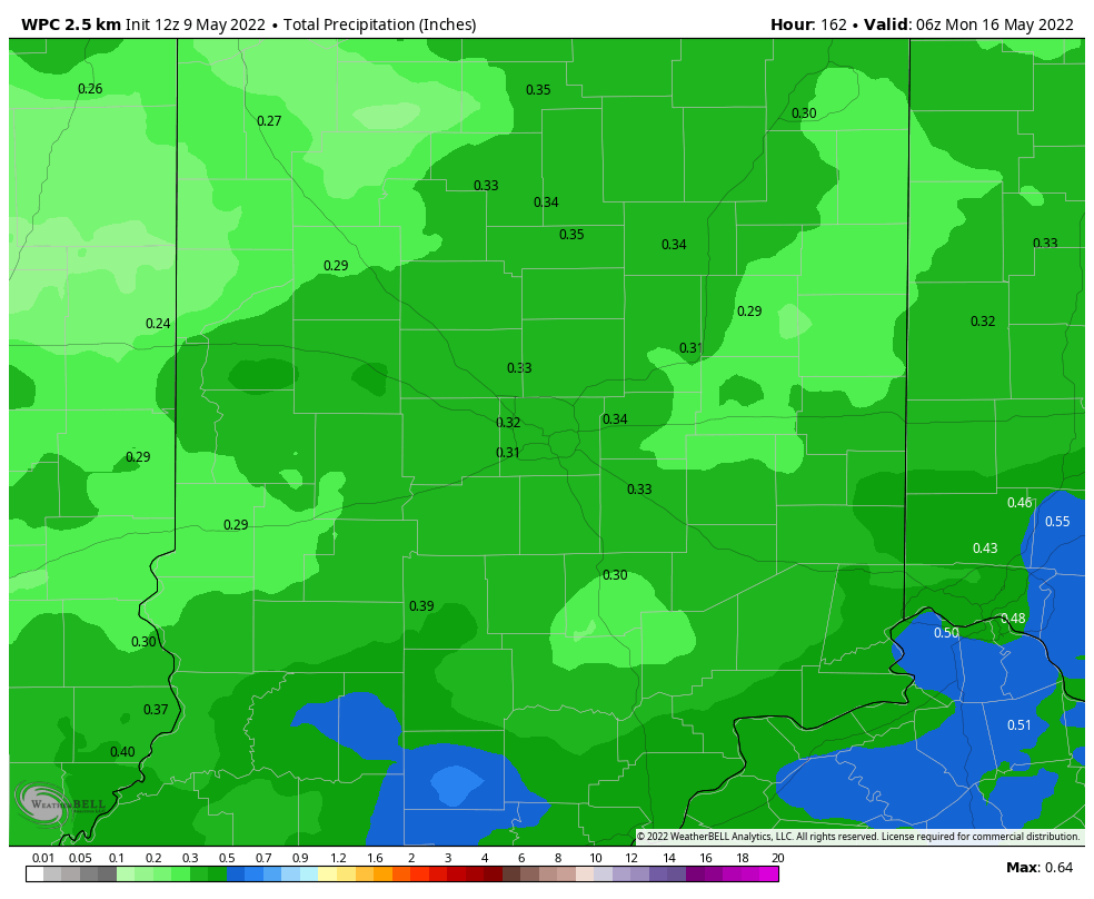
We’re running just a few hundreds of an inch behind for May, and we’re still about an inch ahead for the year to date.
Never miss me! Subscribe for free. My Huge Radar has real-time weather tracking, current temperatures, and severe weather watches and warnings. Get detailed Indiana conditions by clicking here. Click here to see my central Indiana 7-Day Forecast. Follow these links to get my forecasts for Lafayette, Muncie, Hendricks County, and Hamilton County. Need a second opinion? Click here for central Indiana National Weather Service forecasts. (Some charts via WeatherBELL.)
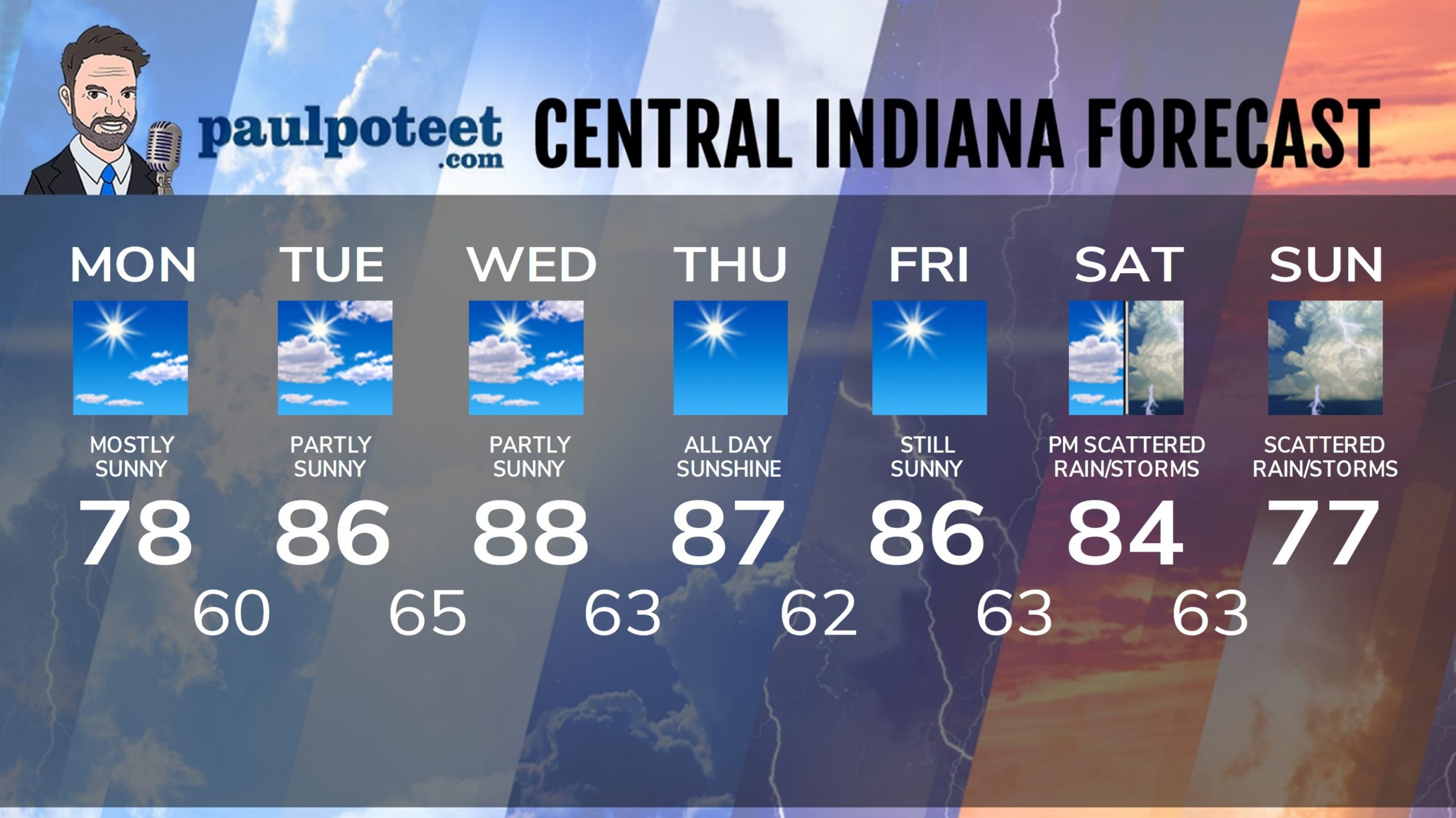
INDY SEVEN DAY FORECAST
Today: Mostly sunny, and warmer! Wind gusting to 30 mph in the afternoon. High 78.
Tonight: Mostly clear. Low 60.
Tuesday: Partly sunny. Humidity increases. High 86.
Tuesday Night: Mostly clear, and muggy. Low 65.
Wednesday: Partly sunny, hot and humid. Record high possible. High 88.
Wednesday Night: Mostly clear. Low 63.
Thursday: Sunny. Not as humid. High 87.
Thursday Night: Clear. Low 62.
Friday: Sunny. High 86.
Friday Night: Partly cloudy. Low 63.
Saturday: Partly sunny. Scattered showers and storms. High 84.
Saturday Night: Scattered showers and storms. Low 63.
Sunday: Partly sunny. Scattered showers and storms. High 77.
Never miss me! Subscribe for free. My Huge Radar has real-time weather tracking, current temperatures, and severe weather watches and warnings. Get detailed Indiana conditions by clicking here. Click here to see my central Indiana 7-Day Forecast. Follow these links to get my forecasts for Lafayette, Muncie, Hendricks County, and Hamilton County. Need a second opinion? Click here for central Indiana National Weather Service forecasts. (Some charts via WeatherBELL.)


