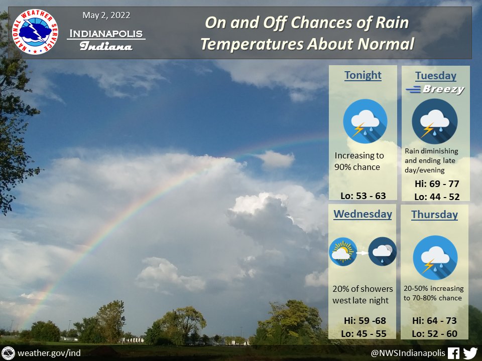
(Via @NWSIndianapolis.) Showers/t-storms tonight & Tue, strong/marginally severe E of Muncie/Indy/Shoals line Tue. Rain to end by Tue eve. Rain chances return late Wed night W IN & overspread the state Thu & Thu night. Near normal temps thru Thu night, w/ highs 59-77°, lows 44-63°. #INwx #nwsind https://t.co/lQeJCJgLvO
My Huge Radar has real-time weather tracking, current temperatures, and severe weather watches and warnings. Get detailed Indiana conditions by clicking here. Follow these links to get my forecasts for Lafayette, Muncie, Hendricks County, and Hamilton County. Need a second opinion? Click here for central Indiana National Weather Service forecasts.
Never miss me! Subscribe for free. My Huge Radar has real-time weather tracking, current temperatures, and severe weather watches and warnings. Get detailed Indiana conditions by clicking here. Click here to see my central Indiana 7-Day Forecast. Follow these links to get my forecasts for Lafayette, Muncie, Hendricks County, and Hamilton County. Need a second opinion? Click here for central Indiana National Weather Service forecasts. (Some charts via WeatherBELL.)


