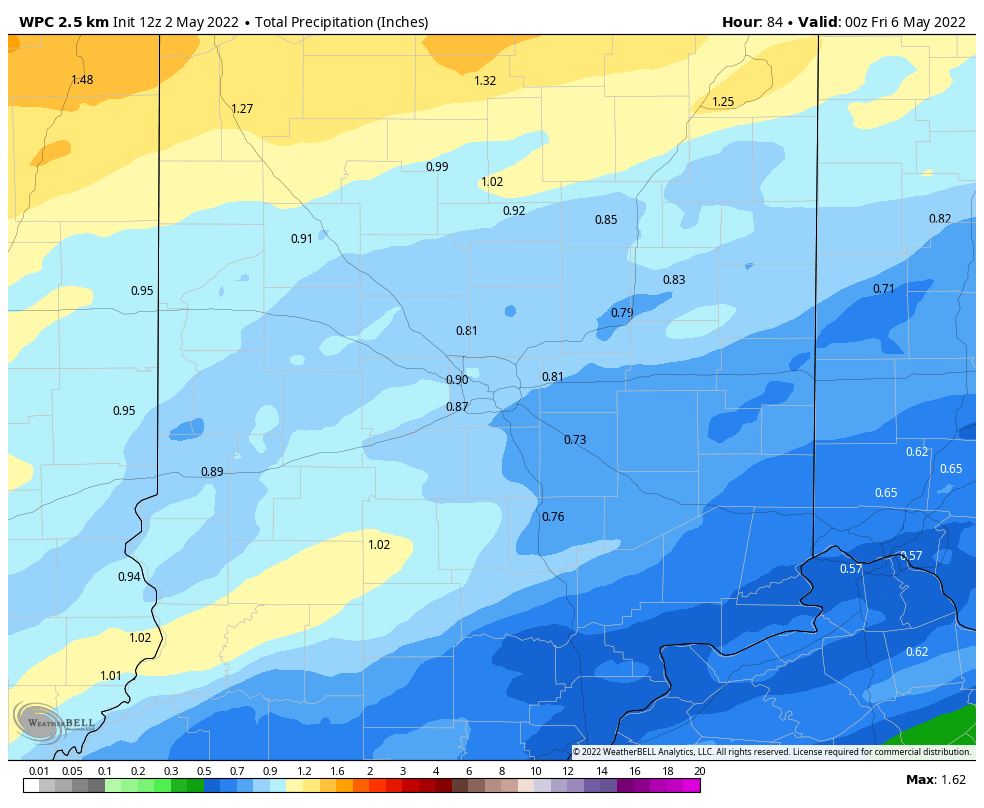
Up to an inch of rain may fall tomorrow across central Indiana, and severe thunderstorms are possible from around Indy eastward and southward.

Never miss me! Subscribe for free. My Huge Radar has real-time weather tracking, current temperatures, and severe weather watches and warnings. Get detailed Indiana conditions by clicking here. Click here to see my central Indiana 7-Day Forecast. Follow these links to get my forecasts for Lafayette, Muncie, Hendricks County, and Hamilton County. Need a second opinion? Click here for central Indiana National Weather Service forecasts. (Some charts via WeatherBELL.)
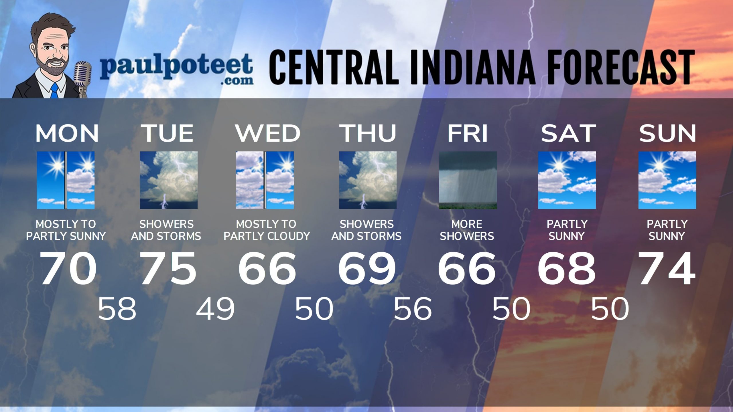
INDY SEVEN DAY FORECAST
Today: Mostly sunny morning. Partly sunny later afternoon. High 70.
Tonight: Clouding up. Showers after midnight. Low 58.
Tuesday: Periods of showers and storms. Strong storms and heavy rainfall are possible. High 75.
Tuesday Night: Scattered showers and storms in the evening, then mostly cloudy. Low 49.
Wednesday: Mostly to partly cloudy. High 66.
Wednesday Night: Partly cloudy. Low 50.
Thursday: Rainy day. Thunder possible. High 69.
Thursday Night: Showers and storms. Low 56.
Friday: More showers. High 66.
Friday Night: Spotty showers. Low 50.
Saturday: Partly sunny. High 68.
Saturday Night: Partly cloudy. Low 50.
Sunday: Partly sunny. High 74.
Never miss me! Subscribe for free. My Huge Radar has real-time weather tracking, current temperatures, and severe weather watches and warnings. Get detailed Indiana conditions by clicking here. Click here to see my central Indiana 7-Day Forecast. Follow these links to get my forecasts for Lafayette, Muncie, Hendricks County, and Hamilton County. Need a second opinion? Click here for central Indiana National Weather Service forecasts. (Some charts via WeatherBELL.)


