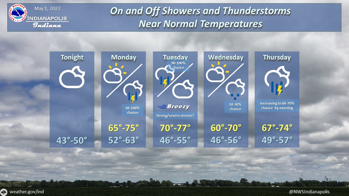
(Via @NWSIndianapolis.) Showers & t-storms are expected Mon night/Tue & Wed night thru Sat. Breezy, w/storms Tue having potential to become strong/severe, greatest chance SE of Indy. Near normal temps thru Thu night, with highs 60-77°, lows 43-63°, warmest Mon night/Tue. #INwx #nwsind https://t.co/6M1TtHpAgS
My Huge Radar has real-time weather tracking, current temperatures, and severe weather watches and warnings. Get detailed Indiana conditions by clicking here. Follow these links to get my forecasts for Lafayette, Muncie, Hendricks County, and Hamilton County. Need a second opinion? Click here for central Indiana National Weather Service forecasts.
Never miss me! Subscribe for free. My Huge Radar has real-time weather tracking, current temperatures, and severe weather watches and warnings. Get detailed Indiana conditions by clicking here. Click here to see my central Indiana 7-Day Forecast. Follow these links to get my forecasts for Lafayette, Muncie, Hendricks County, and Hamilton County. Need a second opinion? Click here for central Indiana National Weather Service forecasts. (Some charts via WeatherBELL.)


