Storms Saturday evening were strong, but not severe in Indiana. There was 1.20″ of rainfall at Indy. Exactly half an inch fell in Muncie, with about two-tenths of an inch in Lafayette, and a third in Terre Haute. It was Indy’s biggest rain total of April. Bring on the May flowers!
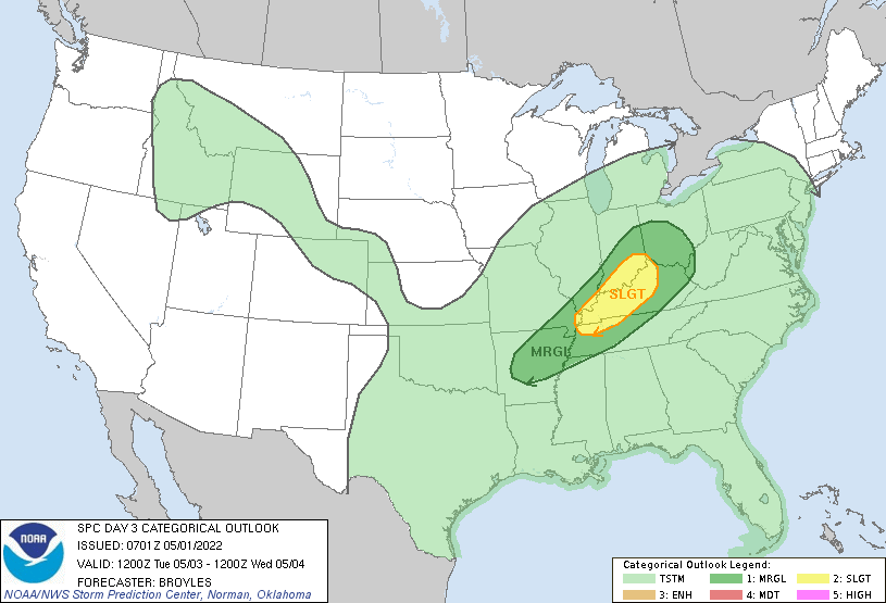
There is a level one (of five) risk of severe weather again on Tuesday.
Never miss me! Subscribe for free. My Huge Radar has real-time weather tracking, current temperatures, and severe weather watches and warnings. Get detailed Indiana conditions by clicking here. Click here to see my central Indiana 7-Day Forecast. Follow these links to get my forecasts for Lafayette, Muncie, Hendricks County, and Hamilton County. Need a second opinion? Click here for central Indiana National Weather Service forecasts. (Some charts via WeatherBELL.)
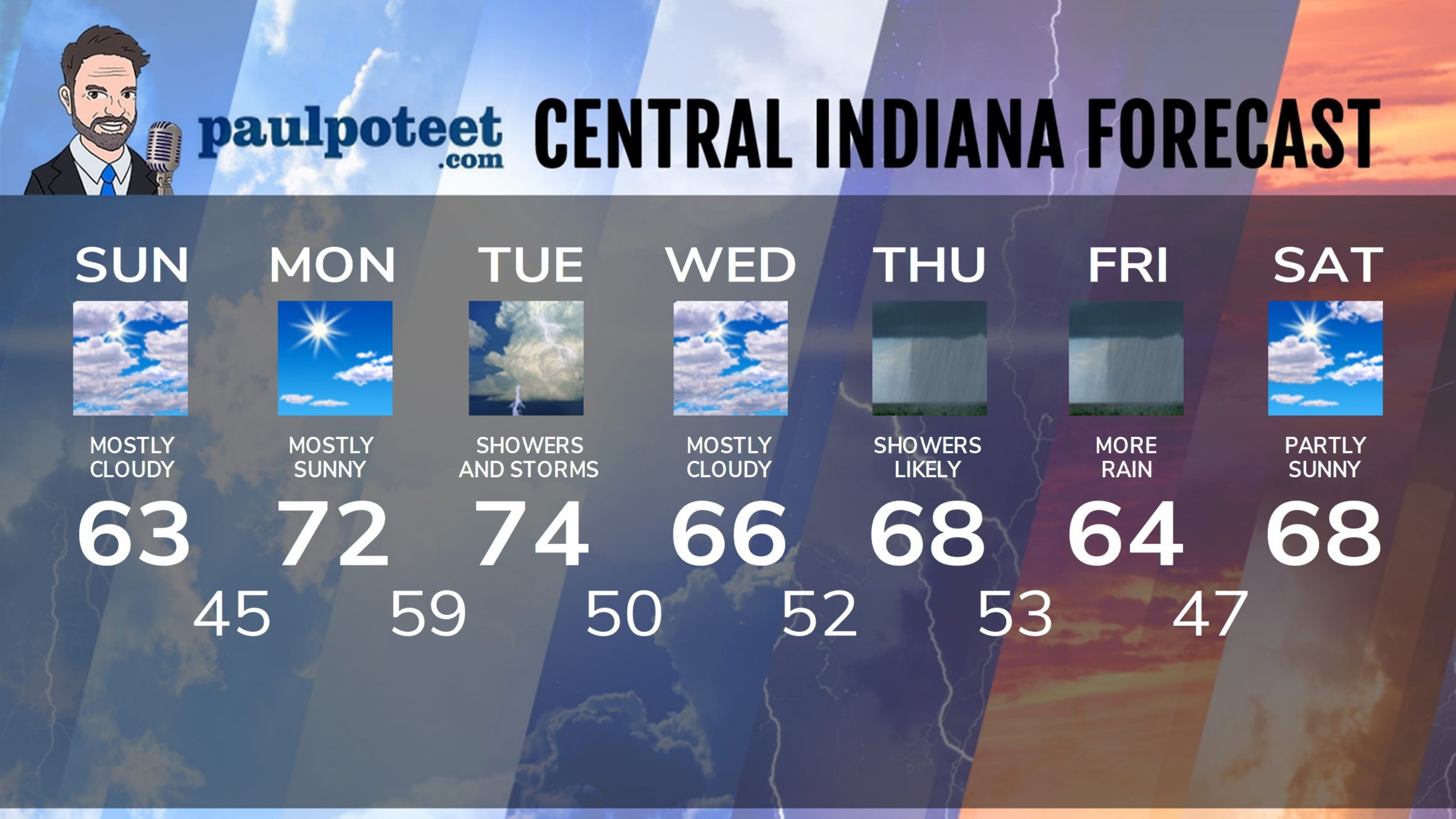
INDY SEVEN DAY FORECAST
Today: Mostly cloudy, and cooler. High 63.
Tonight: Clouds decrease. Low 45.
Monday: Mostly sunny morning. Partly sunny later afternoon. High 72.
Monday Night: Clouding up. Showers after midnight. Low 59.
Tuesday: Periods of showers and storms. Strong storms and heavy rainfall are possible. High 74.
Tuesday Night: Scattered showers and storms. Low 50.
Wednesday: Mostly cloudy. High 66.
Wednesday Night: Showers return after midnight. Low 52.
Thursday: Rainy day. High 68.
Thursday Night: Showers likely. Low 53.
Friday: More showers. High 64.
Friday Night: Spotty showers. Low 47.
Saturday: Partly sunny. High 68.
Never miss me! Subscribe for free. My Huge Radar has real-time weather tracking, current temperatures, and severe weather watches and warnings. Get detailed Indiana conditions by clicking here. Click here to see my central Indiana 7-Day Forecast. Follow these links to get my forecasts for Lafayette, Muncie, Hendricks County, and Hamilton County. Need a second opinion? Click here for central Indiana National Weather Service forecasts. (Some charts via WeatherBELL.)


