Nothing snowy and nothing severe for the next week in central Indiana! What more could you want?
Not only has Indy measured more snow in April (1.6 inches) than in March…it was more snow than in January (1.2 inches!)
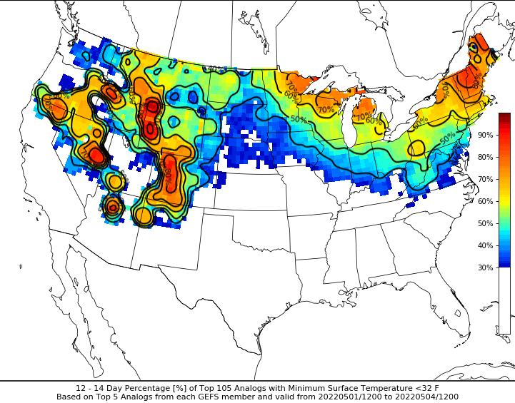
We’ll get closer to average today, and above it Thursday through Sunday. A cold front brings rain and storms later Sunday into Monday. And then: back below average, especially next Wednesday through Friday. Weather Analogs (analysis of similar historical weather patterns) point to at least one more freeze.
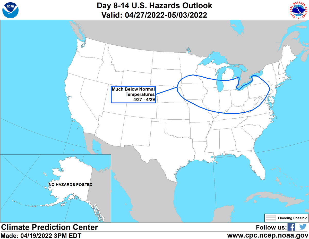
Meanwhile, the strong ridge building in the East should keep severe weather risk, and the heaviest rains to our west.
Never miss me! Subscribe for free. My Huge Radar has real-time weather tracking, current temperatures, and severe weather watches and warnings. Get detailed Indiana conditions by clicking here. Click here to see my central Indiana 7-Day Forecast. Follow these links to get my forecasts for Lafayette, Muncie, Hendricks County, and Hamilton County. Need a second opinion? Click here for central Indiana National Weather Service forecasts. (Some charts via WeatherBELL.)
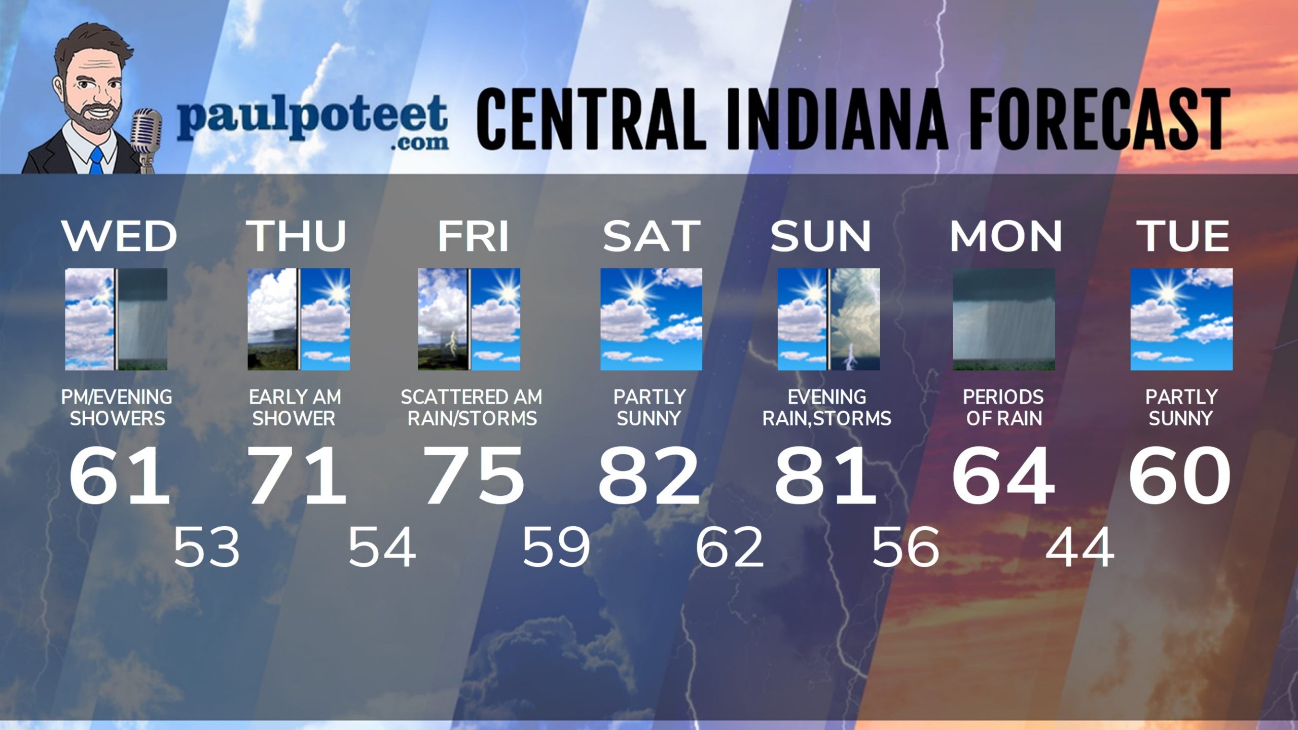
INDY SEVEN DAY FORECAST
Today: Partly to mostly cloudy. A few sprinkles or light showers. High 61.
Tonight: Rainy, with wind gusts to 35 mph. Low 53.
Thursday: Early morning shower chance. Partly sunny and warmer afternoon. High 71.
Thursday Night: Partly cloudy. Mostly cloudy overnight, with a scattered shower or storm possible. Low 54.
Friday: Morning shower and storm chances, then partly sunny. High 75.
Friday Night: Partly cloudy. Low 59.
Saturday: Partly sunny. High 82.
Saturday Night: Partly cloudy. Low 62.
Sunday: Partly sunny. High 81.
Sunday Night: Showers and storms. Low 56.
Monday: Mostly cloudy, with scattered showers and storms. High 64.
Monday Night: Partly cloudy. Low 44.
Tuesday: Partly sunny. High 60.
Never miss me! Subscribe for free. My Huge Radar has real-time weather tracking, current temperatures, and severe weather watches and warnings. Get detailed Indiana conditions by clicking here. Click here to see my central Indiana 7-Day Forecast. Follow these links to get my forecasts for Lafayette, Muncie, Hendricks County, and Hamilton County. Need a second opinion? Click here for central Indiana National Weather Service forecasts. (Some charts via WeatherBELL.)


