The National Weather Service is sending a damage survey team today to southeastern Decatur County, where a possible tornado touched down Wednesday night. The damage is concentrated between Westport and Millhousen. There weren’t any reports of injuries.
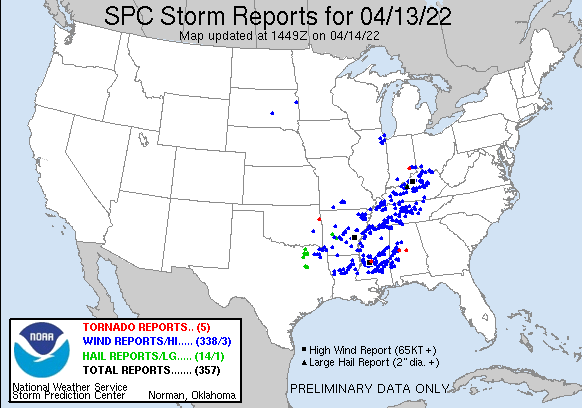
The nastiest weather was in southern Indiana, but widespread rain was common. Over an inch fell in Indy, and just under that in Lafayette. Muncie had about half an inch.
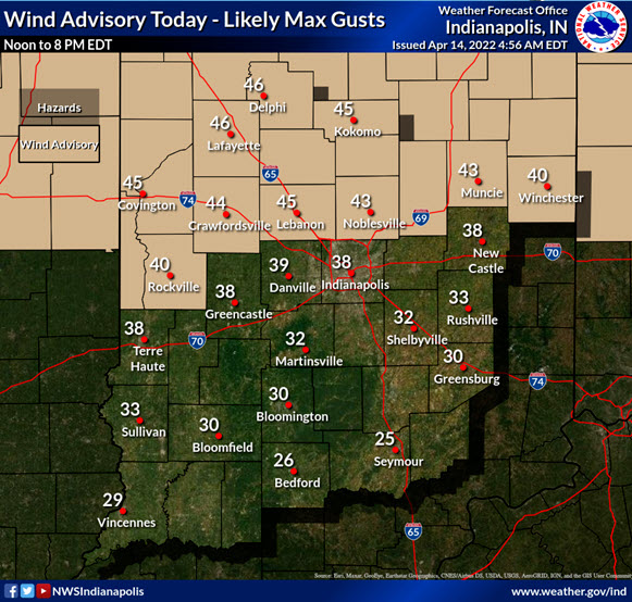
Today’s trouble: big breezes!
Never miss me! Subscribe for free. My Huge Radar has real-time weather tracking, current temperatures, and severe weather watches and warnings. Get detailed Indiana conditions by clicking here. Click here to see my central Indiana 7-Day Forecast. Follow these links to get my forecasts for Lafayette, Muncie, Hendricks County, and Hamilton County. Need a second opinion? Click here for central Indiana National Weather Service forecasts. (Some charts via WeatherBELL.)
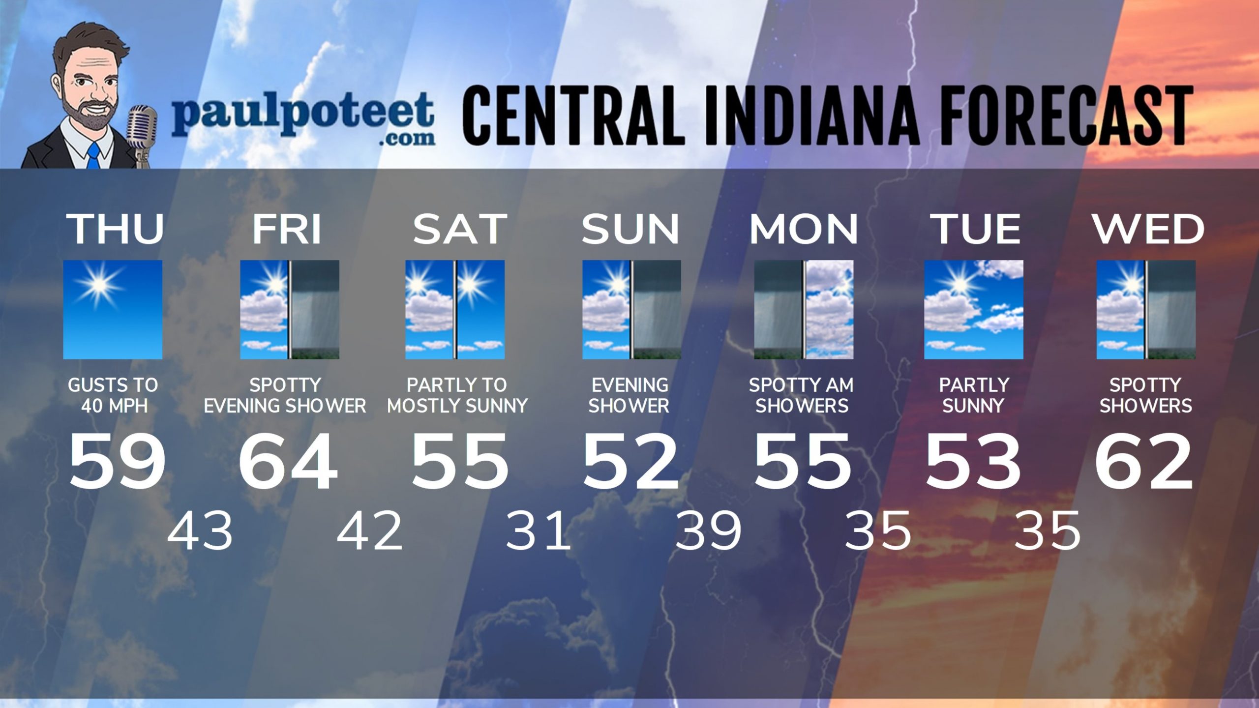
INDY SEVEN DAY FORECAST
Today: Sunny and breezy. Afternoon gusts to 40 mph. High 59.
Tonight: Mostly clear. Wind gusting to 35 mph. Low 43.
Friday: Partly sunny morning. Mostly cloudy afternoon. High 64.
Friday Night: Mostly cloudy, with a few spotty showers. Low 42.
Saturday: Partly to mostly sunny. High 55.
Saturday Night: Mostly clear. Low 31.
Easter Sunday: Morning sun, and afternoon clouds. High 52.
Sunday Night: Mostly cloudy, with spotty showers. Low 39.
Monday: Mostly to partly cloudy, with a few spotty showers in the morning. High 55.
Monday Night: Partly cloudy. Low 35.
Tuesday: Partly sunny. High 53.
Tuesday Night: Partly cloudy. Low 35.
Wednesday: Partly to mostly cloudy, with spotty showers. High 62.
Never miss me! Subscribe for free. My Huge Radar has real-time weather tracking, current temperatures, and severe weather watches and warnings. Get detailed Indiana conditions by clicking here. Click here to see my central Indiana 7-Day Forecast. Follow these links to get my forecasts for Lafayette, Muncie, Hendricks County, and Hamilton County. Need a second opinion? Click here for central Indiana National Weather Service forecasts. (Some charts via WeatherBELL.)


