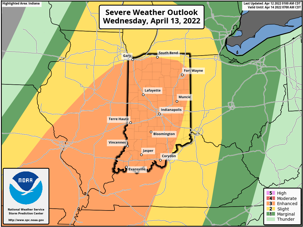
A Wild Wednesday is looking likely for Indiana. Virtually the entire state is under a level 3 (out of 5) risk of severe weather Wednesday afternoon and evening. All severe weather hazards are possible: large hail, damaging wind, and tornadoes. Heavy rainfall is also possible. Charge up your phones and have at least one way to get warnings. Remember, My Huge Radar always displays warnings, and they are also auto-posted by me on Twitter.
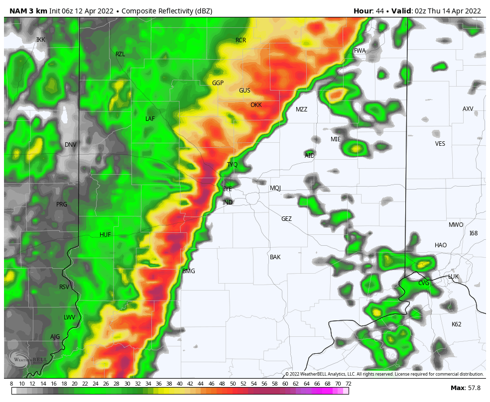
The most likely time is Wednesday evening. Here’s one computer modeled look at 10pm Tuesday. Other models have the line moving through the state a few hours earlier.
Never miss me! Subscribe for free. My Huge Radar has real-time weather tracking, current temperatures, and severe weather watches and warnings. Get detailed Indiana conditions by clicking here. Click here to see my central Indiana 7-Day Forecast. Follow these links to get my forecasts for Lafayette, Muncie, Hendricks County, and Hamilton County. Need a second opinion? Click here for central Indiana National Weather Service forecasts. (Some charts via WeatherBELL.)
INDY SEVEN DAY FORECAST
Today: Patchy morning fog. Partly to mostly cloudy. Isolated shower possible in the afternoon. High 69.
Tonight: Mostly cloudy. Scattered showers possible well after midnight. Low 61.
Wednesday: Showers and storms. Some storms will be severe in the mid to late afternoon. High 69.
Wednesday Night: Evening showers and storms. Some storms will be severe. Quiet after midnight. Low 42.
Thursday: Mostly sunny. Wind gusting to 40 mph. High 59.
Thursday Night: Mostly clear. Low 42.
Friday: Partly sunny. An isolated afternoon shower possible. High 63.
Friday Night: Partly cloudy. Isolated shower possible. Low 42.
Saturday: Partly sunny. High 59.
Saturday Night: Partly cloudy. Low 36.
Easter Sunday: Partly sunny. Spotty shower possible. High 56.
Sunday Night: Scattered showers. Low 40.
Monday: Mostly cloudy, with scattered showers. High 54.

Never miss me! Subscribe for free. My Huge Radar has real-time weather tracking, current temperatures, and severe weather watches and warnings. Get detailed Indiana conditions by clicking here. Click here to see my central Indiana 7-Day Forecast. Follow these links to get my forecasts for Lafayette, Muncie, Hendricks County, and Hamilton County. Need a second opinion? Click here for central Indiana National Weather Service forecasts. (Some charts via WeatherBELL.)


