A front that moved south across the state yesterday moves northward again today. Wander Indiana!
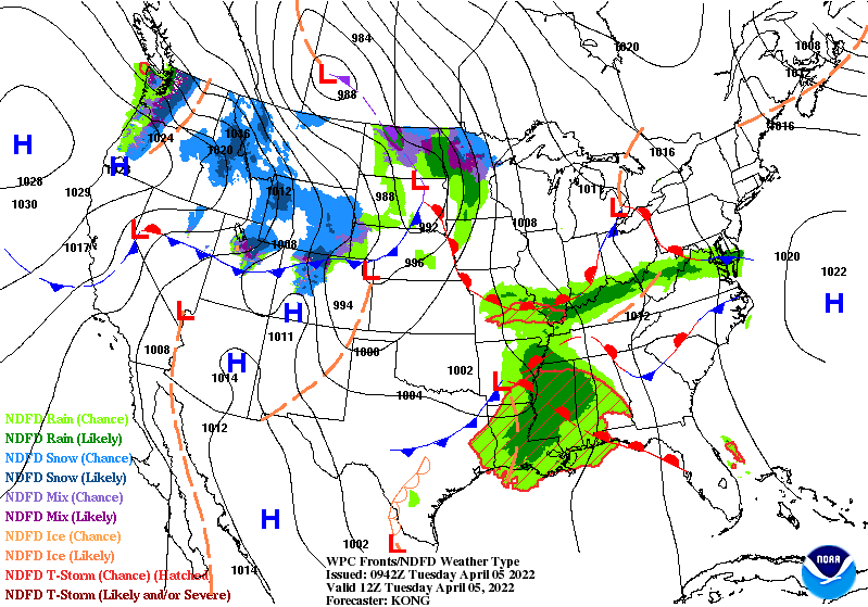
It means showers from late morning into afternoon. Amounts are looking low.
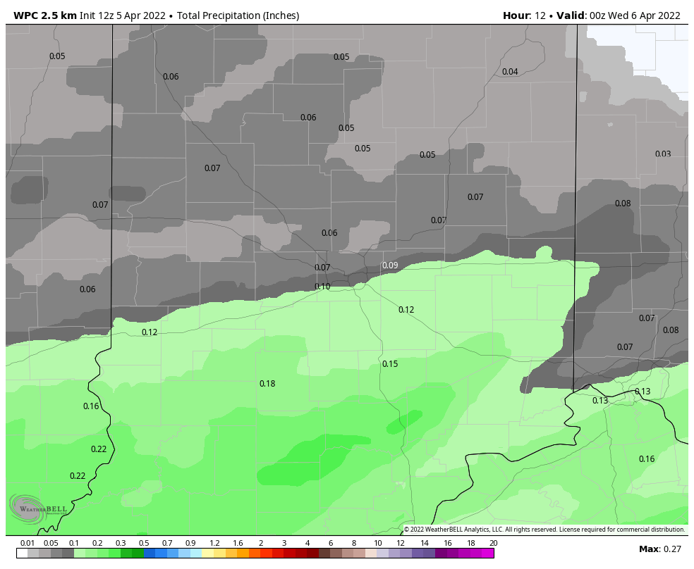
A COLD front arrives tomorrow, with more showers. Again: no heavy rain amounts, and no severe weather…however temperatures behind it will sink below normal again from Thursday through Saturday.

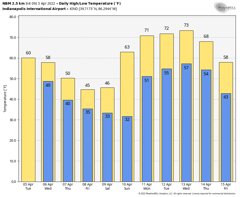
We will get warmer next week, with consecutive days in the 70s looking likely.
Never miss me! Subscribe for free. My Huge Radar has real-time weather tracking, current temperatures, and severe weather watches and warnings. Get detailed Indiana conditions by clicking here. Click here to see my central Indiana 7-Day Forecast. Follow these links to get my forecasts for Lafayette, Muncie, Hendricks County, and Hamilton County. Need a second opinion? Click here for central Indiana National Weather Service forecasts. (Some charts via WeatherBELL.)
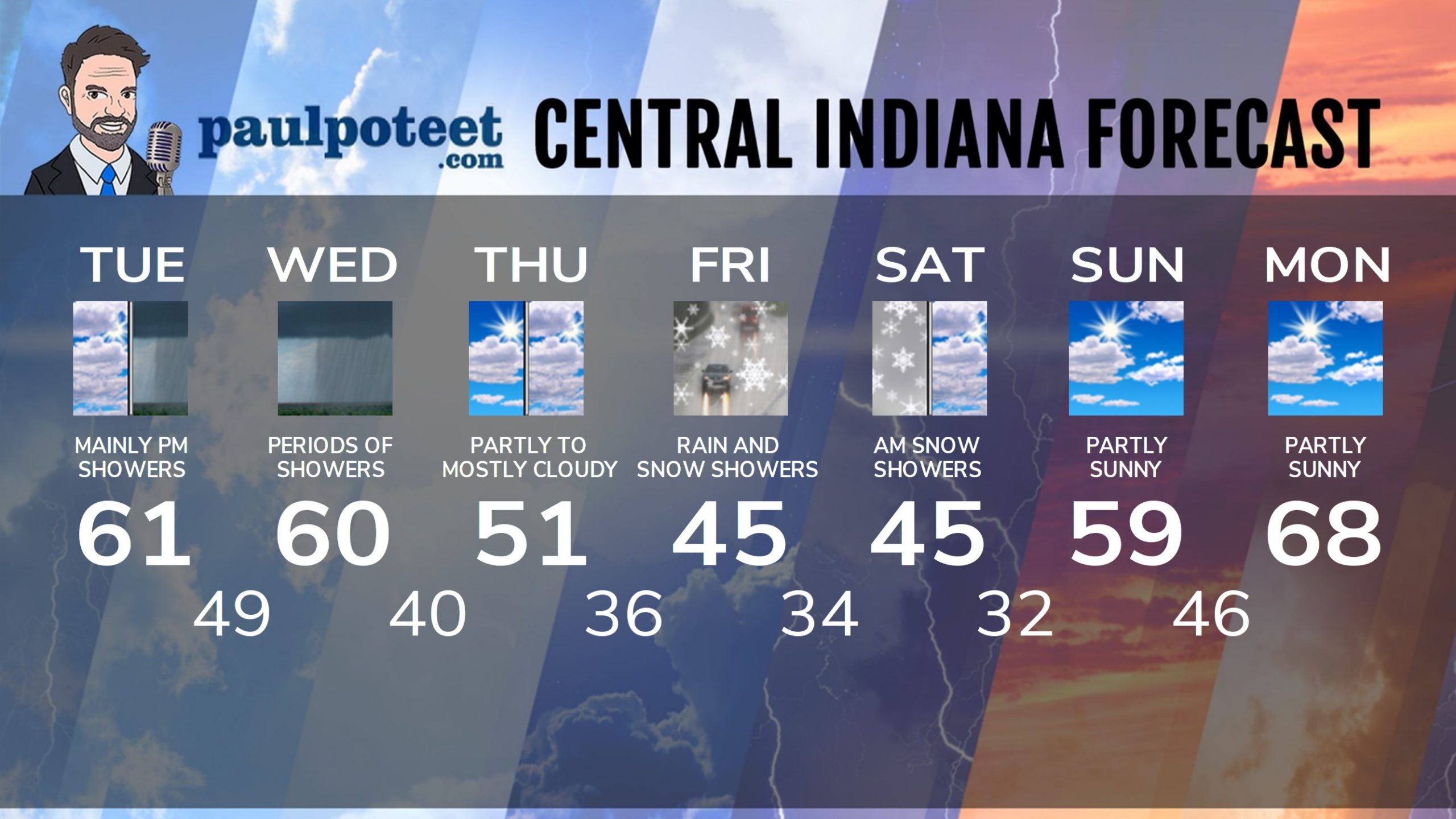
INDY SEVEN DAY FORECAST
Today: Mostly cloudy morning. Rain, mainly in the late morning and afternoon. High 61.
Tonight: Mostly cloudy. Low 49.
Wednesday: Morning rain. Some rumbles of thunder are possible. Scattered afternoon showers. High 60.
Wednesday Night: Clouds decrease. Low 40.
Thursday: Partly to mostly cloudy. High 51.
Thursday Night: Rain and/or snow showers late. Low 36.
Friday: Rain and snow showers. High 45.
Friday Night: Rain and snow showers early. Low 34.
Saturday: Mostly cloudy morning, with a few snow showers. Partly cloudy afternoon. High 45.
Saturday Night: Partly cloudy. Low 32.
Sunday: Partly sunny. High 59.
Sunday Night: Partly cloudy. Low 46.
Monday: Partly sunny. High 68.
Never miss me! Subscribe for free. My Huge Radar has real-time weather tracking, current temperatures, and severe weather watches and warnings. Get detailed Indiana conditions by clicking here. Click here to see my central Indiana 7-Day Forecast. Follow these links to get my forecasts for Lafayette, Muncie, Hendricks County, and Hamilton County. Need a second opinion? Click here for central Indiana National Weather Service forecasts. (Some charts via WeatherBELL.)


