Bright and brisk start to a work week that swings from the 20s to the 70s. The Indy low Monday was 22, not too far from the record of 16. The normal low would be 37, and the average high 57. Exactly one day this week will be above average.
Speaking of numbers, the forecast Wednesday is 74. Current record high on that date is 82. We’re in the ball park on both, but we’re not hitting any home runs.
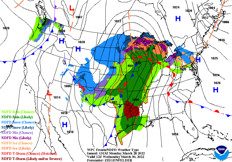
The big heat Wednesday…and storms Wednesday night…are in linked to this large low pressure system.
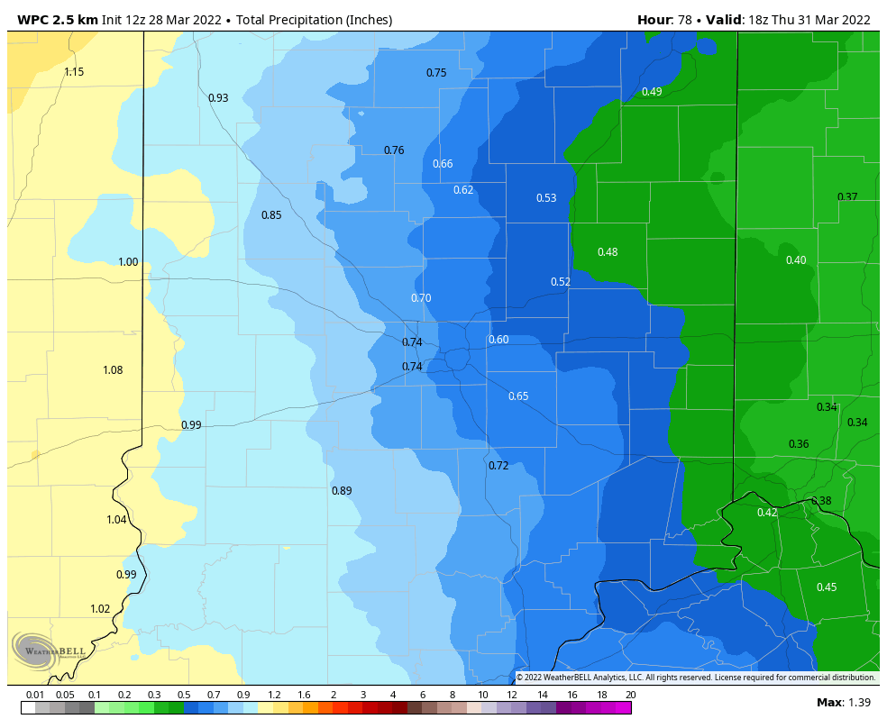
There could be up to an inch of rainfall through Thursday, especially in the western third of the state.
Never miss me! Subscribe for free. My Huge Radar has real-time weather tracking, current temperatures, and severe weather watches and warnings. Get detailed Indiana conditions by clicking here. Click here to see my central Indiana 7-Day Forecast. Follow these links to get my forecasts for Lafayette, Muncie, Hendricks County, and Hamilton County. Need a second opinion? Click here for central Indiana National Weather Service forecasts. (Some charts via WeatherBELL.)
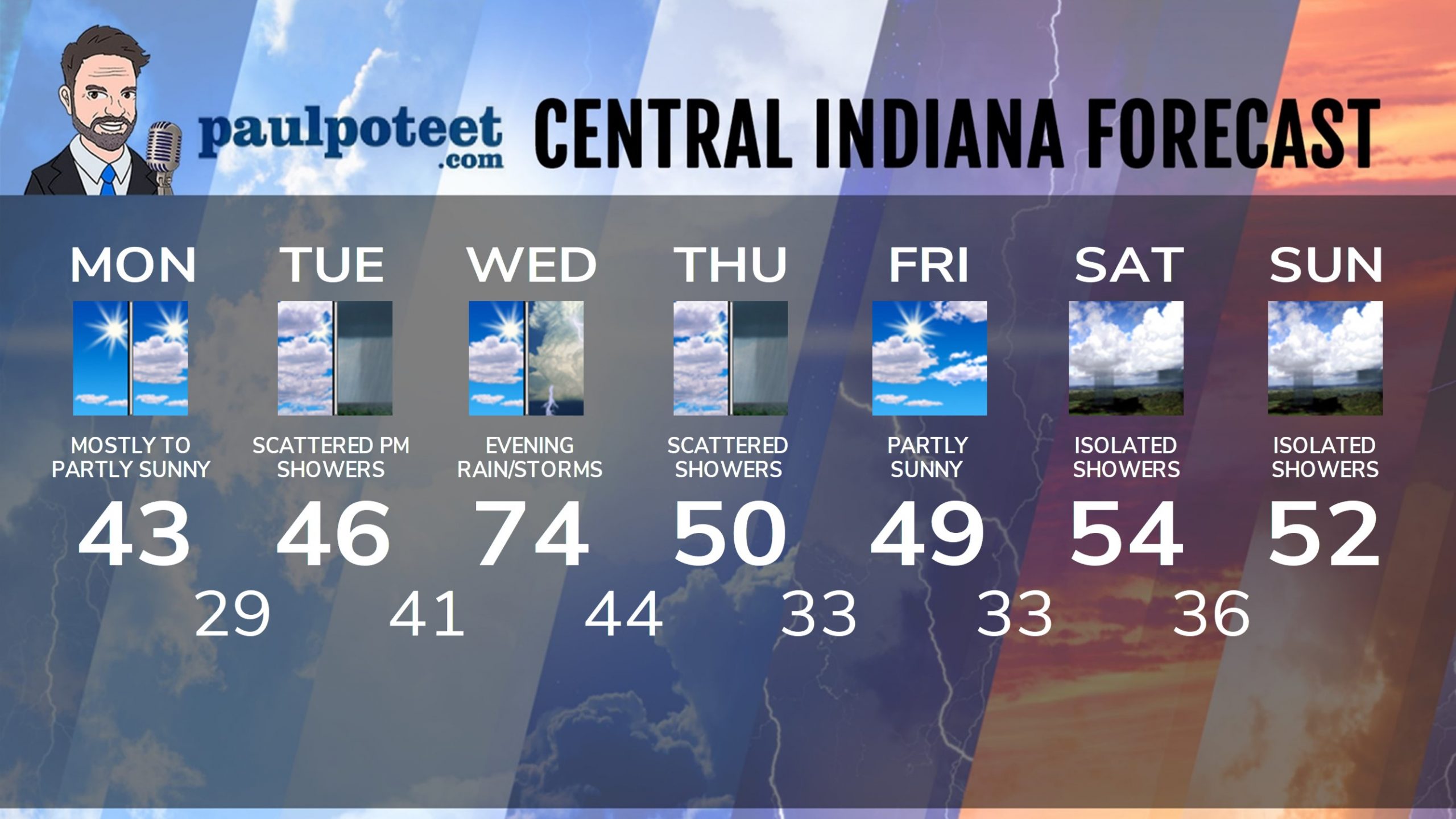
INDY SEVEN DAY FORECAST
Today: Mostly to partly sunny. High 43.
Tonight: Mostly cloudy. Low 29.
Tuesday: Mostly cloudy. High 46.
Tuesday Night: Scattered showers. Low 41.
Wednesday: Mostly cloudy, breezy and warmer. High 74.
Wednesday Night: Showers and storms. Low 44.
Thursday: Mostly cloudy, with a few lingering showers. High 50.
Thursday Night: Clouds decrease. Low 33.
Friday: Partly sunny. High 49.
Friday Night: Partly cloudy. Low 33.
Saturday: Partly to mostly cloudy. Spotty showers. High 54.
Saturday Night: Scattered showers. Low 36.
Sunday: Partly sunny. Spotty showers. High 52.
Never miss me! Subscribe for free. My Huge Radar has real-time weather tracking, current temperatures, and severe weather watches and warnings. Get detailed Indiana conditions by clicking here. Click here to see my central Indiana 7-Day Forecast. Follow these links to get my forecasts for Lafayette, Muncie, Hendricks County, and Hamilton County. Need a second opinion? Click here for central Indiana National Weather Service forecasts. (Some charts via WeatherBELL.)


