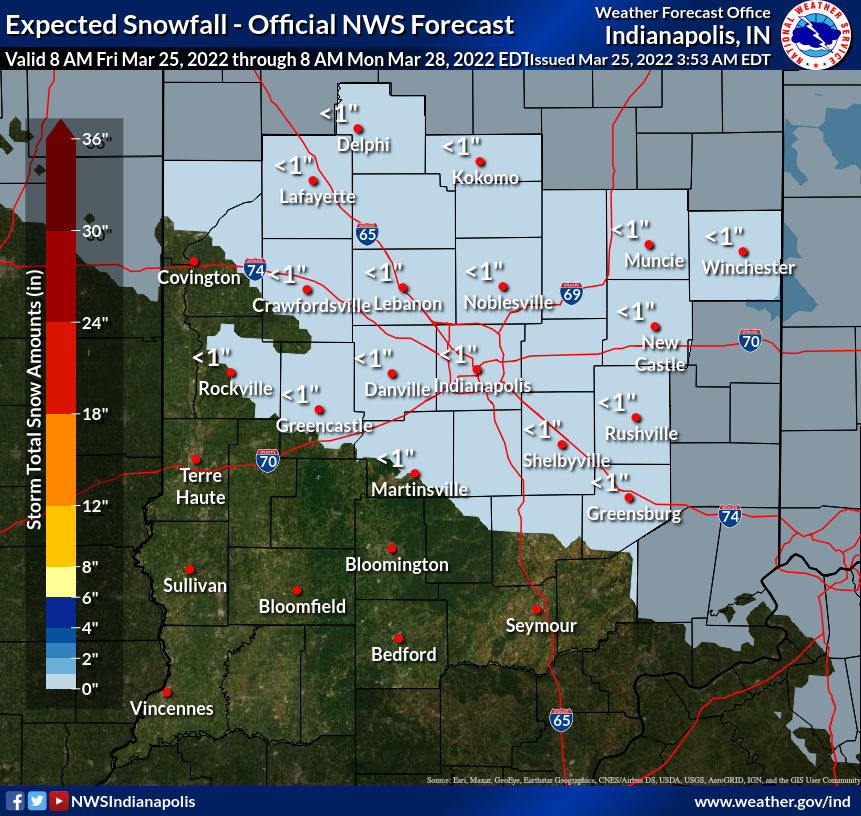
The snow will dust ya, and the chills will disgust ya this weekend. The absolute low point is Saturday, with snow showers and wind gusts to 35 mph.
Here’s the snow…
And here’s the chill, computer-modeled for Saturday afternoon…

Never miss me! Subscribe for free. My Huge Radar has real-time weather tracking, current temperatures, and severe weather watches and warnings. Get detailed Indiana conditions by clicking here. Click here to see my central Indiana 7-Day Forecast. Follow these links to get my forecasts for Lafayette, Muncie, Hendricks County, and Hamilton County. Need a second opinion? Click here for central Indiana National Weather Service forecasts. (Some charts via WeatherBELL.)
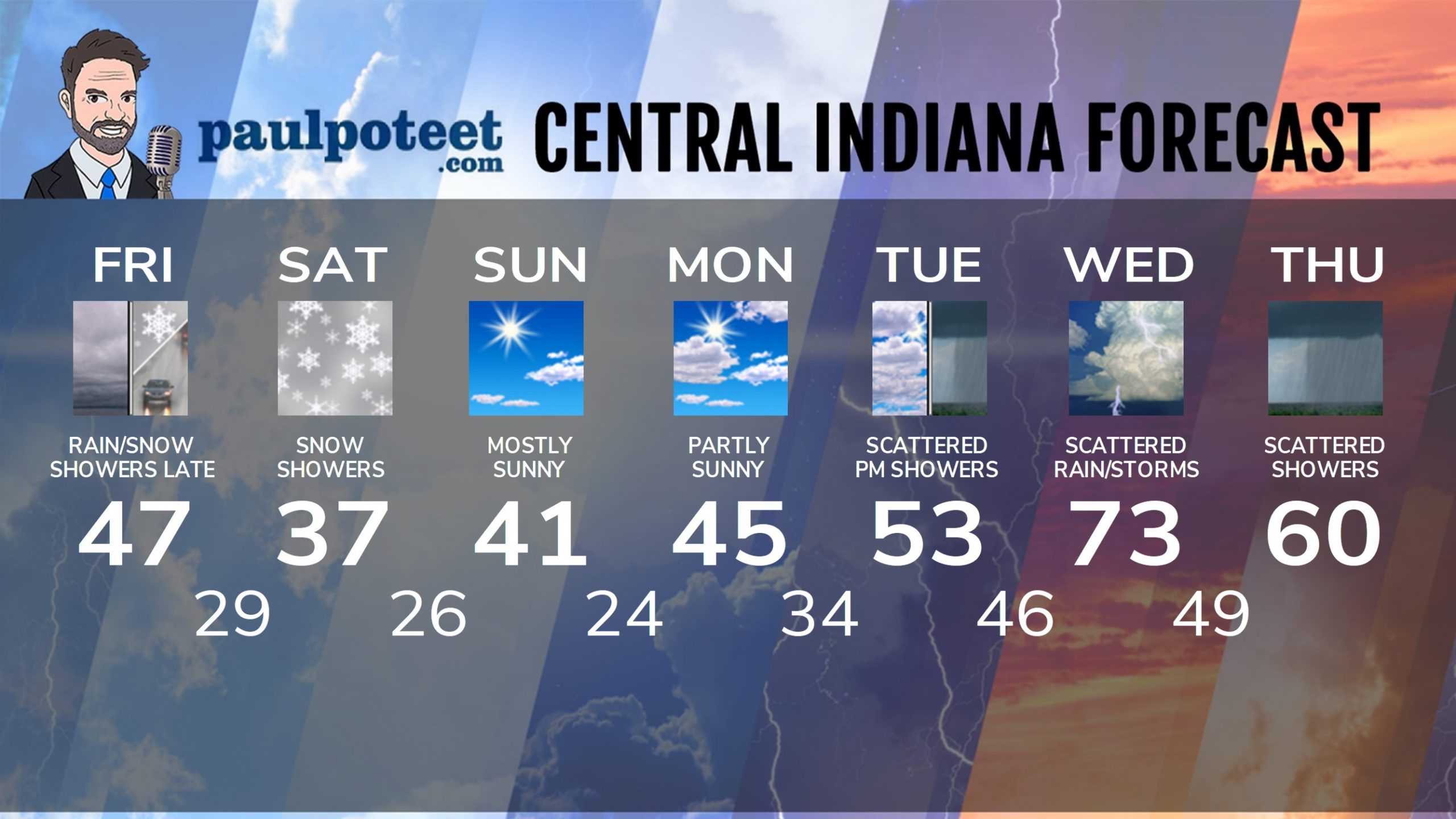
INDY SEVEN DAY FORECAST
Friday: Cloudy. Isolated showers. Best chance in the late afternoon. High 47.
Friday Night: Scattered evening showers. Rain and snow showers after midnight. Low 29.
Saturday: Mostly cloudy, with flurries or snow showers. Gusts to 35 mph. Chills in the teens and 20s! High 37.
Saturday Night: Partly cloudy. Low 26.
Sunday: Mostly sunny. High 41.
Sunday Night: Mostly clear. Low 24.
Monday: Partly sunny. High 45.
Monday Night: Mostly cloudy. Low 34.
Tuesday: Scattered showers by afternoon. High 53.
Tuesday Night: Scattered showers. Low 46.
Wednesday: Mostly cloudy, with scattered showers and storms. High 73.
Wednesday Night: Scattered showers. Low 49.
Thursday: Scattered showers still possible. High 60.
Never miss me! Subscribe for free. My Huge Radar has real-time weather tracking, current temperatures, and severe weather watches and warnings. Get detailed Indiana conditions by clicking here. Click here to see my central Indiana 7-Day Forecast. Follow these links to get my forecasts for Lafayette, Muncie, Hendricks County, and Hamilton County. Need a second opinion? Click here for central Indiana National Weather Service forecasts. (Some charts via WeatherBELL.)


