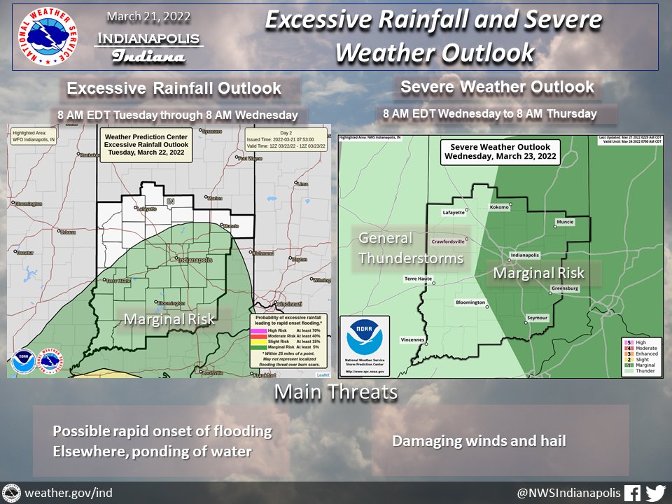
(Via @NWSIndianapolis.) Over 1″ of rain thru Wed night w/ already wet soil conditions brings a marginal risk of rapid onset flooding Tue. Frontal passage Wed may bring strong to marginally severe t-storms. Cloud cover & proximity of better upper air support to affect storm potential. #INwx #nwsind https://t.co/URp7nALf11
My Huge Radar has real-time weather tracking, current temperatures, and severe weather watches and warnings. Get detailed Indiana conditions by clicking here. Follow these links to get my forecasts for Lafayette, Muncie, Hendricks County, and Hamilton County. Need a second opinion? Click here for central Indiana National Weather Service forecasts.
Never miss me! Subscribe for free. My Huge Radar has real-time weather tracking, current temperatures, and severe weather watches and warnings. Get detailed Indiana conditions by clicking here. Click here to see my central Indiana 7-Day Forecast. Follow these links to get my forecasts for Lafayette, Muncie, Hendricks County, and Hamilton County. Need a second opinion? Click here for central Indiana National Weather Service forecasts. (Some charts via WeatherBELL.)


