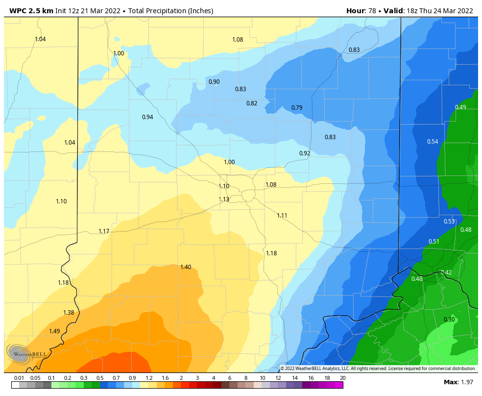
Forget that “case of the Mondays”…this is the best day of the week! Some sunshine and temps in the low 70s in the afternoon. High pressure near the East Coast is large and in charge for one more day. The map shows what’s waiting out West.
It will bring over an inch of rain from Tuesday through Thursday.
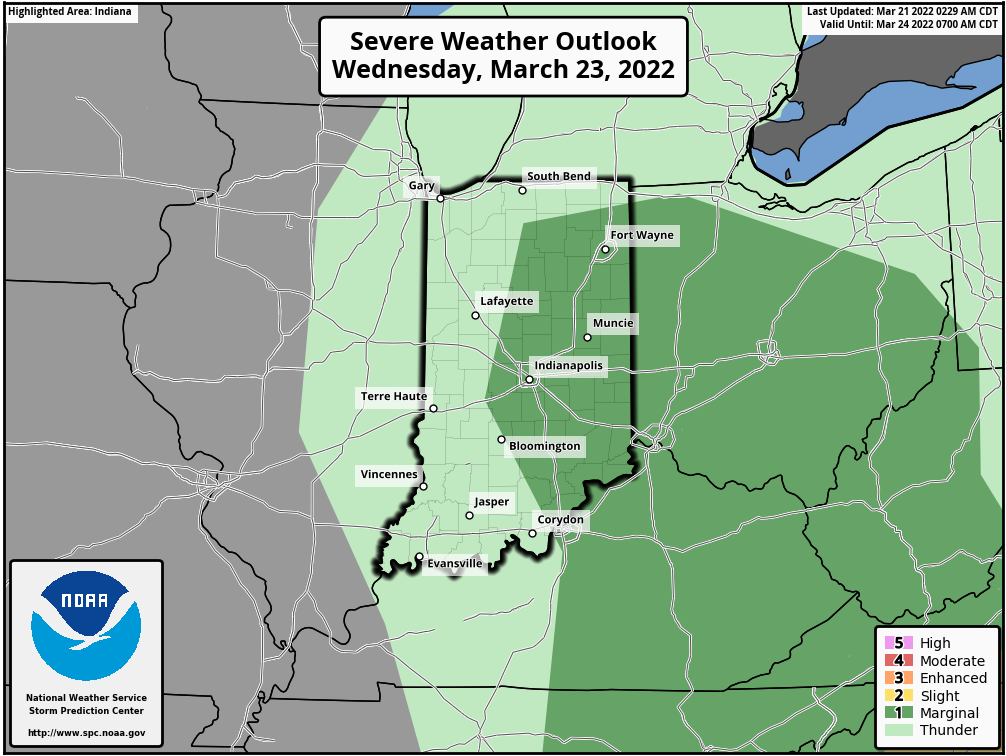
Severe weather is also possible for some Wednesday.
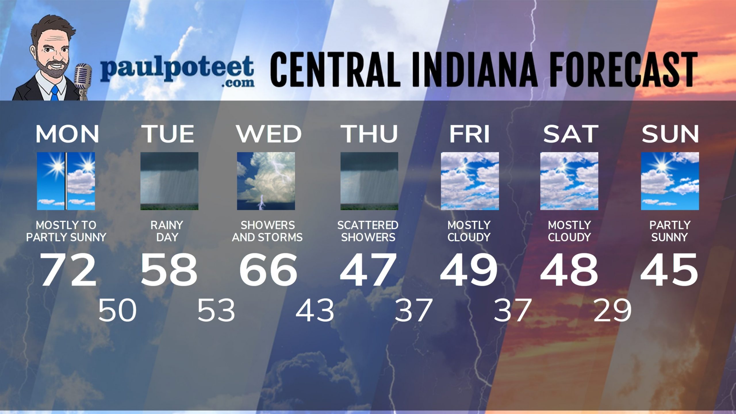
INDY SEVEN DAY FORECAST
Today: Mostly to partly sunny. High 72.
Tonight: Showers after midnight. Low 50.
Tuesday: Rainy. High 58.
Tuesday Night: Rain. Storms possible late. Low 53.
Wednesday: Rain and storms. High 66.
Wednesday Night: Scattered showers and storms. Low 43.
Thursday: Mostly cloudy. High 47.
Thursday Night: Showers end. Low 37.
Friday: Mostly cloudy. High 49.
Friday Night: Partly cloudy. Low 37.
Saturday: Mostly cloudy. High 48.
Saturday Night: Partly cloudy. Low 29.
Sunday: Partly sunny. High 45.
Never miss me! Subscribe for free. My Huge Radar has real-time weather tracking, current temperatures, and severe weather watches and warnings. Get detailed Indiana conditions by clicking here. Click here to see my central Indiana 7-Day Forecast. Follow these links to get my forecasts for Lafayette, Muncie, Hendricks County, and Hamilton County. Need a second opinion? Click here for central Indiana National Weather Service forecasts. (Some charts via WeatherBELL.)


