Two Saturdays ago we hit the mid 70s with tons of sun…it’s been tough to top! Last Saturday was in the 20s! This Saturday won’t be as bad, but we will still tumble into the 40s during the day. As usual the fight between air masses provides drama. Here’s the strong surface low Friday evening, working its way northeastward.
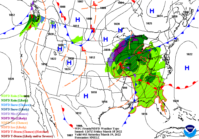
As it moves through there is a chance of not only showers, but storms that could be severe in mainly the southern half of the state.

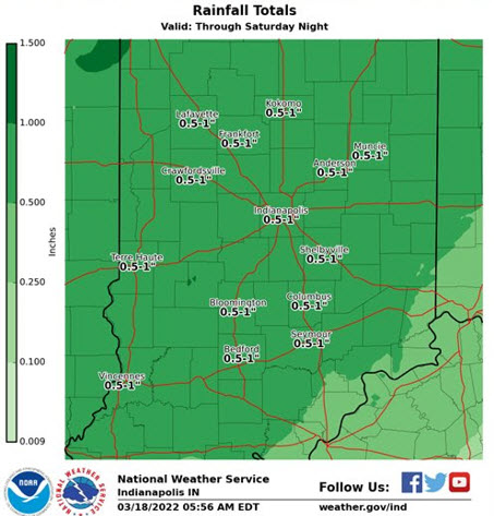
Rainfall should stay under an inch, but more large low pressure moving through next week.
It will hang around longer next week. Rain could be heavy Tuesday and Wednesday.
Never miss me! Subscribe for free. My Huge Radar has real-time weather tracking, current temperatures, and severe weather watches and warnings. Get detailed Indiana conditions by clicking here. Click here to see my central Indiana 7-Day Forecast. Follow these links to get my forecasts for Lafayette, Muncie, Hendricks County, and Hamilton County. Need a second opinion? Click here for central Indiana National Weather Service forecasts. (Some charts via WeatherBELL.)
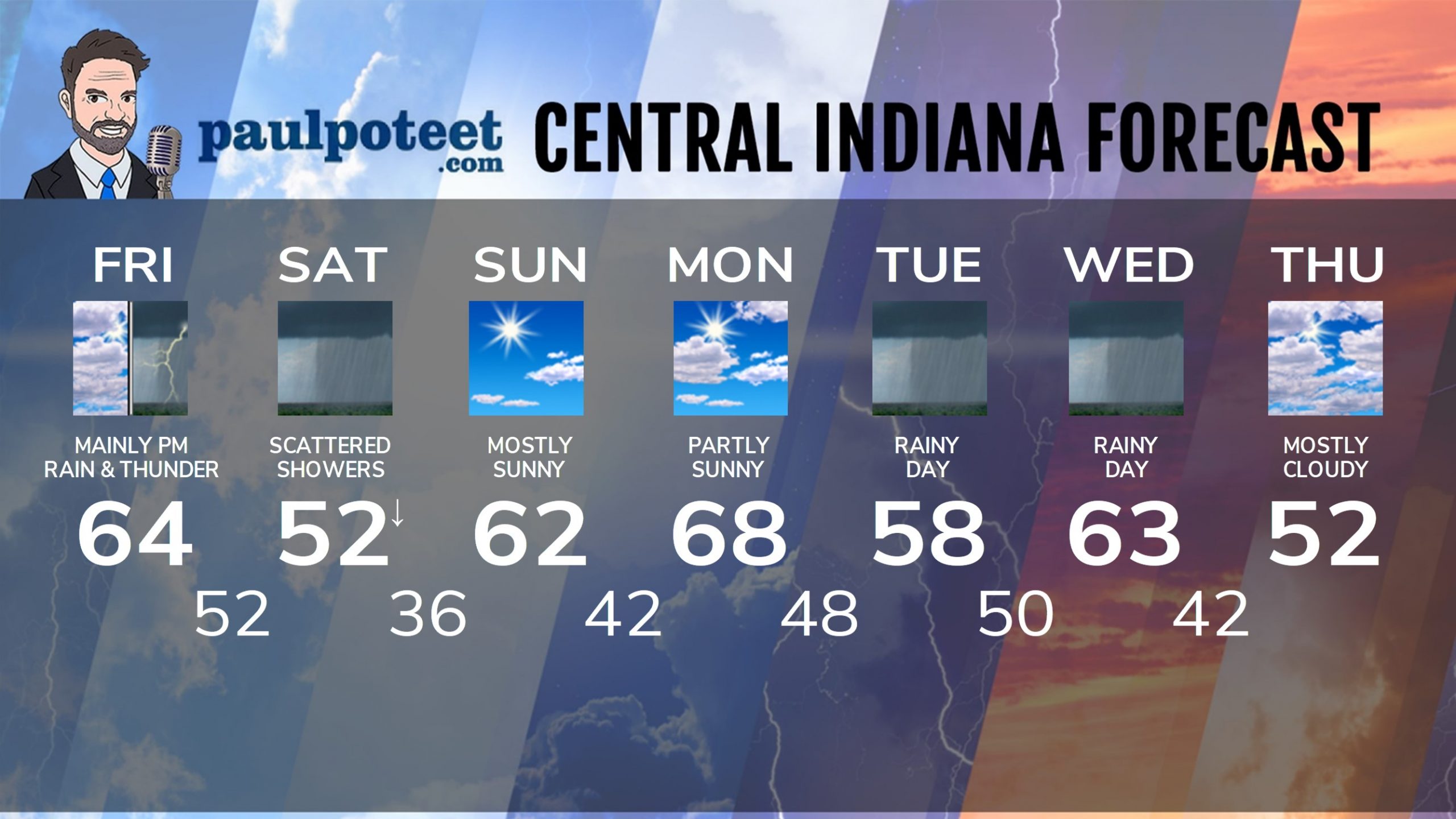
INDY SEVEN DAY FORECAST
Friday: Spotty morning shower. Scattered showers in the afternoon. High 64.
Friday Night: Showers likely, and thunder possible. A few storms could be severe. Low 52.
Saturday: Mostly cloudy. Scattered showers. Temps fall into the 40s by afternoon. High 52.
Saturday Night: Mostly cloudy evening. Partly cloudy overnight. Low 36.
Sunday: Mostly sunny. High 62.
Sunday Night: Mostly clear. Low 42.
Monday: Partly sunny. High 68.
Monday Night: Showers after midnight. Low 48.
Tuesday: Rainy. High 58.
Tuesday Night: Rainy. Low 50.
Wednesday: More rain. High 63.
Wednesday Night: Scattered showers. Low 42.
Thursday: Mostly cloudy. High 52.
Never miss me! Subscribe for free. My Huge Radar has real-time weather tracking, current temperatures, and severe weather watches and warnings. Get detailed Indiana conditions by clicking here. Click here to see my central Indiana 7-Day Forecast. Follow these links to get my forecasts for Lafayette, Muncie, Hendricks County, and Hamilton County. Need a second opinion? Click here for central Indiana National Weather Service forecasts. (Some charts via WeatherBELL.)


