Nice and mild again today. The stats are in for “Meteorological Winter” (Dec/Jan/Feb) and they are slightly above average for temperature. You can thank December for that.
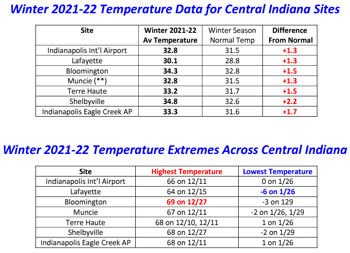
Despite only ten inches of snow in Indy for the season (24 inches is average) we were actually slightly above average with respect to precipitation.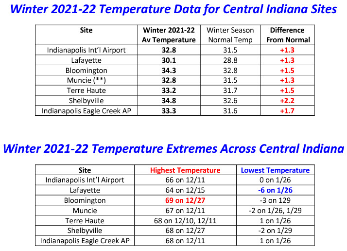
Never miss me! Subscribe for free. My Huge Radar has real-time weather tracking, current temperatures, and severe weather watches and warnings. Get detailed Indiana conditions by clicking here. Click here to see my central Indiana 7-Day Forecast. Follow these links to get my forecasts for Lafayette, Muncie, Hendricks County, and Hamilton County. Need a second opinion? Click here for central Indiana National Weather Service forecasts. (Some charts via WeatherBELL.)
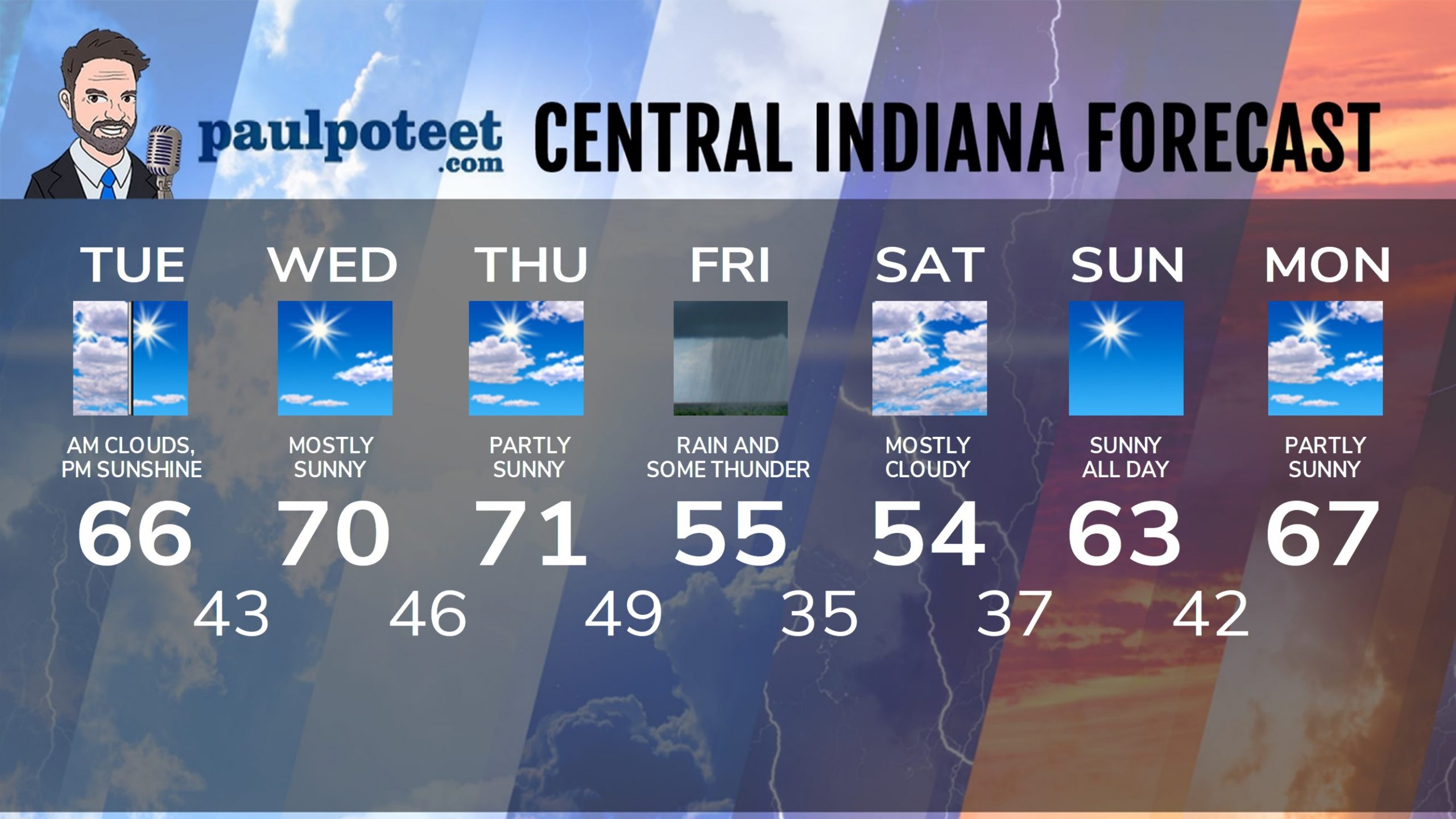
INDY SEVEN DAY FORECAST
Today: Morning clouds, and maybe a sprinkle. Clouds decrease in the afternoon. High 66.
Tonight: Mostly clear. Low 43.
Wednesday: Mostly sunny. High 70.
Wednesday Night: Mostly clear. Low 46.
Thursday: Partly sunny. High 71.
Thursday Night: Partly cloudy. Spotty showers after midnight. Low 49.
Friday: Periods of rain. Thunder also possible. High 55.
Friday Night: More rain. Low 35.
Saturday: Mostly cloudy. High 54.
Saturday Night: Partly cloudy. Low 37.
Sunday: Sunny. High 63.
Sunday Night: Partly cloudy. Low 42.
Monday: Partly sunny. High 67.
Never miss me! Subscribe for free. My Huge Radar has real-time weather tracking, current temperatures, and severe weather watches and warnings. Get detailed Indiana conditions by clicking here. Click here to see my central Indiana 7-Day Forecast. Follow these links to get my forecasts for Lafayette, Muncie, Hendricks County, and Hamilton County. Need a second opinion? Click here for central Indiana National Weather Service forecasts. (Some charts via WeatherBELL.)


