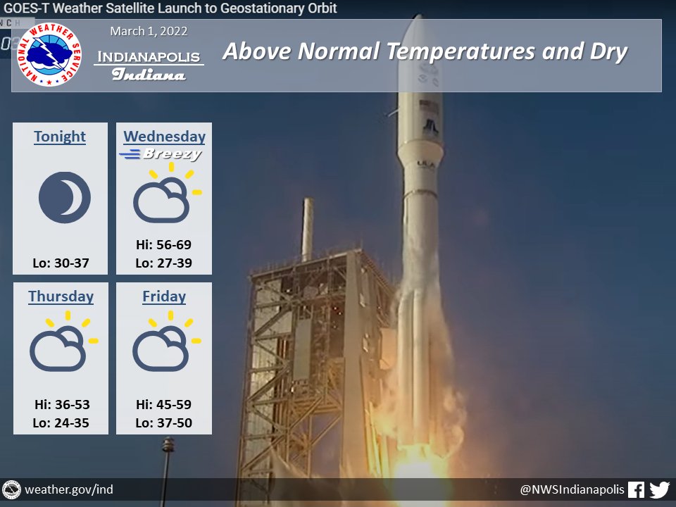
(Via @NWSIndianapolis.) Dry & above normal temps thru the end of the workweek, though a bit of cool down is in store Thu. Rain is expected Sat afternoon onward into the next workweek. Thru Fri night high temps to range from 36-69° and lows 24-50, warmest Wed & Fri. #INwx #nwsind https://t.co/5ewecfDriP
My Huge Radar has real-time weather tracking, current temperatures, and severe weather watches and warnings. Get detailed Indiana conditions by clicking here. Follow these links to get my forecasts for Lafayette, Muncie, Hendricks County, and Hamilton County. Need a second opinion? Click here for central Indiana National Weather Service forecasts.
Never miss me! Subscribe for free. My Huge Radar has real-time weather tracking, current temperatures, and severe weather watches and warnings. Get detailed Indiana conditions by clicking here. Click here to see my central Indiana 7-Day Forecast. Follow these links to get my forecasts for Lafayette, Muncie, Hendricks County, and Hamilton County. Need a second opinion? Click here for central Indiana National Weather Service forecasts. (Some charts via WeatherBELL.)


