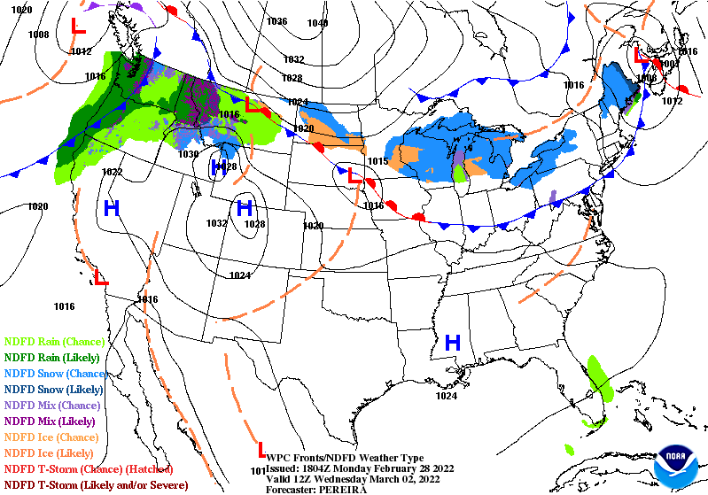
Quiet weather this week. One surface cold front will move southward through the area late Wednesday and Thursday. It will bring some clouds and briefly cooler temps, but no rain or snow.
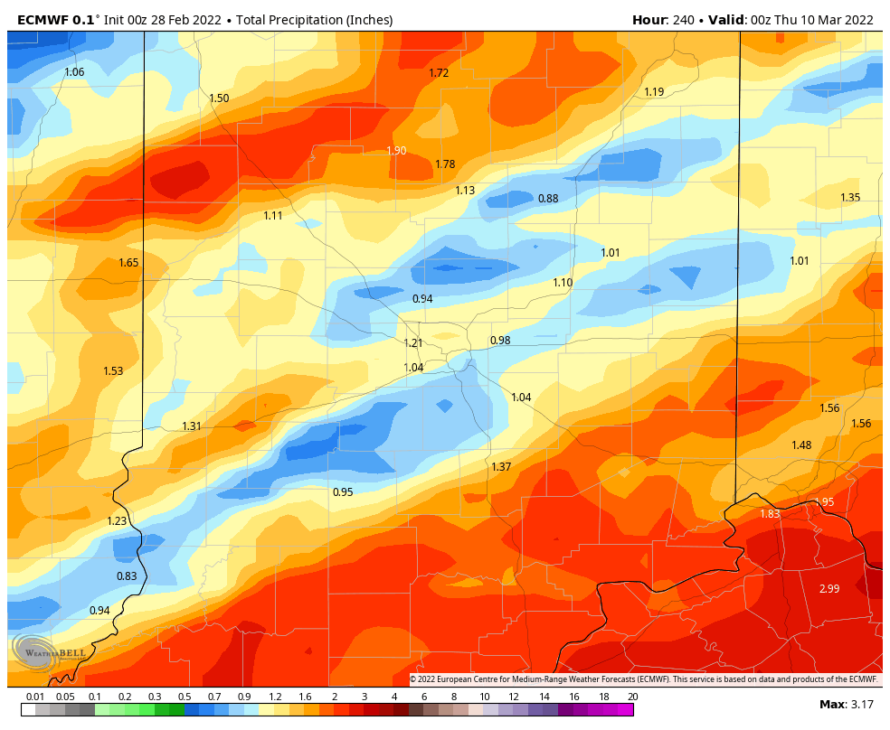
Rain ramps up from Saturday afternoon through Sunday morning, and again for at least the first half of next week. Up to an around an inch is possible.
Never miss me! Subscribe for free. My Huge Radar has real-time weather tracking, current temperatures, and severe weather watches and warnings. Get detailed Indiana conditions by clicking here. Click here to see my central Indiana 7-Day Forecast. Follow these links to get my forecasts for Lafayette, Muncie, Hendricks County, and Hamilton County. Need a second opinion? Click here for central Indiana National Weather Service forecasts. (Some charts via WeatherBELL.)
INDY SEVEN DAY FORECAST
Today: Sunny morning. A few high clouds this afternoon. High 50.
Tonight: Partly cloudy. Low 34.
Tuesday: Partly sunny. High 58.
Tuesday Night: Partly cloudy. Low 34.
Wednesday: Mostly sunny. High 59.
Wednesday Night: Partly, then mostly cloudy. Low 34.
Thursday: Mostly, then partly cloudy. High 44.
Thursday Night: Partly cloudy. Low 30.
Friday: Partly sunny. High 53.
Friday Night: Partly cloudy. Low 45.
Saturday: Mostly cloudy. Scattered afternoon showers. High 65.
Saturday Night: Showers likely. Thunder possible. Low 53.
Sunday: Mainly morning showers. Mostly cloudy. High 64.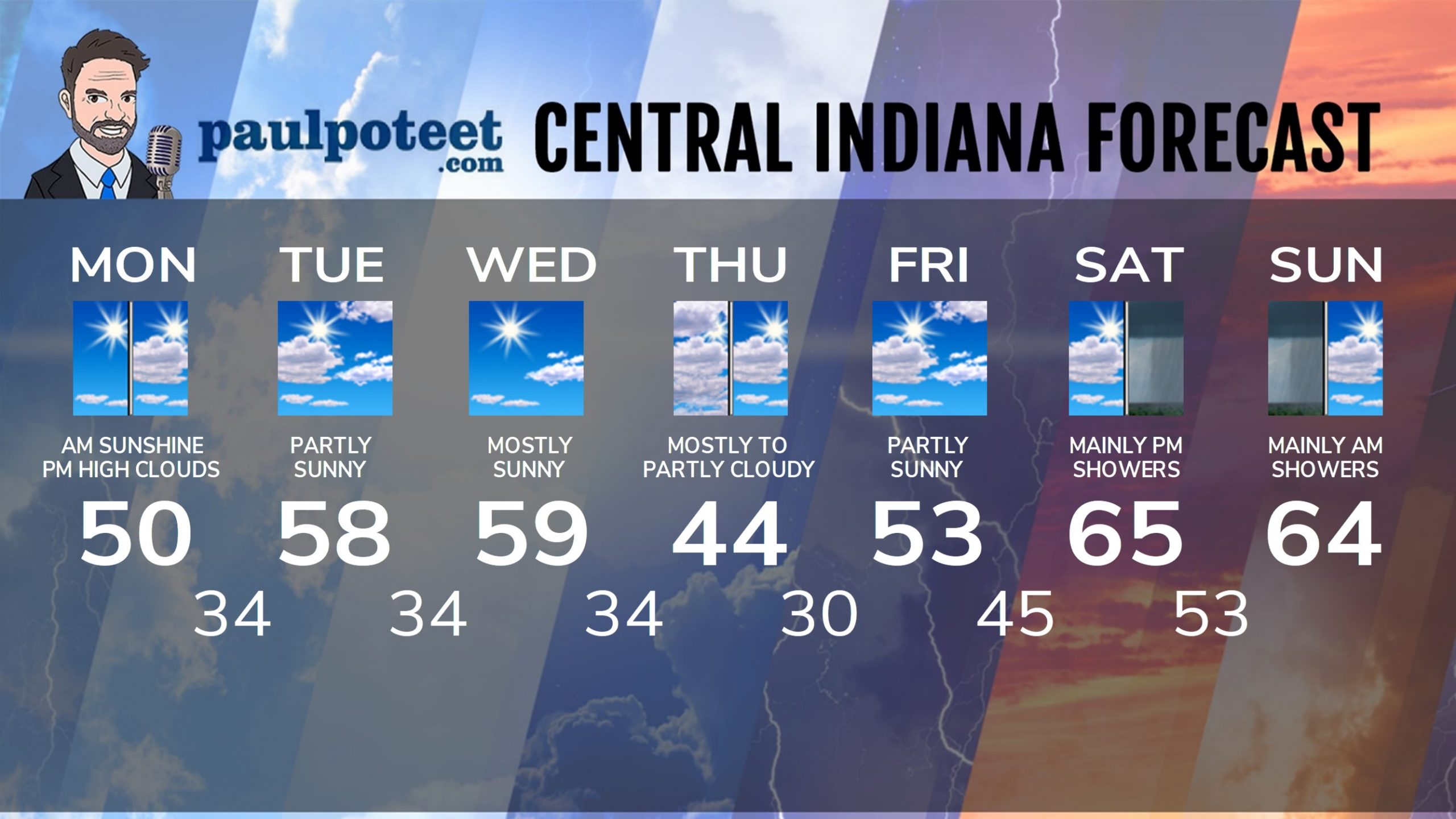
Never miss me! Subscribe for free. My Huge Radar has real-time weather tracking, current temperatures, and severe weather watches and warnings. Get detailed Indiana conditions by clicking here. Click here to see my central Indiana 7-Day Forecast. Follow these links to get my forecasts for Lafayette, Muncie, Hendricks County, and Hamilton County. Need a second opinion? Click here for central Indiana National Weather Service forecasts. (Some charts via WeatherBELL.)


