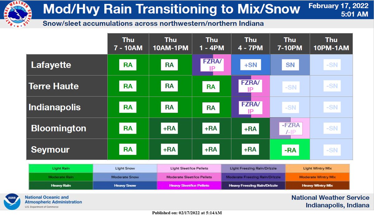
(Via @NWSIndianapolis.) Moderate to heavy rain will transition to a wintry mix and then snow across central Indiana later today from northwest to southeast. Total snowfall across far NW areas will be 3-6 inches, with less than a tenth inch of ice. Accumulations will quickly drop off SE from there. #INwx https://t.co/98KWKMzmfr
My Huge Radar has real-time weather tracking, current temperatures, and severe weather watches and warnings. Get detailed Indiana conditions by clicking here. Follow these links to get my forecasts for Lafayette, Muncie, Hendricks County, and Hamilton County. Need a second opinion? Click here for central Indiana National Weather Service forecasts.
Never miss me! Subscribe for free. My Huge Radar has real-time weather tracking, current temperatures, and severe weather watches and warnings. Get detailed Indiana conditions by clicking here. Click here to see my central Indiana 7-Day Forecast. Follow these links to get my forecasts for Lafayette, Muncie, Hendricks County, and Hamilton County. Need a second opinion? Click here for central Indiana National Weather Service forecasts. (Some charts via WeatherBELL.)


