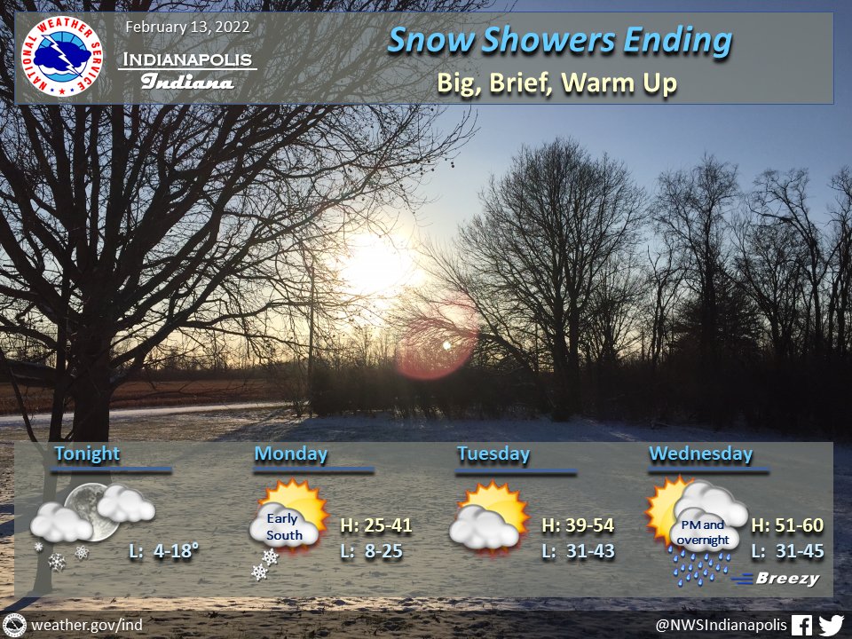
(Via @NWSIndianapolis.) Snow showers w/ brief heavier bursts ending this eve. Flurries possible late night, lingering south Mon morn. Temp quickly warm Mon thru Wed, w/ highs up to low 40s Mon, mid 50s Tue, & ~60 Wed. Rain Wed PM & overnight with breezy winds. Colder Thursday.
#INwx #nwsind https://t.co/3yH4JCJq4o
My Huge Radar has real-time weather tracking, current temperatures, and severe weather watches and warnings. Get detailed Indiana conditions by clicking here. Follow these links to get my forecasts for Lafayette, Muncie, Hendricks County, and Hamilton County. Need a second opinion? Click here for central Indiana National Weather Service forecasts.
Never miss me! Subscribe for free. My Huge Radar has real-time weather tracking, current temperatures, and severe weather watches and warnings. Get detailed Indiana conditions by clicking here. Click here to see my central Indiana 7-Day Forecast. Follow these links to get my forecasts for Lafayette, Muncie, Hendricks County, and Hamilton County. Need a second opinion? Click here for central Indiana National Weather Service forecasts. (Some charts via WeatherBELL.)


