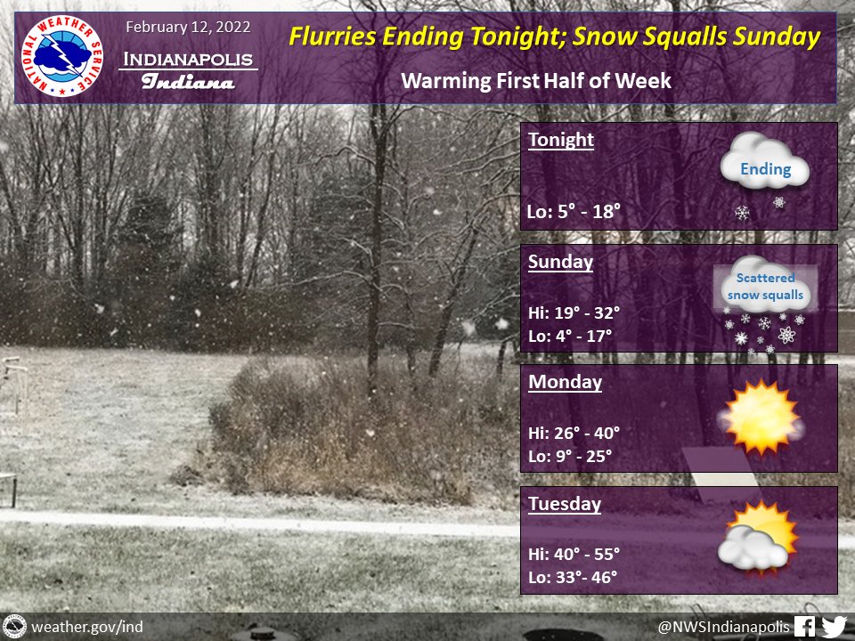
(Via @NWSIndianapolis.) Flurries ending tonight. Snow showers w/ scattered squalls likely Sunday. Squalls most likely mid-afternoon to early eve, causing fast drops in visibility & increase in snow accumulation. Accumulations up to 1″ possible. Temps warming into mainly 50s Wed. #INwx #nwsind https://t.co/wORWTtVUnq
My Huge Radar has real-time weather tracking, current temperatures, and severe weather watches and warnings. Get detailed Indiana conditions by clicking here. Follow these links to get my forecasts for Lafayette, Muncie, Hendricks County, and Hamilton County. Need a second opinion? Click here for central Indiana National Weather Service forecasts.
Never miss me! Subscribe for free. My Huge Radar has real-time weather tracking, current temperatures, and severe weather watches and warnings. Get detailed Indiana conditions by clicking here. Click here to see my central Indiana 7-Day Forecast. Follow these links to get my forecasts for Lafayette, Muncie, Hendricks County, and Hamilton County. Need a second opinion? Click here for central Indiana National Weather Service forecasts. (Some charts via WeatherBELL.)


