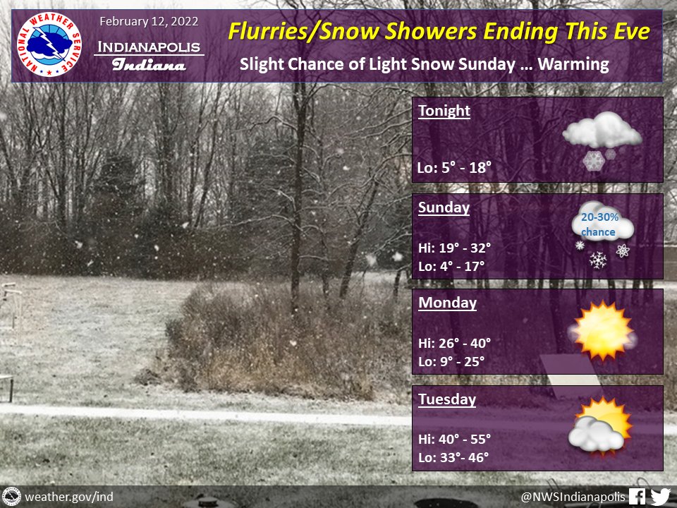
(Via @NWSIndianapolis.) Snow flurries/snow showers ending this eve. Slight chance of light snow Sunday. Accumulations 0.2 to 0.5″ possible. Temps warming Mon thru Wed, peaking mainly in the 50s Wed. Coldest temps will be tonight and Sunday with lows ~5-20°. #INwx #nwsind https://t.co/oIhpEjiyRd
My Huge Radar has real-time weather tracking, current temperatures, and severe weather watches and warnings. Get detailed Indiana conditions by clicking here. Follow these links to get my forecasts for Lafayette, Muncie, Hendricks County, and Hamilton County. Need a second opinion? Click here for central Indiana National Weather Service forecasts.
Never miss me! Subscribe for free. My Huge Radar has real-time weather tracking, current temperatures, and severe weather watches and warnings. Get detailed Indiana conditions by clicking here. Click here to see my central Indiana 7-Day Forecast. Follow these links to get my forecasts for Lafayette, Muncie, Hendricks County, and Hamilton County. Need a second opinion? Click here for central Indiana National Weather Service forecasts. (Some charts via WeatherBELL.)


