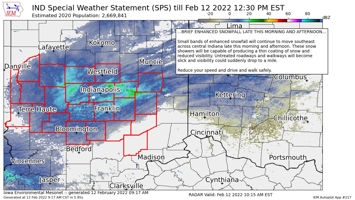
A thin coating of snow could trip you up today in central Indiana from a narrow band of snow showers slipping southward. Watch untreated roads and sidewalks.
There will be another round of snow showers late Sunday morning into Sunday afternoon. Again: another coating of snow is possible.

Never miss me! Subscribe for free. My Huge Radar has real-time weather tracking, current temperatures, and severe weather watches and warnings. Get detailed Indiana conditions by clicking here. Click here to see my central Indiana 7-Day Forecast. Follow these links to get my forecasts for Lafayette, Muncie, Hendricks County, and Hamilton County. Need a second opinion? Click here for central Indiana National Weather Service forecasts. (Some charts via WeatherBELL.)
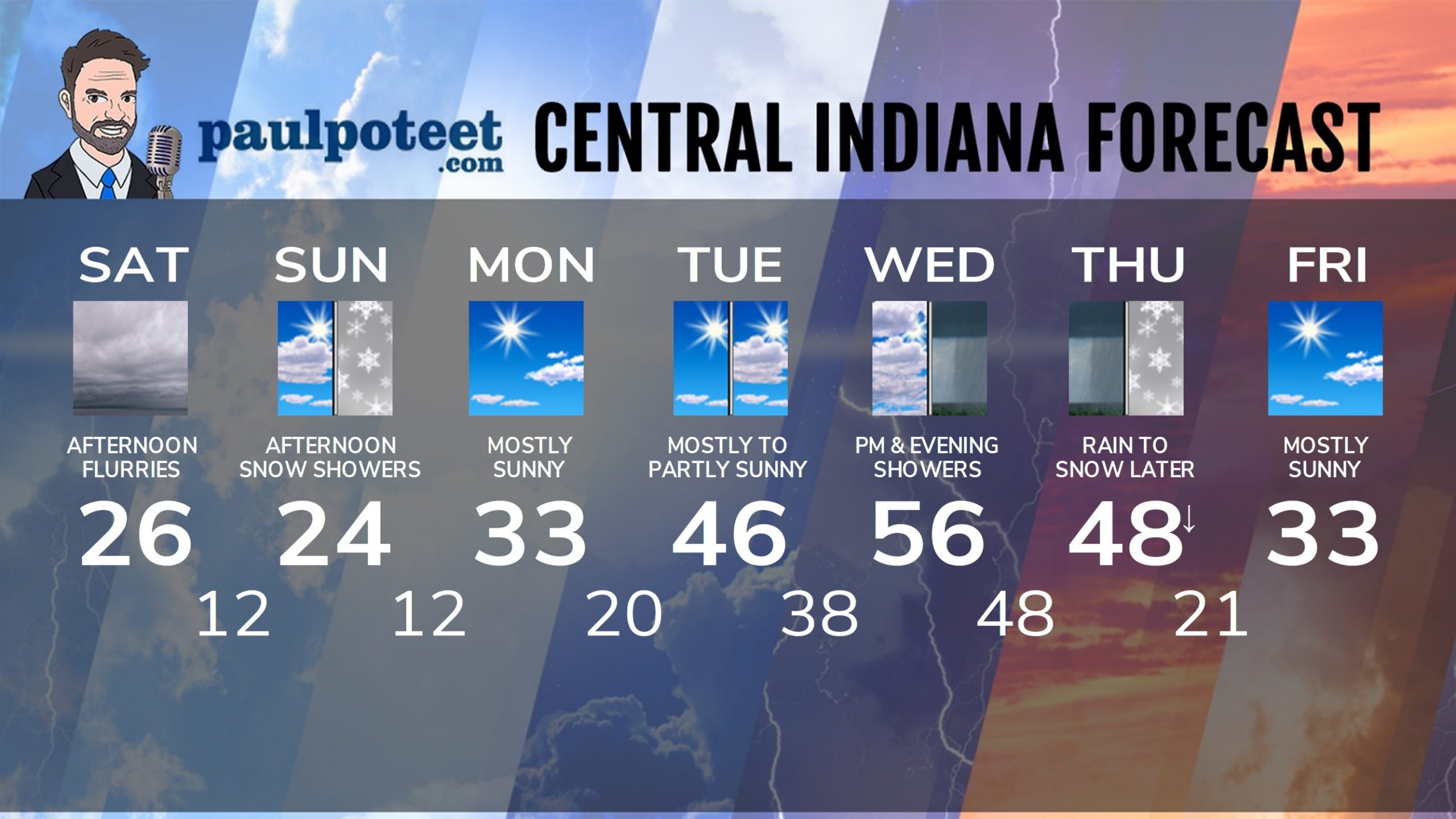
INDY SEVEN DAY FORECAST
Saturday: Mostly cloudy. Morning snow showers. Afternoon flurries. High 26.
Saturday Night: Partly cloudy. Low 12.
Sunday: Partly cloudy morning. Afternoon snow showers. High 24.
Sunday Night: Partly cloudy. Low 12.
Monday: Mostly sunny. High 33.
Monday Night: Mostly clear. Low 20.
Tuesday: Mostly to partly sunny. High 46.
Tuesday Night: Partly cloudy. Low 38.
Wednesday: Clouds increase. Spotty afternoon showers. High 56.
Wednesday Night: Showers. Low 48.
Thursday: Morning rain. Rain mixes with snow by late afternoon. High 48.
Thursday Night: Snow early, then partly cloudy. Low 21.
Friday: Mostly sunny. High 33.
Never miss me! Subscribe for free. My Huge Radar has real-time weather tracking, current temperatures, and severe weather watches and warnings. Get detailed Indiana conditions by clicking here. Click here to see my central Indiana 7-Day Forecast. Follow these links to get my forecasts for Lafayette, Muncie, Hendricks County, and Hamilton County. Need a second opinion? Click here for central Indiana National Weather Service forecasts. (Some charts via WeatherBELL.)


