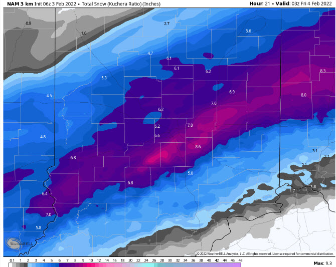
A Winter Storm Warning today, with snow and blowing snow, limiting visibility at times. Wind chills will be between 5-15 degrees. Some wintry mix is still possible southeast of a line from Sullivan to Bloomington to Rushville line. Otherwise: all snow, all the time. Snow diminishes from northwest to southeast this evening. Final totals over the heart of central Indiana will range from 6-10 inches. Lafayette-area totals will end up at around 12 inches. Amounts south and east of Indy will be less, where more of the precipitation has fallen as freezing rain.
Here’s a computer-modeled look at *additional* snowfall today. I think this particular modeling will be closest to reality. Your mileage may vary.
Never miss me! Subscribe for free. My Huge Radar has real-time weather tracking, current temperatures, and severe weather watches and warnings. Get detailed Indiana conditions by clicking here. Click here to see my central Indiana 7-Day Forecast. Follow these links to get my forecasts for Lafayette, Muncie, Hendricks County, and Hamilton County. Need a second opinion? Click here for central Indiana National Weather Service forecasts. (Some charts via WeatherBELL.)
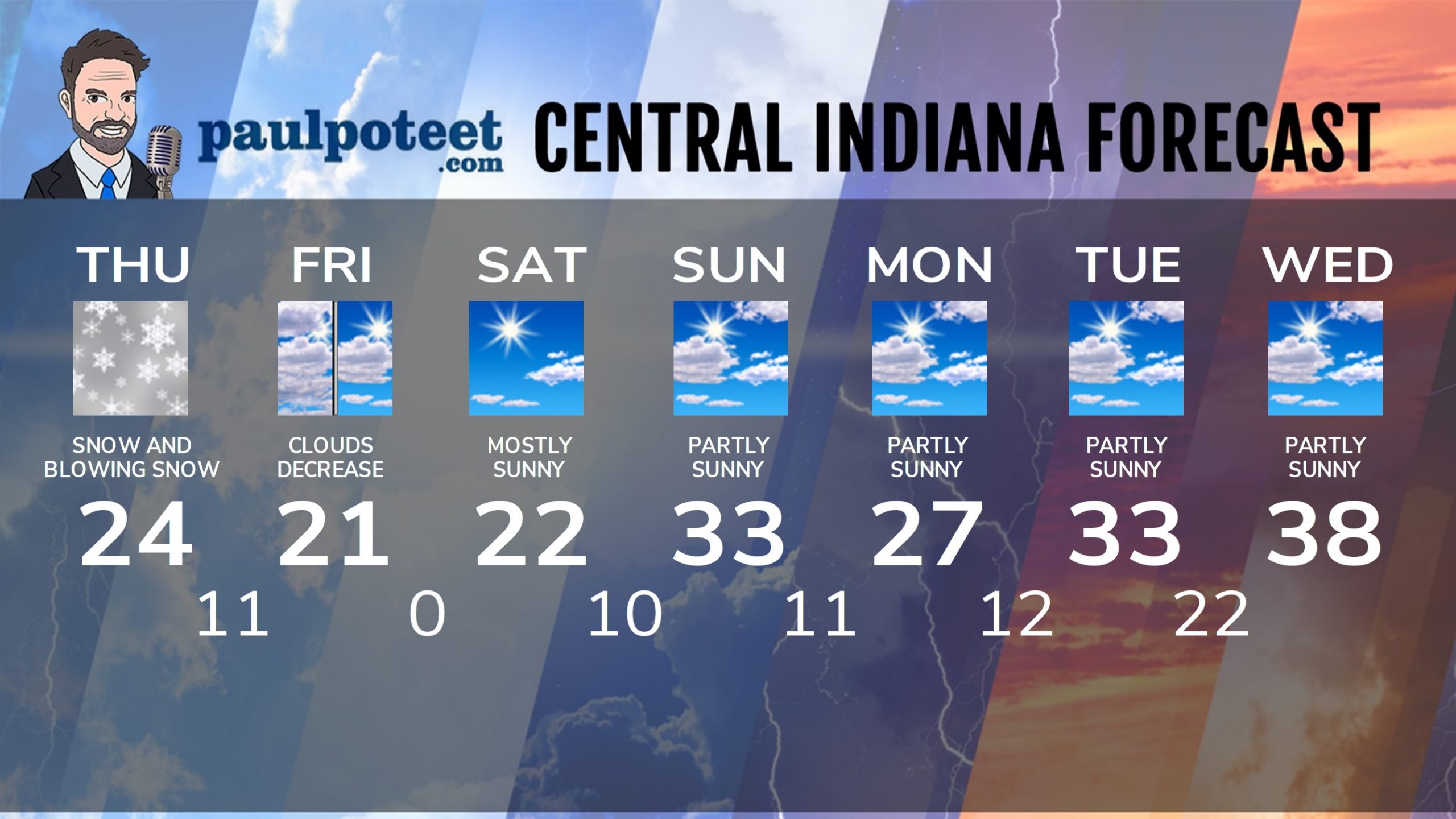
INDY SEVEN DAY FORECAST
Today: Snow, and blowing snow. Wind gusting to 35 mph. High 24.
Tonight: Snow diminishes by late evening. Final totals of 6-9 inches. Low 11.
Friday: Mostly cloudy morning. Partly sunny afternoon. High 21.
Friday Night: Clear and cold. Low 0.
Saturday: Mostly sunny. High 22.
Saturday Night: Mostly clear. Low 10.
Sunday: Partly sunny. High 33.
Sunday Night: Partly cloudy. Low 11.
Monday: Partly sunny. High 27.
Monday Night: Partly cloudy. Low 12.
Tuesday: Partly sunny. High 33.
Tuesday Night: Partly cloudy. Low 22.
Wednesday: Partly sunny. High 38.
Never miss me! Subscribe for free. My Huge Radar has real-time weather tracking, current temperatures, and severe weather watches and warnings. Get detailed Indiana conditions by clicking here. Click here to see my central Indiana 7-Day Forecast. Follow these links to get my forecasts for Lafayette, Muncie, Hendricks County, and Hamilton County. Need a second opinion? Click here for central Indiana National Weather Service forecasts. (Some charts via WeatherBELL.)


