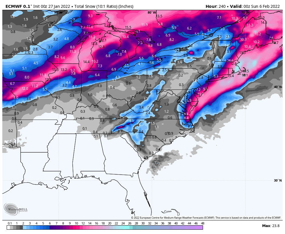
Not as cold today…but a fresh chill arrives Friday and Saturday. Few flurries flying today, but odds are still again shoveling through NEXT weekend, although accumulating snow could sneak into places like Lafayette and Kokomo the second half of next week.

Never miss me! Subscribe for free. My Huge Radar has real-time weather tracking, current temperatures, and severe weather watches and warnings. Get detailed Indiana conditions by clicking here. Click here to see my central Indiana 7-Day Forecast. Follow these links to get my forecasts for Lafayette, Muncie, Hendricks County, and Hamilton County. Need a second opinion? Click here for central Indiana National Weather Service forecasts. (Some charts via WeatherBELL.)
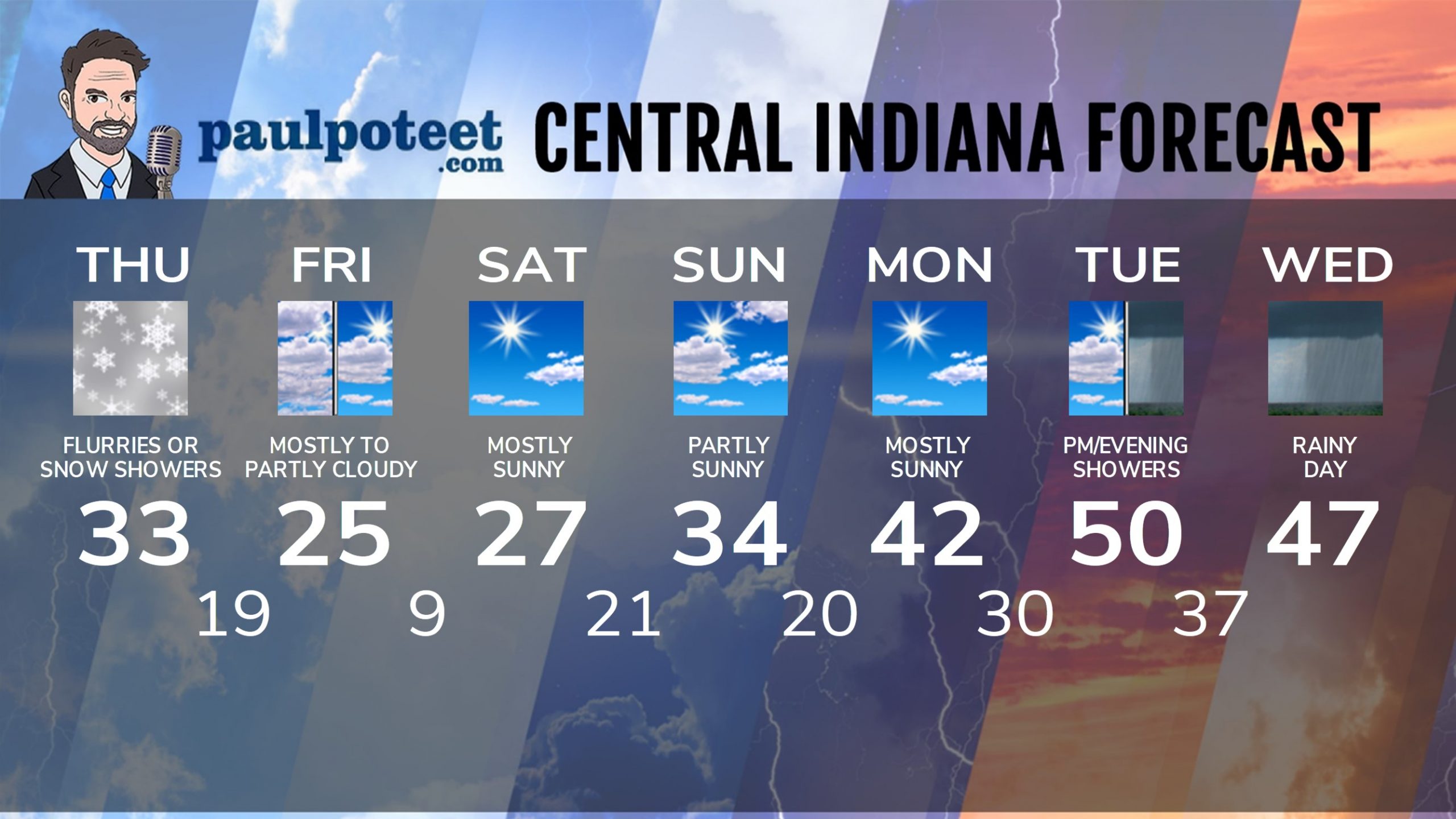
INDY SEVEN DAY FORECAST
Today: Clouds increase. A few flurries or snow showers in the midday and afternoon. Wind gusting to 25 mph. High 33.
Tonight: Cloudy. Scattered snow showers or flurries. Wind gusting to 20 mph. Low 19.
Friday: Mostly cloudy morning. Partly cloudy afternoon. High 25.
Friday Night: Clearing and colder again. Low 9.
Saturday: Mostly sunny. High 27.
Saturday Night: Partly cloudy. Low 21.
Sunday: Partly sunny. High 34.
Sunday Night: Partly cloudy. Low 20.
Monday: Mostly sunny. High 42.
Monday Night: Mostly clear. Low 30.
Tuesday: Partly cloudy morning. Mostly cloudy afternoon. Scattered showers possible. High 50.
Tuesday Night: Rainy. Low 37.
Wednesday: Rainy. High 47.
Never miss me! Subscribe for free. My Huge Radar has real-time weather tracking, current temperatures, and severe weather watches and warnings. Get detailed Indiana conditions by clicking here. Click here to see my central Indiana 7-Day Forecast. Follow these links to get my forecasts for Lafayette, Muncie, Hendricks County, and Hamilton County. Need a second opinion? Click here for central Indiana National Weather Service forecasts. (Some charts via WeatherBELL.)


