Still no shoveling for Central Indiana, but some snow is possible this weekend in two parts. One system will sink southward Friday night into Saturday morning….to the west of the state. Could be minor accumulation from around Terre Haute southward.
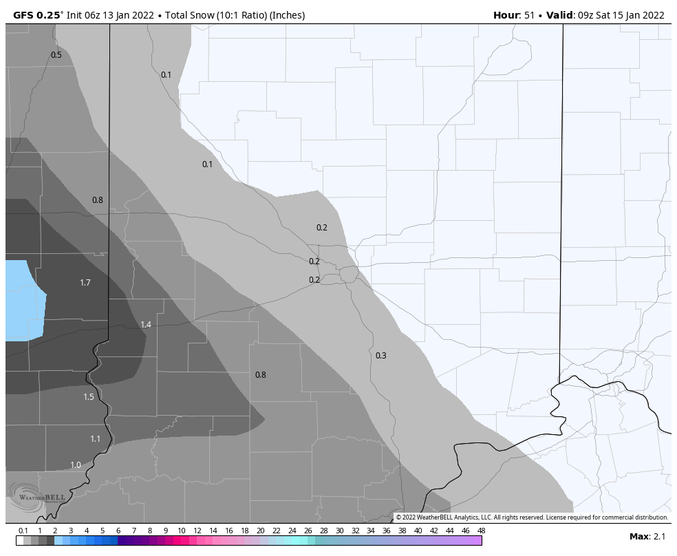
Low pressure re-organizes and re-strengthens in the Southeast Sunday, and as it plows northeastward snow could fall in the southeast half of the state in the afternoon and evening.

Never miss me! Subscribe for free. My Huge Radar has real-time weather tracking, current temperatures, and severe weather watches and warnings. Get detailed Indiana conditions by clicking here. Click here to see my central Indiana 7-Day Forecast. Follow these links to get my forecasts for Lafayette, Muncie, Hendricks County, and Hamilton County. Need a second opinion? Click here for central Indiana National Weather Service forecasts. (Some charts via WeatherBELL.)
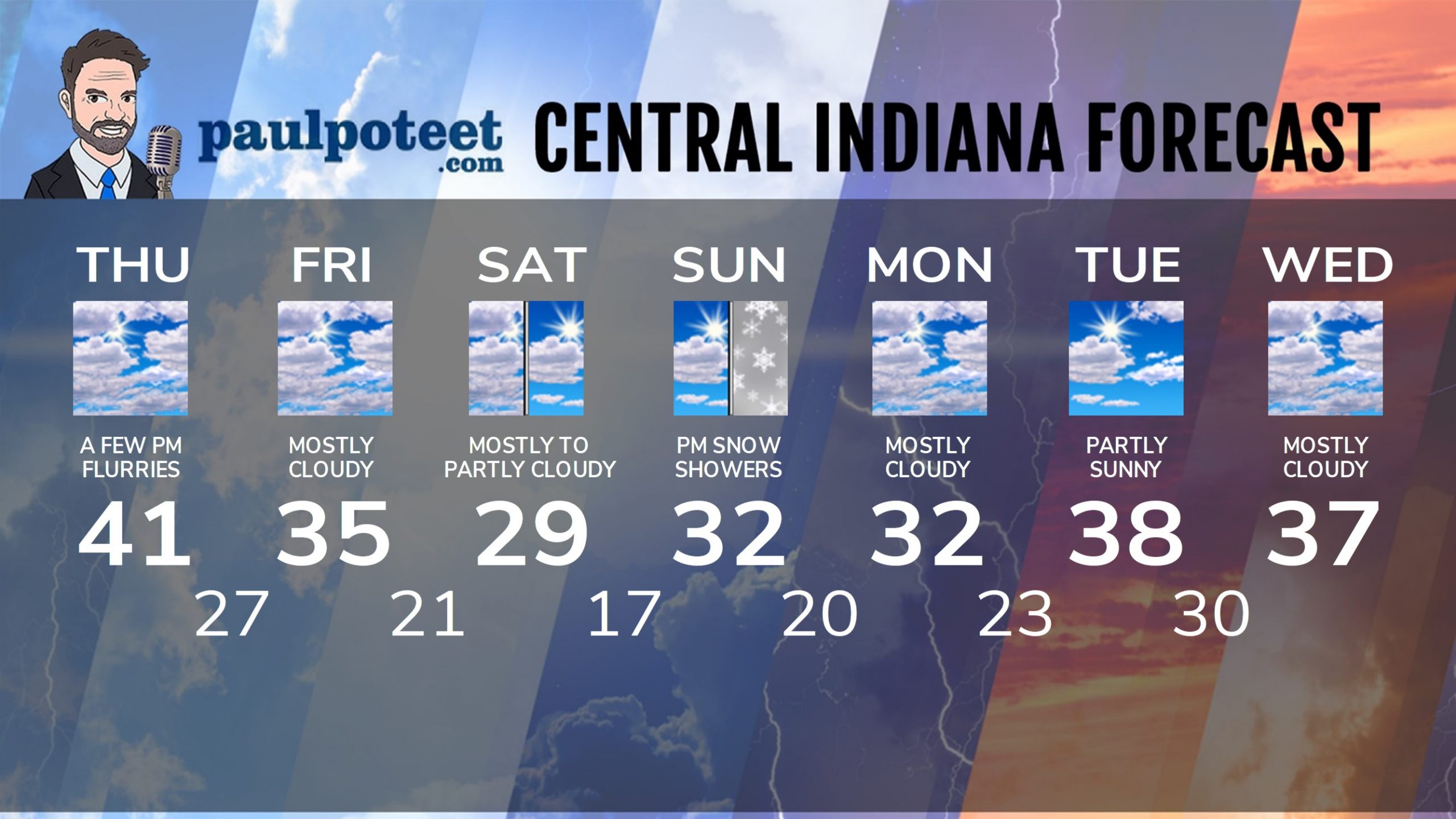
INDY SEVEN DAY FORECAST
Today: Mostly cloudy. Afternoon wind gusts to 20 mph. High 41.
Tonight: Mostly cloudy. A few flurries. Evening wind gusts to 20 mph. Low 27.
Friday: Mostly cloudy. High 35.
Friday Night: Flurries or snow showers after midnight. Little or no accumulation. Low 21.
Saturday: Mostly, then partly cloudy. High 29.
Saturday Night: Partly cloudy. Low 17.
Sunday: Partly sunny morning. Afternoon snow showers, with an inch or less accumulation. High 32.
Sunday Night: Scattered snow showers in the evening, then partly cloudy. Low 20.
Monday: Mostly cloudy, with a few flurries. High 32.
Monday Night: Mostly cloudy. Low 23.
Tuesday: Partly sunny. High 38.
Tuesday Night: Mostly cloudy. Low 30.
Wednesday: Mostly cloudy. High 37.
Never miss me! Subscribe for free. My Huge Radar has real-time weather tracking, current temperatures, and severe weather watches and warnings. Get detailed Indiana conditions by clicking here. Click here to see my central Indiana 7-Day Forecast. Follow these links to get my forecasts for Lafayette, Muncie, Hendricks County, and Hamilton County. Need a second opinion? Click here for central Indiana National Weather Service forecasts. (Some charts via WeatherBELL.)


