Wet, not white! The Christmas showers are coming into better focus now, with the most likely time for rain between midnight and Noon Saturday. It won’t necessarily be a foggy Christmas Eve, but Santa may need the wipers.
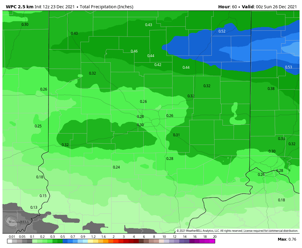
Total rainfall should be around a third of an inch or less.
Never miss me! Subscribe for free. My Huge Radar has real-time weather tracking, current temperatures, and severe weather watches and warnings. Get detailed Indiana conditions by clicking here. Click here to see my central Indiana 7-Day Forecast. Follow these links to get my forecasts for Lafayette, Muncie, Hendricks County, and Hamilton County. Need a second opinion? Click here for central Indiana National Weather Service forecasts. (Some charts via WeatherBELL.)
INDY SEVEN DAY FORECAST
Today: Partly sunny. Breezy, but not as cold. Clouds thicken in the afternoon. High 48.
Tonight: Mostly cloudy. Breezy. Low 45.
Friday: Clouds, breezy, and mild. Drizzle possible. High 57.
Christmas Eve: Mostly cloudy, breezy, and mild. Drizzle in the evening. Showers after midnight. Low 53.
Christmas Day: Mostly cloudy, with periods of showers, mainly in the morning. High 61.
Saturday Night: Partly cloudy. Low 36.
Sunday: Partly to mostly cloudy. High 51.
Sunday Night: Periods of showers. Low 43.
Monday: Mostly cloudy, with scattered showers in the morning. High 54.
Monday Night: Mostly cloudy, with scattered showers late. Low 40.
Tuesday: Mostly cloudy, with scattered showers. High 57.
Tuesday Night: Mostly cloudy, with scattered showers. Low 37.
Wednesday: Mostly cloudy, with scattered showers. High 50.

Never miss me! Subscribe for free. My Huge Radar has real-time weather tracking, current temperatures, and severe weather watches and warnings. Get detailed Indiana conditions by clicking here. Click here to see my central Indiana 7-Day Forecast. Follow these links to get my forecasts for Lafayette, Muncie, Hendricks County, and Hamilton County. Need a second opinion? Click here for central Indiana National Weather Service forecasts. (Some charts via WeatherBELL.)


