One weather scenario for Christmas Eve: temperatures zoom back into the 50s in the afternoon and evening, and rain returns. Temps stay up all night (like me when I was younger) and fall back into the 40s Christmas morning, as the rain ends.
Never miss me! Subscribe for free. My Huge Radar has real-time weather tracking, current temperatures, and severe weather watches and warnings. Get detailed Indiana conditions by clicking here. Click here to see my central Indiana 7-Day Forecast. Follow these links to get my forecasts for Lafayette, Muncie, Hendricks County, and Hamilton County. Need a second opinion? Click here for central Indiana National Weather Service forecasts. (Some charts via WeatherBELL.)
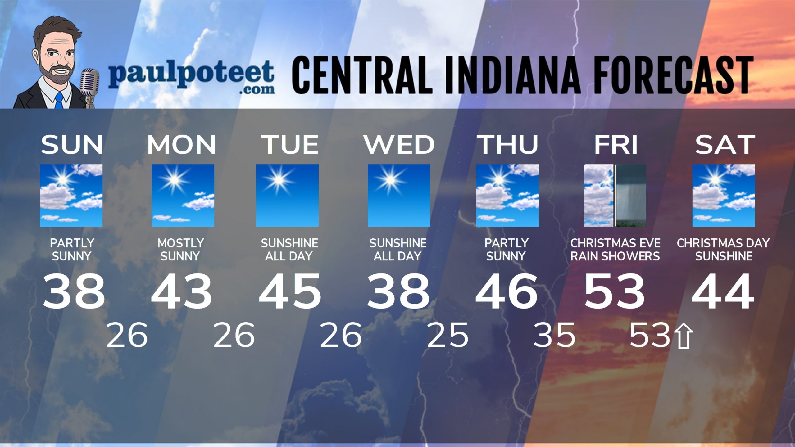
INDY SEVEN DAY FORECAST
Sunday: Partly sunny. High 38.
Sunday Night: Mostly clear. Low 26.
Monday: Mostly sunny. High 43.
Monday Night: Mostly clear. Low 26.
Tuesday: Mostly sunny. High 45.
Tuesday Night: Partly cloudy. Low 26.
Wednesday: Partly sunny. High 38.
Wednesday Night: Partly cloudy. Low 25.
Thursday: Partly sunny. High 46.
Thursday Night: Clouds increase. Low 35.
Friday: Cloudy, with showers around in the afternoon. High 53.
Christmas Eve: Scattered showers. Temps rising into the upper 50s!
Christmas Day: Partly sunny. Temps fall into the mid 40s.
Never miss me! Subscribe for free. My Huge Radar has real-time weather tracking, current temperatures, and severe weather watches and warnings. Get detailed Indiana conditions by clicking here. Click here to see my central Indiana 7-Day Forecast. Follow these links to get my forecasts for Lafayette, Muncie, Hendricks County, and Hamilton County. Need a second opinion? Click here for central Indiana National Weather Service forecasts. (Some charts via WeatherBELL.)


