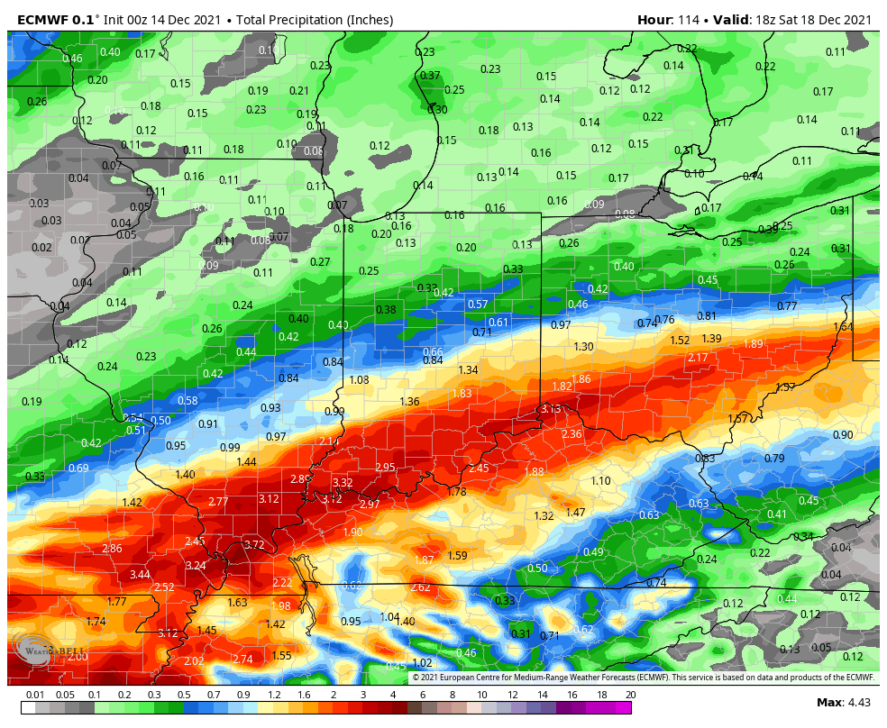
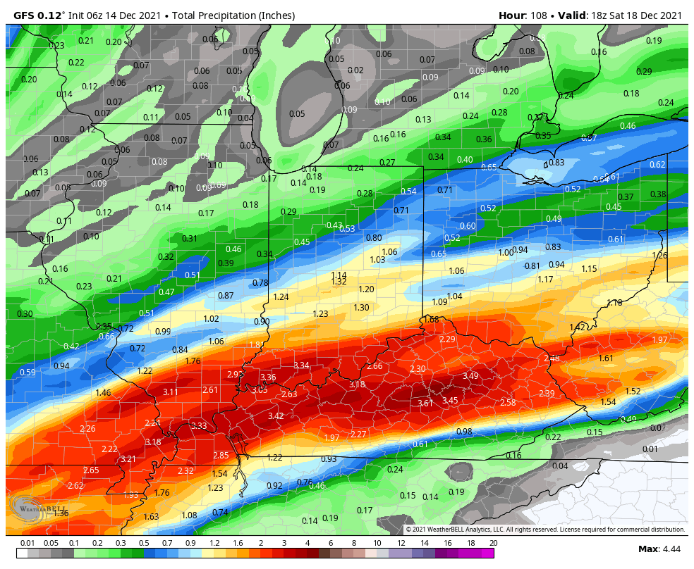
Nobody was asking for more rain, but it’s on the back burner. Spotty stuff Wednesday morning, then a bigger soak Thursday, and a super soaker Friday afternoon and evening. Two of the main computer modeling schemes are in pretty good agreement that rainfall southeast and east of Indy could exceed an inch through that period.
Never miss me! Subscribe for free. My Huge Radar has real-time weather tracking, current temperatures, and severe weather watches and warnings. Get detailed Indiana conditions by clicking here. Click here to see my central Indiana 7-Day Forecast. Follow these links to get my forecasts for Lafayette, Muncie, Hendricks County, and Hamilton County. Need a second opinion? Click here for central Indiana National Weather Service forecasts. (Some charts via WeatherBELL.)
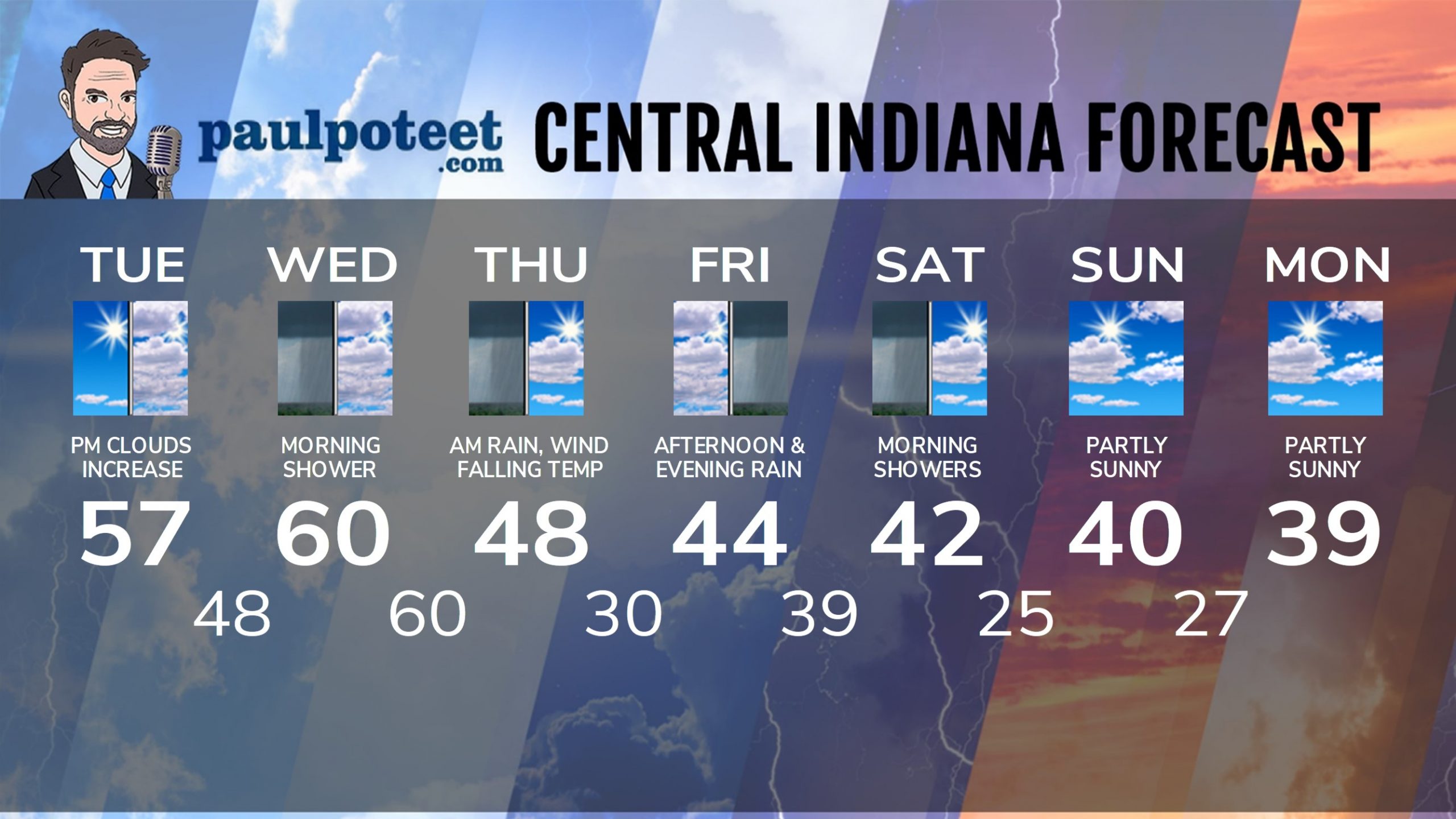
INDY SEVEN DAY FORECAST
Today: Sunny morning. Increasing afternoon clouds. High 57.
Tonight: Cloudy. A few showers after midnight. Low 48.
Wednesday: Mostly cloudy. Spotty showers in the morning. High 60.
Wednesday Night: Mostly cloudy. Steady temps around 60. Showers after midnight.
Thursday: Rain in the morning. Some sun in the afternoon. Wind gusting to 30 mph. Temps fall to the upper 40s by afternoon.
Thursday Night: Partly cloudy. Low 30.
Friday: Cloudy and cooler, with periods of rain, mainly in the afternoon. High 44.
Friday Night: Rainy. Low 39.
Saturday: Morning showers. Some sun in the afternoon. High 42.
Saturday Night: Partly cloudy. Low 25.
Sunday: Partly sunny. High 40.
Sunday Night: Partly cloudy. Low 27.
Monday: Partly sunny. High 39.
Never miss me! Subscribe for free. My Huge Radar has real-time weather tracking, current temperatures, and severe weather watches and warnings. Get detailed Indiana conditions by clicking here. Click here to see my central Indiana 7-Day Forecast. Follow these links to get my forecasts for Lafayette, Muncie, Hendricks County, and Hamilton County. Need a second opinion? Click here for central Indiana National Weather Service forecasts. (Some charts via WeatherBELL.)


