What a storm! Indianapolis tied the record high for December 11th by hitting 66 degrees. At 2 o’clock in the morning.
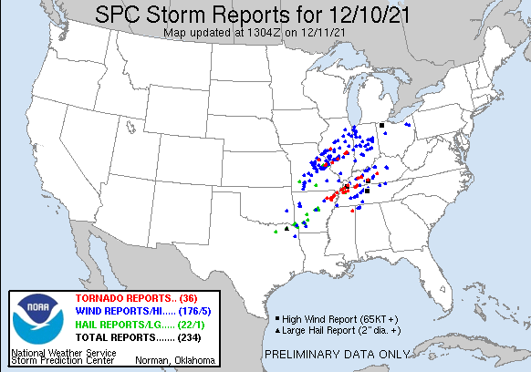
The Spring-like December storm unfortunately lived up to advance advertising, and the results may be a historic tornado death toll to our south in Kentucky. I saw no reports of tornadoes in Indiana, but there were plenty of reports of high winds.
Never miss me! Subscribe for free. My Huge Radar has real-time weather tracking, current temperatures, and severe weather watches and warnings. Get detailed Indiana conditions by clicking here. Click here to see my central Indiana 7-Day Forecast. Follow these links to get my forecasts for Lafayette, Muncie, Hendricks County, and Hamilton County. Need a second opinion? Click here for central Indiana National Weather Service forecasts. (Some charts via WeatherBELL.)
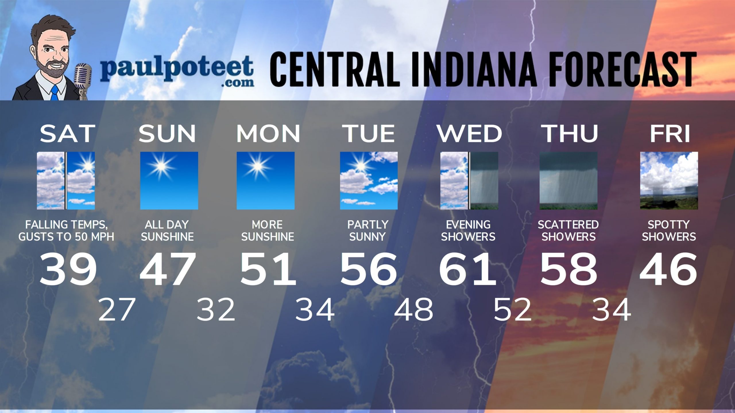
INDY SEVEN DAY FORECAST
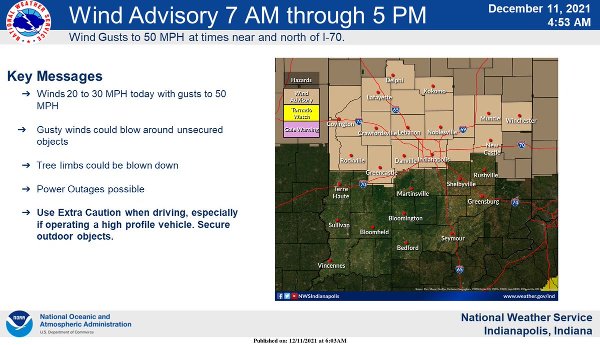
Saturday: Temps falling from around 60 at sunrise into the upper 30s by afternoon. Wind gusting to 40 mph. Chills in the 20s by late morning. High 39.
Saturday Night: Clearing and cold. Wind gusting to 20 mph in the evening. Low 27.
Sunday: Sunny. High 47.
Sunday Night: Clear. Low 32.
Monday: Sunny. High 51.
Monday Night: Partly cloudy. Low 34.
Tuesday: Partly sunny. High 56.
Tuesday Night: Mostly cloudy. Low 48.
Wednesday: Mostly cloudy. High 61.
Wednesday Night: Scattered showers. Low 52.
Thursday: Mostly cloudy, with scattered showers. High 58.
Thursday Night: Scattered showers. Low 34.
Friday: Partly sunny and cooler. Spotty showers. High 46.
Never miss me! Subscribe for free. My Huge Radar has real-time weather tracking, current temperatures, and severe weather watches and warnings. Get detailed Indiana conditions by clicking here. Click here to see my central Indiana 7-Day Forecast. Follow these links to get my forecasts for Lafayette, Muncie, Hendricks County, and Hamilton County. Need a second opinion? Click here for central Indiana National Weather Service forecasts. (Some charts via WeatherBELL.)


