It won’t be as dreary or as cold this afternoon in central Indiana, and the second round of thunderstorms in one week is waiting Friday night.
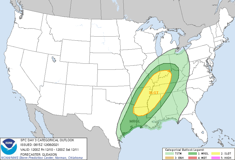
A major storm system will organize in the West in the next 24 hours. First thing: a warm front moves up over the area later Thursday, perhaps bringing a stray sprinkle and lots of clouds. Temps will jump into the 60s Friday, and stay there through about sunrise Saturday. Ahead of the front, a risk of severe weather Friday evening and overnight, in the southern half of the state.
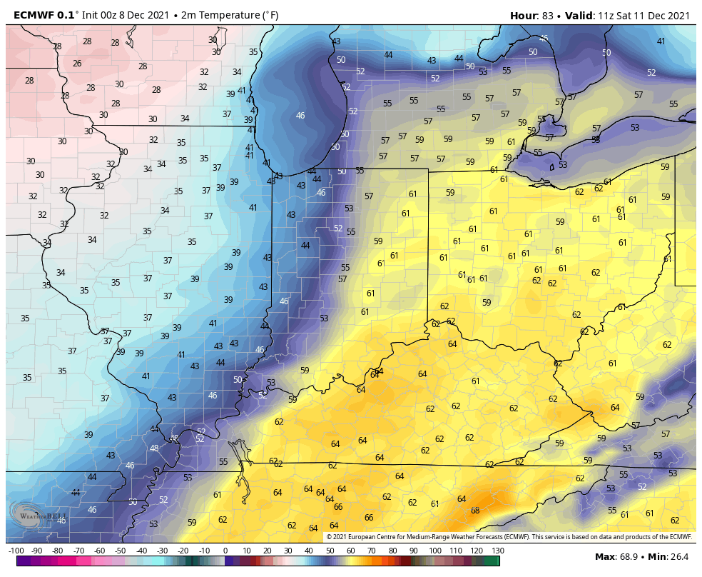
This shows computer-modeled temperatures at 6am Saturday, with the cooler air advancing behind the cold front from the west.
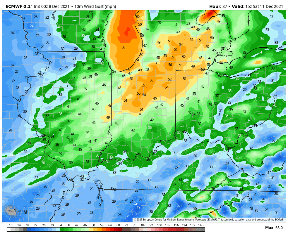
Saturday will be dry…but windy! Chills will be in the 20s.
Never miss me! Subscribe for free. My Huge Radar has real-time weather tracking, current temperatures, and severe weather watches and warnings. Get detailed Indiana conditions by clicking here. Click here to see my central Indiana 7-Day Forecast. Follow these links to get my forecasts for Lafayette, Muncie, Hendricks County, and Hamilton County. Need a second opinion? Click here for central Indiana National Weather Service forecasts. (Some charts via WeatherBELL.)
INDY SEVEN DAY FORECAST
Today: Morning clouds, and afternoon sun. Might be a few flurries in the morning. High 39.
Tonight: Mostly clear. Low 25.
Thursday: Partly to mostly cloudy. High 49.
Thursday Night: Mostly cloudy. Low 44.
Friday: Cloudy. Shower chance in the morning. Rain in the afternoon. High 62.
Friday Night: Rain and storms. Low 62.
Saturday: Early morning showers, then mostly cloudy, with temps falling from around 60 at sunrise into the 30s. Wind gusting to 40 mph.
Saturday Night: Partly cloudy. Low 27.
Sunday: Sunny. High 45.
Sunday Night: Clear. Low 33.
Monday: Sunny. High 50.
Monday Night: Mostly clear. Low 34.
Tuesday: Partly sunny. High 53.

Never miss me! Subscribe for free. My Huge Radar has real-time weather tracking, current temperatures, and severe weather watches and warnings. Get detailed Indiana conditions by clicking here. Click here to see my central Indiana 7-Day Forecast. Follow these links to get my forecasts for Lafayette, Muncie, Hendricks County, and Hamilton County. Need a second opinion? Click here for central Indiana National Weather Service forecasts. (Some charts via WeatherBELL.)


