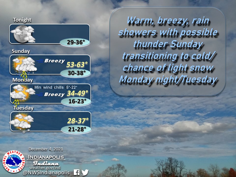
(Via @NWSIndianapolis.) High temps Sunday 53-63, increasingly breezy and rain/t-storm chances. Best chance thunder S of I-70 overnight. Breezy into Mon, slight chance of showers/t-storms SE IN. Wind chills Mon night dip to 5 to ~20°. Chance light snow Tue PM into Wed. #INwx #nwsind https://t.co/jDCDhmTpYx
My Huge Radar has real-time weather tracking, current temperatures, and severe weather watches and warnings. Get detailed Indiana conditions by clicking here. Follow these links to get my forecasts for Lafayette, Muncie, Hendricks County, and Hamilton County. Need a second opinion? Click here for central Indiana National Weather Service forecasts.
Never miss me! Subscribe for free. My Huge Radar has real-time weather tracking, current temperatures, and severe weather watches and warnings. Get detailed Indiana conditions by clicking here. Click here to see my central Indiana 7-Day Forecast. Follow these links to get my forecasts for Lafayette, Muncie, Hendricks County, and Hamilton County. Need a second opinion? Click here for central Indiana National Weather Service forecasts. (Some charts via WeatherBELL.)


