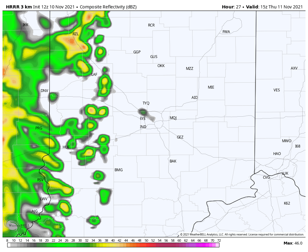
I just told Mrs. P to ride her bike and ignore the leaves today, because they are just going to get re-arranged tomorrow. Wind gusts to 40 mph are likely Thursday. Expect steady rain by mid-morning in Lafayette and the Haute, moving eastward. It will arrive by late morning in the Indy metro, and in the afternoon to the east.
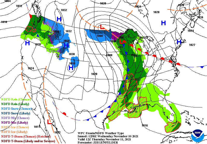
The fuss is from a cold front (first of two) that will start the process of cooling down into the weekend. We will probably see our first flakes of snow flying around by Sunday.
Never miss me! Subscribe for free. My Huge Radar has real-time weather tracking, current temperatures, and severe weather watches and warnings. Get detailed Indiana conditions by clicking here. Click here to see my central Indiana 7-Day Forecast. Follow these links to get my forecasts for Lafayette, Muncie, Hendricks County, and Hamilton County. Need a second opinion? Click here for central Indiana National Weather Service forecasts. (Some charts via WeatherBELL.)
INDY SEVEN DAY FORECAST
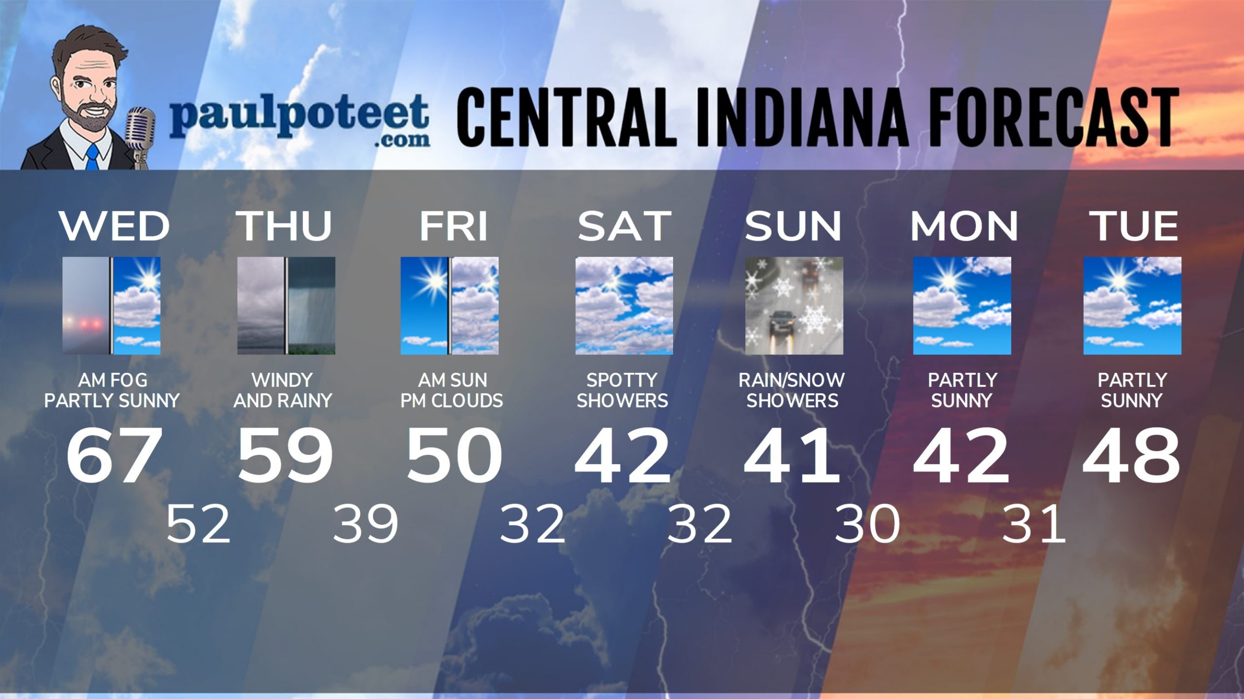
Today: Dense Fog Advisory until 9am, then partly sunny. High 67.
Tonight: Partly to mostly cloudy. Low 52.
Thursday: Cloudy, with steady rain, mainly in the afternoon. Wind gusting to 40 mph. High 59.
Thursday Night: Clouds decrease. Low 39.
Friday: Morning sun, and afternoon clouds. Wind gusting to 30 mph. High 50.
Friday Night: Mostly cloudy. Spotty rain and/or snow shower possible. Low 32.
Saturday: Partly to mostly cloudy. Spotty rain and/or snow shower possible. High 42.
Saturday Night: Mostly cloudy. Spotty rain and/or snow shower possible. Low 32.
Sunday: Mostly cloudy. Scattered rain and/or snow showers. High 41.
Sunday Night: Mostly cloudy. Spotty rain/snow showers. Low 30.
Monday: Partly sunny. High 42.
Monday Night: Partly cloudy. Low 31.
Tuesday: Partly sunny. High 48.
Never miss me! Subscribe for free. My Huge Radar has real-time weather tracking, current temperatures, and severe weather watches and warnings. Get detailed Indiana conditions by clicking here. Click here to see my central Indiana 7-Day Forecast. Follow these links to get my forecasts for Lafayette, Muncie, Hendricks County, and Hamilton County. Need a second opinion? Click here for central Indiana National Weather Service forecasts. (Some charts via WeatherBELL.)


