Rain since Sunday totals 2-3 inches across most of central Indiana. Nope, you don’t need any more, but you’re gonna get it Monday. The heaviest, sustained rain is over, but scattered showers will continue, mainly in the morning.
SUNDAY TOTALS
2.52″ Lafayette (8.04 for the month!)
1.41″ Indianapolis (6.20 for the month)
1.28″ Muncie (3.98 for the month)
0.73″ Terre Haute (2.27 for the month)
0.59″ Bloomington (4.17 for the month)
MONDAY MIDNIGHT-6AM UNOFFICIAL TOTALS
1.30″ Muncie
0.75″ Terre Haute
0.61″ Indianapolis
0.47″ Bloomington
0.40″ Lafayette
Never miss me! Subscribe for free. My Huge Radar has real-time weather tracking, current temperatures, and severe weather watches and warnings. Get detailed Indiana conditions by clicking here. Click here to see my central Indiana 7-Day Forecast. Follow these links to get my forecasts for Lafayette, Muncie, Hendricks County, and Hamilton County. Need a second opinion? Click here for central Indiana National Weather Service forecasts. (Some charts via WeatherBELL.)
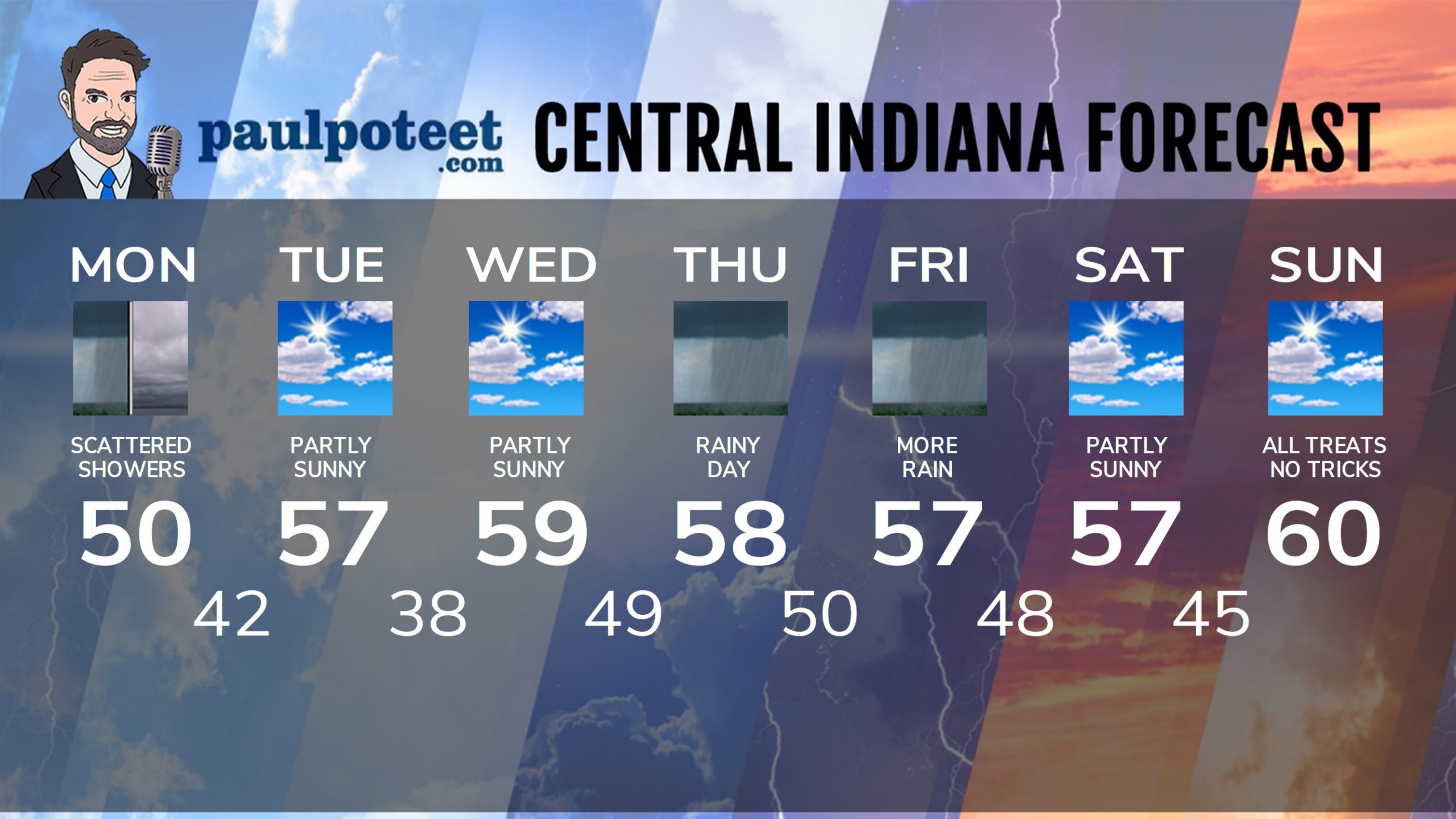
INDY SEVEN DAY FORECAST
Today: Cloudy and cooler, with scattered showers, especially in the morning and midday. Wind gusts to 35 mph. Temps fall to around 50 by afternoon.
Tonight: Mostly cloudy. Low 42.
Tuesday: Partly sunny. High 57.
Tuesday Night: Mostly clear. Low 38.
Wednesday: Patchy morning frost. Partly sunny. High 59.
Wednesday Night: Mostly cloudy. Scattered showers. Low 49.
Thursday: Periods of rain. High 58.
Thursday Night: Periods of rain. Low 50.
Friday: Periods of rain. High 57.
Friday Night: Scattered showers. Low 48.
Saturday: Partly sunny. High 57.
Saturday Night: Partly cloudy. Low 45.
Sunday: Partly sunny. High 60.
Never miss me! Subscribe for free. My Huge Radar has real-time weather tracking, current temperatures, and severe weather watches and warnings. Get detailed Indiana conditions by clicking here. Click here to see my central Indiana 7-Day Forecast. Follow these links to get my forecasts for Lafayette, Muncie, Hendricks County, and Hamilton County. Need a second opinion? Click here for central Indiana National Weather Service forecasts. (Some charts via WeatherBELL.)


