Let’s talk “Fall.” Temps and rain…fall.
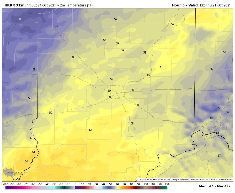
Temps will fall from morning 60s to afternoon 50s today. To add to the Fall Feels: wind gusting to 25mph.
An inch or two of rainFALL is possible over the next seven days, primarily on Sunday and Monday.
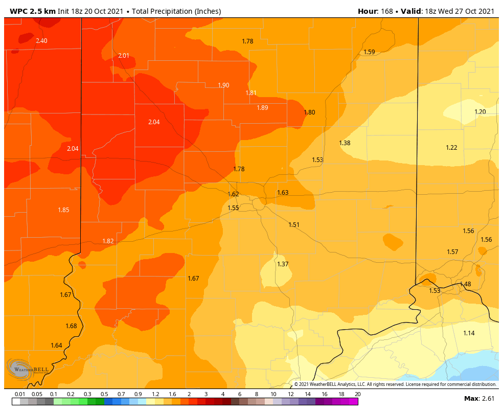
Lighter stuff ends early this morning north of Indy, and a few sprinkles are possible tomorrow afternoon. Get your outdoor stuff done on Saturday! No big severe weather threats at this time, but there could be some thunder Sunday night and Monday.
Never miss me! Subscribe for free. My Huge Radar has real-time weather tracking, current temperatures, and severe weather watches and warnings. Get detailed Indiana conditions by clicking here. Click here to see my central Indiana 7-Day Forecast. Follow these links to get my forecasts for Lafayette, Muncie, Hendricks County, and Hamilton County. Need a second opinion? Click here for central Indiana National Weather Service forecasts. (Some charts via WeatherBELL.)
INDY SEVEN DAY FORECAST
Today: Isolated early morning shower, then partly sunny. Morning high 64. Mostly cloudy afternoon, with temps falling into the 50s. Wind gusting to 25 mph. High 64.
Tonight: Mostly cloudy. Low 48.
Friday: Mostly cloudy. A few spotty showers possible in the afternoon. High 57.
Friday Night: Partly cloudy. Low 42.
Saturday: Partly sunny. High 61.
Saturday Night: Partly cloudy. Scattered showers after midnight. Low 46.
Sunday: Cloudy, with periods of rain. High 66.
Sunday Night: More rain. Thunder possible. Low 55.
Monday: Scattered showers, and maybe some thunderstorms. High 64.
Monday Night: Scattered showers. Low 51.
Tuesday: Partly sunny. High 65.
Tuesday Night: Partly cloudy. Showers late. Low 52.
Wednesday: Mostly cloudy, with scattered showers. High 65.

Never miss me! Subscribe for free. My Huge Radar has real-time weather tracking, current temperatures, and severe weather watches and warnings. Get detailed Indiana conditions by clicking here. Click here to see my central Indiana 7-Day Forecast. Follow these links to get my forecasts for Lafayette, Muncie, Hendricks County, and Hamilton County. Need a second opinion? Click here for central Indiana National Weather Service forecasts. (Some charts via WeatherBELL.)


