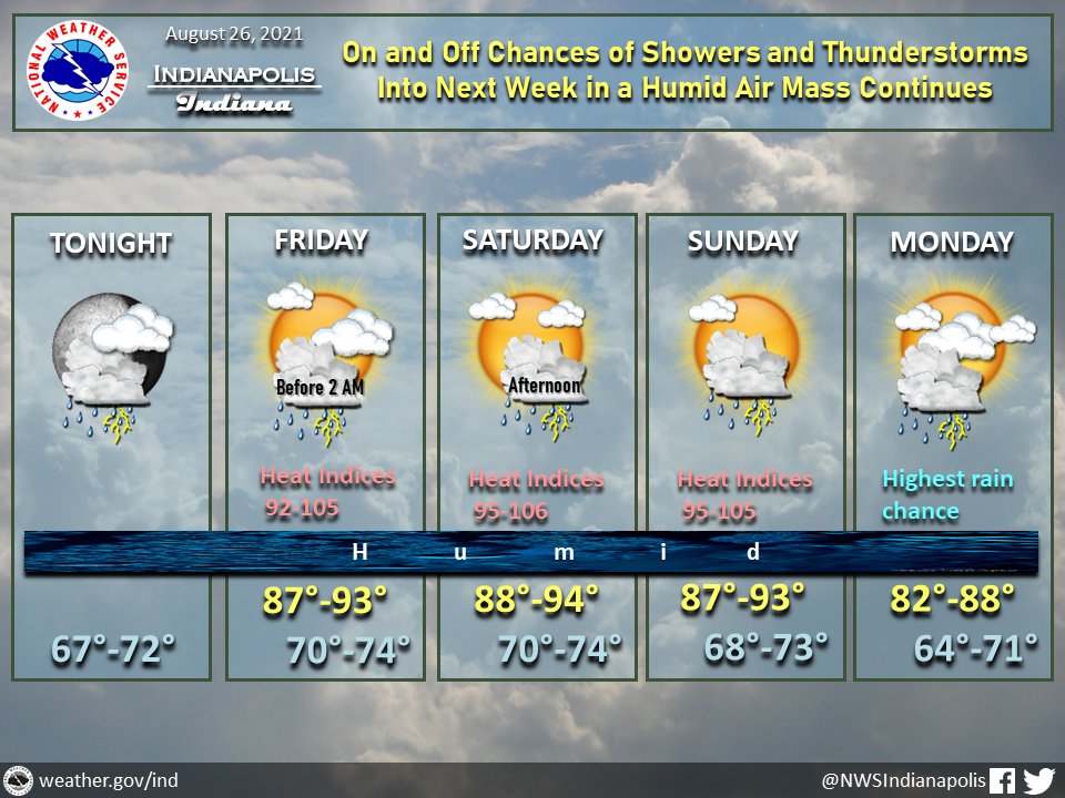
(Via @NWSIndianapolis.) On/off showers & t-storms in a humid air mass will continue into next week. Highest chance of rain on Monday. Heat indices Fri thru Sun, peaking in lower 90s to ~105°, hottest western IN. High temps lower 80s to mid 90s, lows mid 60s to mid 70s. #INwx #nwsind https://t.co/bAnO7AzjVt
My Huge Radar has real-time weather tracking, current temperatures, and severe weather watches and warnings. Get detailed Indiana conditions by clicking here. Follow these links to get my forecasts for Lafayette, Muncie, Hendricks County, and Hamilton County. Need a second opinion? Click here for central Indiana National Weather Service forecasts.
Never miss me! Subscribe for free. My Huge Radar has real-time weather tracking, current temperatures, and severe weather watches and warnings. Get detailed Indiana conditions by clicking here. Click here to see my central Indiana 7-Day Forecast. Follow these links to get my forecasts for Lafayette, Muncie, Hendricks County, and Hamilton County. Need a second opinion? Click here for central Indiana National Weather Service forecasts. (Some charts via WeatherBELL.)


