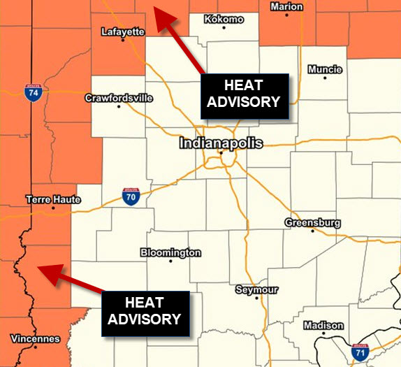
Spotty showers and storms Tuesday morning, with a few spotty storms possible Tuesday afternoon, mainly east and south of Indianapolis. Meanwhile, there’s a Heat Advisory in the western part of Indiana, including Lafayette and Terre Haute. Afternoon heat index numbers will be in the triple digits.
Never miss me! Subscribe for free. My Huge Radar has real-time weather tracking, current temperatures, and severe weather watches and warnings. Get detailed Indiana conditions by clicking here. Click here to see my central Indiana 7-Day Forecast. Follow these links to get my forecasts for Lafayette, Muncie, Hendricks County, and Hamilton County. Need a second opinion? Click here for central Indiana National Weather Service forecasts. (Some charts via WeatherBELL.)
INDY SEVEN DAY FORECAST
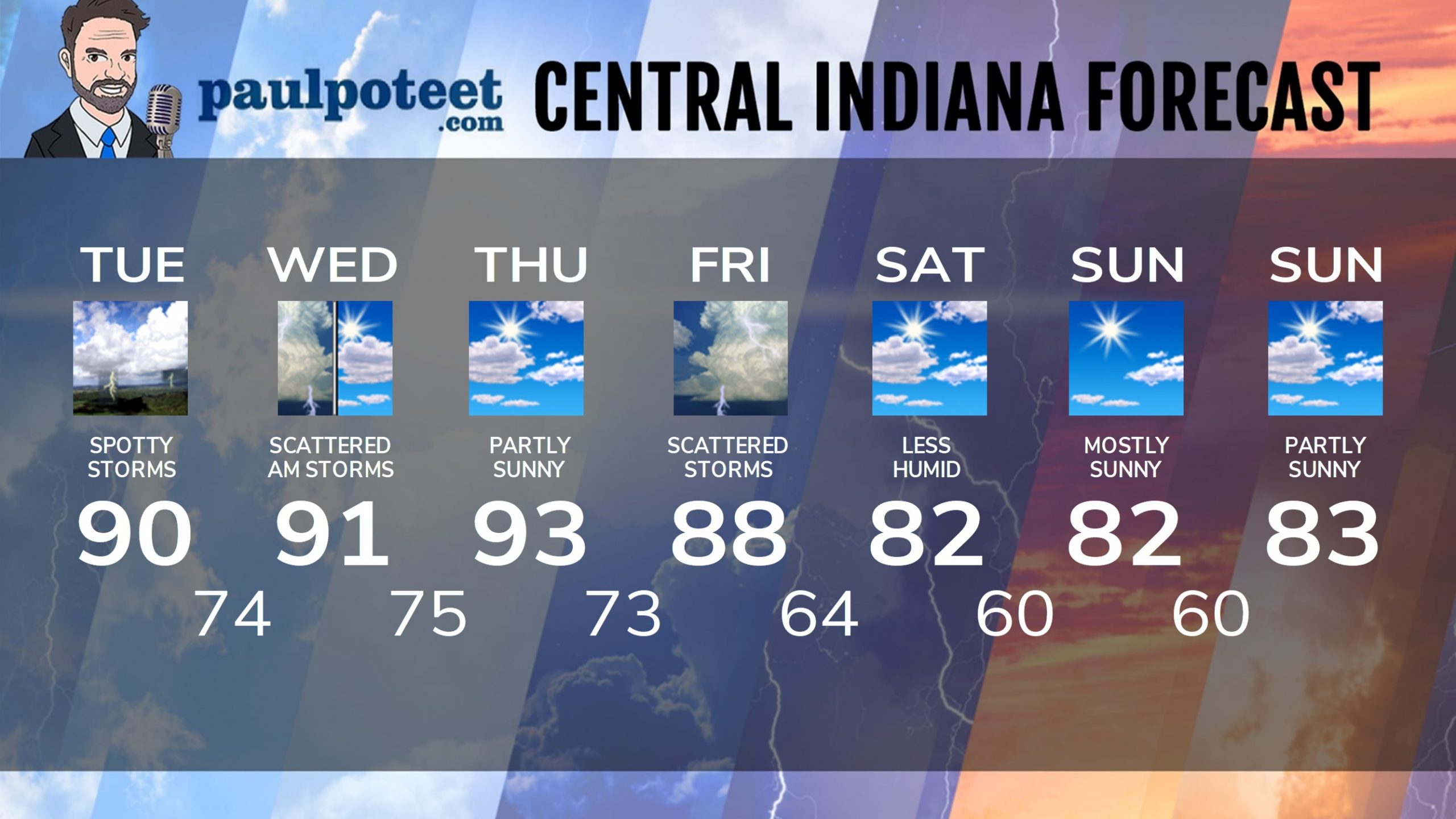
Today: Partly sunny. Stray showers and storms possible in the early morning, and again in the afternoon. High 90.
Tonight: Spotty storm early. Showers and storms are likely after midnight. Low 74.
Wednesday: Partly sunny, with scattered showers and storms in the morning. High 91.
Wednesday Night: Partly cloudy. Isolated shower or storm possible in the afternoon. Low 75.
Thursday: Partly sunny. High 93.
Thursday Night: Scattered showers and storms. Low 73.
Friday: Scattered showers and storms. High 88.
Friday Night: Scattered showers and storms. Low 64.
Saturday: Partly sunny, and less humid. High 82.
Saturday Night: Mostly clear. Low 60.
Sunday: Mostly sunny. High 82.
Sunday Night: Mostly clear. Low 60.
Monday: Partly sunny. High 83.
Never miss me! Subscribe for free. My Huge Radar has real-time weather tracking, current temperatures, and severe weather watches and warnings. Get detailed Indiana conditions by clicking here. Click here to see my central Indiana 7-Day Forecast. Follow these links to get my forecasts for Lafayette, Muncie, Hendricks County, and Hamilton County. Need a second opinion? Click here for central Indiana National Weather Service forecasts. (Some charts via WeatherBELL.)


