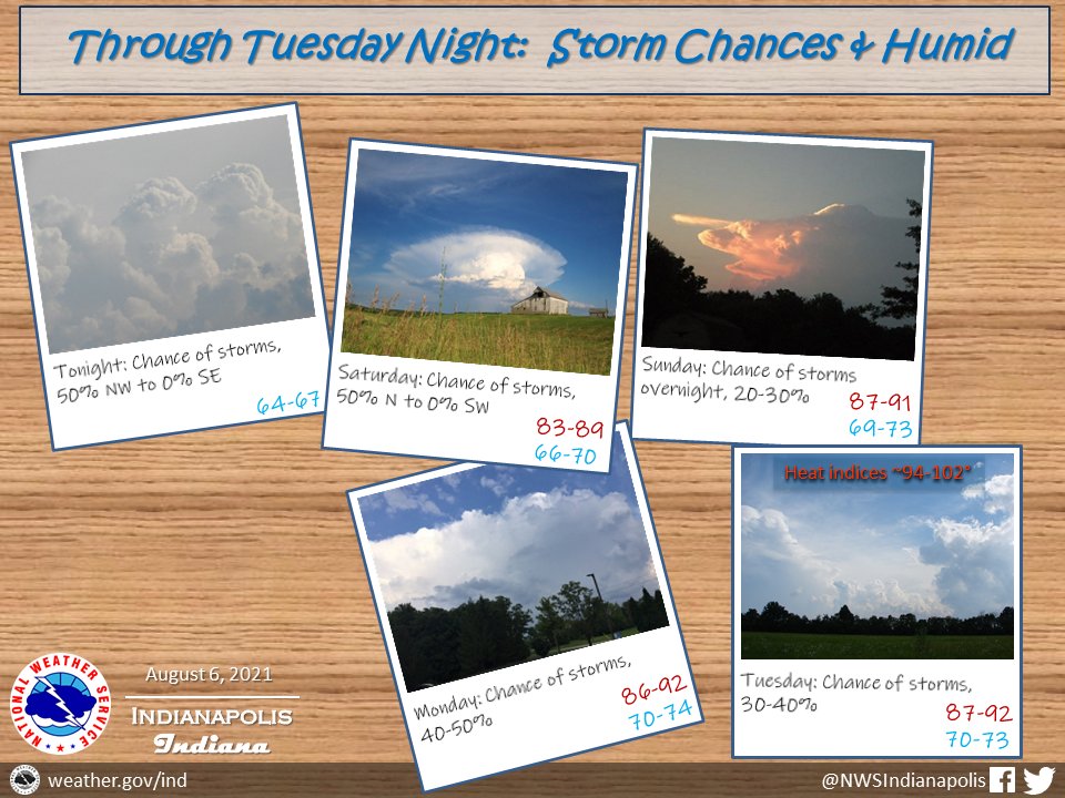
(Via @NWSIndianapolis.) Thru Tuesday night: Very warm and humid conditions with up to a 50% chance of thunderstorms. High temperatures will range from the lower 80s to lower 90s with heat indices topping in the approximately 94 to 102-degree range, lows in the mid 60s to lower 70s. #INwx #nwsind https://t.co/vuGi2oTyR4
My Huge Radar has real-time weather tracking, current temperatures, and severe weather watches and warnings. Get detailed Indiana conditions by clicking here. Follow these links to get my forecasts for Lafayette, Muncie, Hendricks County, and Hamilton County. Need a second opinion? Click here for central Indiana National Weather Service forecasts.
Never miss me! Subscribe for free. My Huge Radar has real-time weather tracking, current temperatures, and severe weather watches and warnings. Get detailed Indiana conditions by clicking here. Click here to see my central Indiana 7-Day Forecast. Follow these links to get my forecasts for Lafayette, Muncie, Hendricks County, and Hamilton County. Need a second opinion? Click here for central Indiana National Weather Service forecasts. (Some charts via WeatherBELL.)


