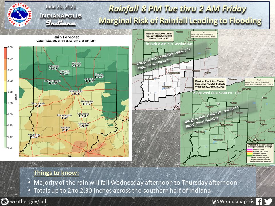
(Via @NWSIndianapolis.) More showers/t-storms thru Thu night, majority Wed PM thru Thu PM. Moderate to possibly locally heavy rain w/ totals by 2 AM Fri up to 2-2.30″ much of S 1/2 of IN. Marginal risk of rapid onset flooding tonight ~N 1/2 of IN, then ~S 3/4 of IN Wed & Wed night. #INwx #nwsind https://t.co/s9nDLwyuof
My Huge Radar has real-time weather tracking, current temperatures, and severe weather watches and warnings. Get detailed Indiana conditions by clicking here. Follow these links to get my forecasts for Lafayette, Muncie, Hendricks County, and Hamilton County. Need a second opinion? Click here for central Indiana National Weather Service forecasts.
Never miss me! Subscribe for free. My Huge Radar has real-time weather tracking, current temperatures, and severe weather watches and warnings. Get detailed Indiana conditions by clicking here. Click here to see my central Indiana 7-Day Forecast. Follow these links to get my forecasts for Lafayette, Muncie, Hendricks County, and Hamilton County. Need a second opinion? Click here for central Indiana National Weather Service forecasts. (Some charts via WeatherBELL.)


