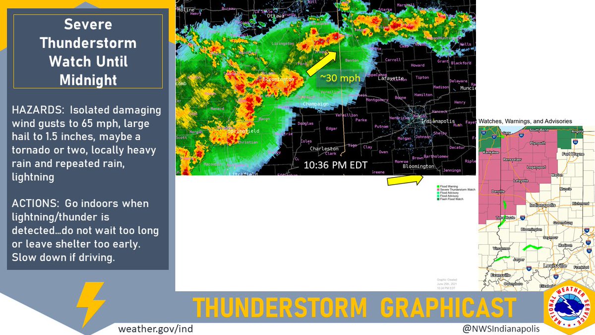
(Via @NWSIndianapolis.) Storms in IL being monitored as they move NE ~35 mph while the line they are in moves E toward IN. Severe t-storm watch in effect until 12 AM EDT west central to north central IN. Potential for severe storms is expected to diminish as we head into the early AM. #INwx #nwsind https://t.co/4cglACcMFz
My Huge Radar has real-time weather tracking, current temperatures, and severe weather watches and warnings. Get detailed Indiana conditions by clicking here. Follow these links to get my forecasts for Lafayette, Muncie, Hendricks County, and Hamilton County. Need a second opinion? Click here for central Indiana National Weather Service forecasts.
Never miss me! Subscribe for free. My Huge Radar has real-time weather tracking, current temperatures, and severe weather watches and warnings. Get detailed Indiana conditions by clicking here. Click here to see my central Indiana 7-Day Forecast. Follow these links to get my forecasts for Lafayette, Muncie, Hendricks County, and Hamilton County. Need a second opinion? Click here for central Indiana National Weather Service forecasts. (Some charts via WeatherBELL.)


