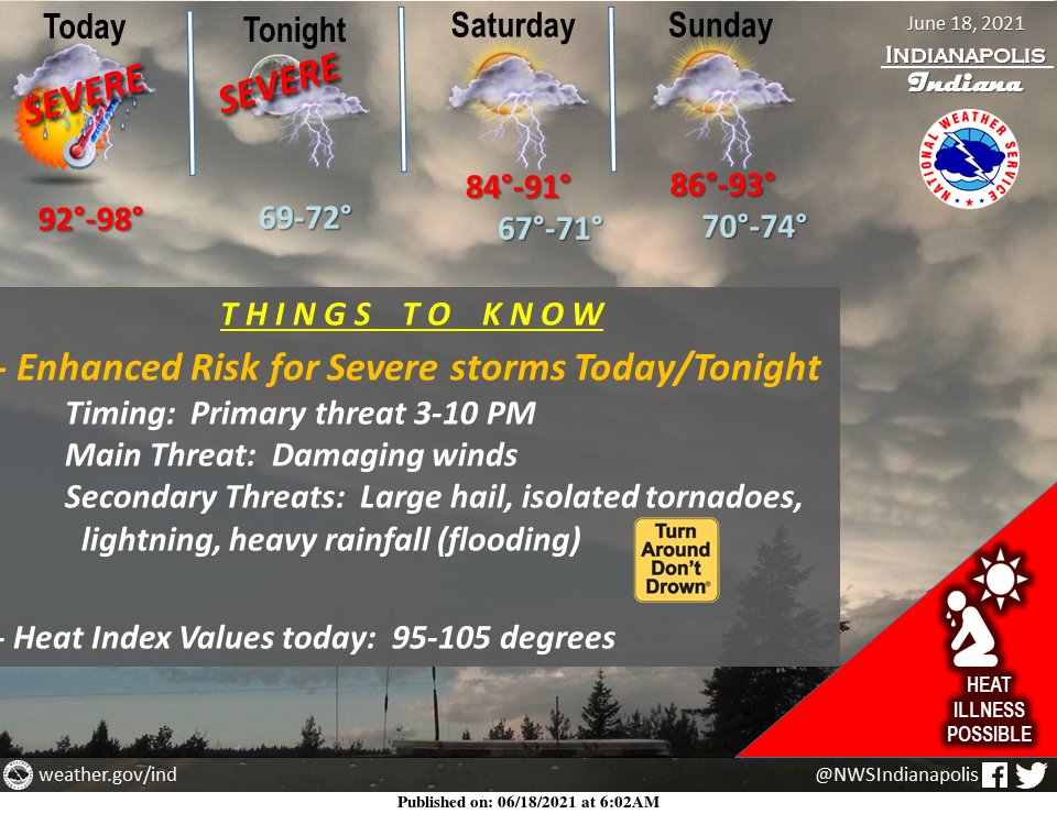
(Via @NWSIndianapolis.) ENHANCED RISK for severe thunderstorms today-tonight, main threat damaging winds. Large hail, frequent lightning, isolated tornadoes, and heavy rainfall that could lead to flooding are also possible. High temps will peak in the 90s, with heat index values as high as 95-105. #INwx https://t.co/djTLllG4nf
My Huge Radar has real-time weather tracking, current temperatures, and severe weather watches and warnings. Get detailed Indiana conditions by clicking here. Follow these links to get my forecasts for Lafayette, Muncie, Hendricks County, and Hamilton County. Need a second opinion? Click here for central Indiana National Weather Service forecasts.
Never miss me! Subscribe for free. My Huge Radar has real-time weather tracking, current temperatures, and severe weather watches and warnings. Get detailed Indiana conditions by clicking here. Click here to see my central Indiana 7-Day Forecast. Follow these links to get my forecasts for Lafayette, Muncie, Hendricks County, and Hamilton County. Need a second opinion? Click here for central Indiana National Weather Service forecasts. (Some charts via WeatherBELL.)


