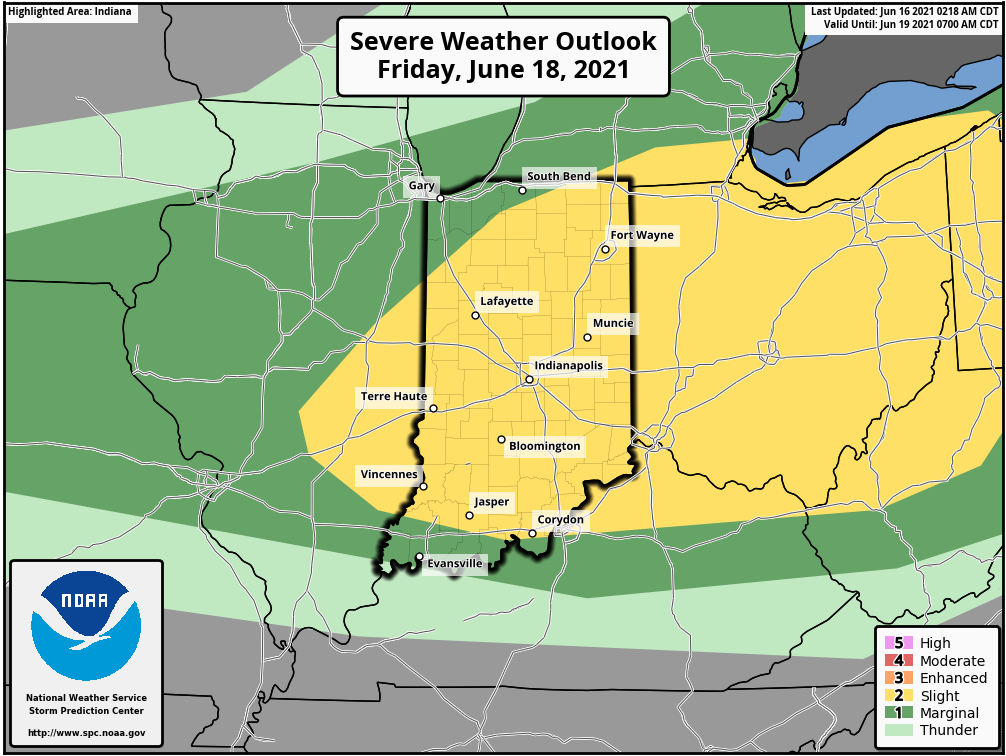
Make hay while the sun shines! And it will today and tomorrow, before heat, humidity, and thunderstorms return Friday. Large hail and damaging wind are possible with these storms. At the moment there is a level 2 out of 5 risk.
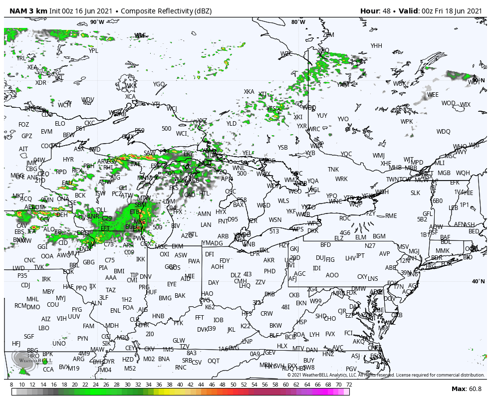
Much depends on the evolution of a complex of storms that may form to our west and northwest Thursday night.
Never miss me! Subscribe for free. My Huge Radar has real-time weather tracking, current temperatures, and severe weather watches and warnings. Get detailed Indiana conditions by clicking here. Click here to see my central Indiana 7-Day Forecast. Follow these links to get my forecasts for Lafayette, Muncie, Hendricks County, and Hamilton County. Need a second opinion? Click here for central Indiana National Weather Service forecasts. (Some charts via WeatherBELL.)
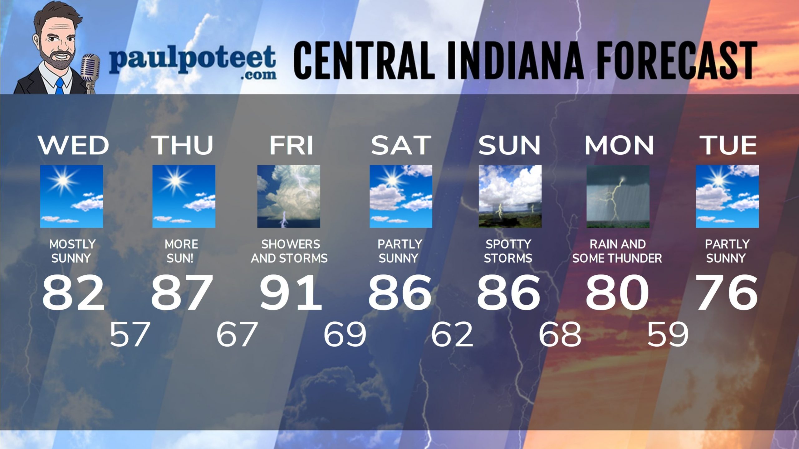
INDY SEVEN DAY FORECAST
Today: Mostly sunny. High 82.
Tonight: Clear. Low 57.
Thursday: Mostly sunny. High 87.
Thursday Night: Partly cloudy. Shower and storm chances after midnight. Low 67.
Friday: Partly to mostly cloudy and muggy. Periods of showers and storms. High 91.
Friday Night: Partly cloudy. Scattered showers and storms. Low 69.
Saturday: Partly sunny. High 86.
Saturday Night: Partly cloudy. Low 62.
Sunday: Partly sunny. Spotty showers and storms, mainly in the afternoon. High 86.
Sunday Night: Partly cloudy. Scattered showers and storms. Low 68.
Monday: Mostly cloudy, with showers likely, and storms possible. High 80.
Monday Night: Scattered showers. Low 59.
Tuesday: Partly sunny. High 76.
Never miss me! Subscribe for free. My Huge Radar has real-time weather tracking, current temperatures, and severe weather watches and warnings. Get detailed Indiana conditions by clicking here. Click here to see my central Indiana 7-Day Forecast. Follow these links to get my forecasts for Lafayette, Muncie, Hendricks County, and Hamilton County. Need a second opinion? Click here for central Indiana National Weather Service forecasts. (Some charts via WeatherBELL.)


