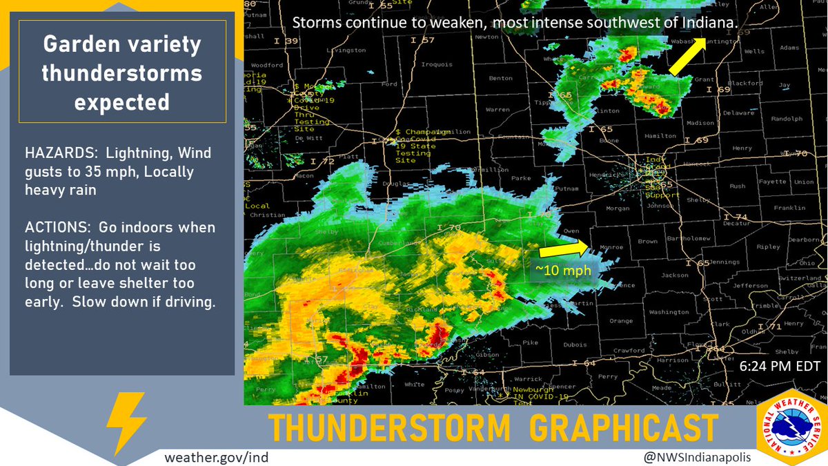
(Via @NWSIndianapolis.) Scattered garden variety thunderstorms pushing thru/into IN. Intensity diminishing. Heaviest storms in central/southern IN are in Tipton, Sullivan, and Knox counties as of 6:24 PM. Wind gusts to about 35 mph, lightning, and locally heavy rainfall possible. #INwx #nwsind https://t.co/GQrUaol3B5
My Huge Radar has real-time weather tracking, current temperatures, and severe weather watches and warnings. Get detailed Indiana conditions by clicking here. Follow these links to get my forecasts for Lafayette, Muncie, Hendricks County, and Hamilton County. Need a second opinion? Click here for central Indiana National Weather Service forecasts.
Never miss me! Subscribe for free. My Huge Radar has real-time weather tracking, current temperatures, and severe weather watches and warnings. Get detailed Indiana conditions by clicking here. Click here to see my central Indiana 7-Day Forecast. Follow these links to get my forecasts for Lafayette, Muncie, Hendricks County, and Hamilton County. Need a second opinion? Click here for central Indiana National Weather Service forecasts. (Some charts via WeatherBELL.)


