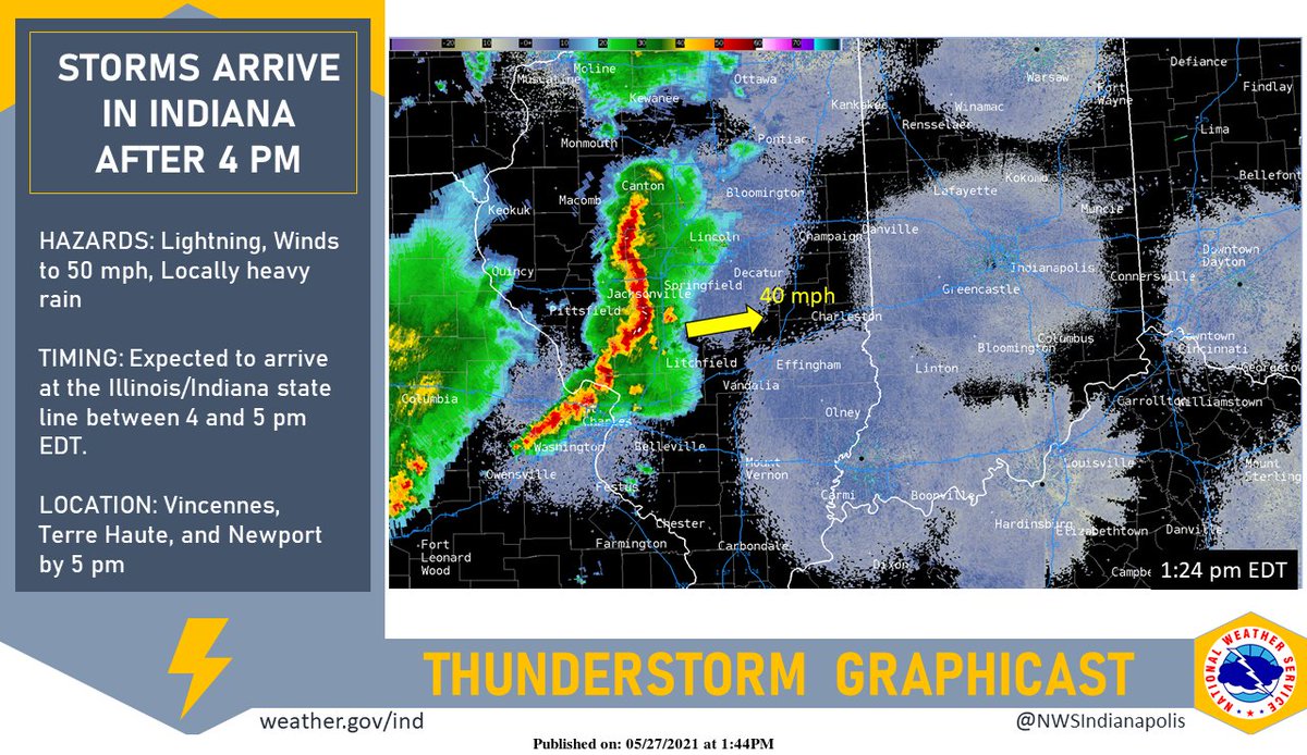
(Via @NWSIndianapolis.) A line of strong to severe storms in Illinois is moving ENE at 40 mph and should cross the state line into Indiana between 4 and 5 pm EDT. Lightning, winds to 50 mph, and locally heavy rainfall will be possible with these storms as they arrive in Indiana. #INwx https://t.co/tngz5OCoAo
My Huge Radar has real-time weather tracking, current temperatures, and severe weather watches and warnings. Get detailed Indiana conditions by clicking here. Follow these links to get my forecasts for Lafayette, Muncie, Hendricks County, and Hamilton County. Need a second opinion? Click here for central Indiana National Weather Service forecasts.
Never miss me! Subscribe for free. My Huge Radar has real-time weather tracking, current temperatures, and severe weather watches and warnings. Get detailed Indiana conditions by clicking here. Click here to see my central Indiana 7-Day Forecast. Follow these links to get my forecasts for Lafayette, Muncie, Hendricks County, and Hamilton County. Need a second opinion? Click here for central Indiana National Weather Service forecasts. (Some charts via WeatherBELL.)


