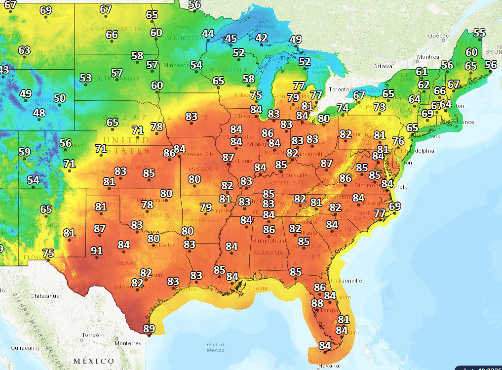
The present record high for April 27 in Indy is 84. If we tie it, it won’t be the first time. It’s happened in 1962, 1986, and 1990.
It’s a toasty Tuesday for much of the country.

There is a marginal (level one out of five) risk of severe thunderstorms tomorrow as a cold front approaches. On the other side Thursday: showers, and highs only around 60 by Friday.
Rain could be heavy Wednesday night into Thursday morning.
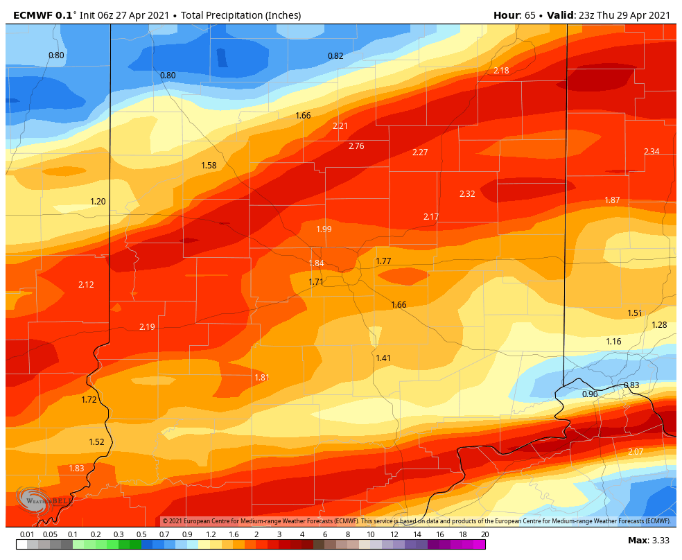
Best guess is around and inch and a half. We’re about three-quarters of an inch behind for the month right now.
Never miss me! Subscribe for free. My Huge Radar has real-time weather tracking, current temperatures, and severe weather watches and warnings. Get detailed Indiana conditions by clicking here. Click here to see my central Indiana 7-Day Forecast. Follow these links to get my forecasts for Lafayette, Muncie, Hendricks County, and Hamilton County. Need a second opinion? Click here for central Indiana National Weather Service forecasts. (Some charts via WeatherBELL.)
INDY SEVEN DAY FORECAST
Today: Mostly sunny. Wind gusting to 35 mph. High 84.
Tonight: Shower or storm chance late. Low 67.
Wednesday: Showers and storms at times. Gusty wind in storms. High 78.
Wednesday Night: Showers and storms. Low 63.
Thursday: Showers likely. High 70.
Thursday Night: Evening showers, then partly cloudy. Low 46.
Friday: Mostly sunny. High 61.
Friday Night: Mostly clear. Low 39.
Saturday: Mostly sunny. High 67.
Saturday Night: Partly cloudy. Low 51.
Sunday: Partly sunny. High 75.
Sunday Night: Partly cloudy. Low 57.
Monday: Partly sunny. Spotty showers and storms. High 78.

Never miss me! Subscribe for free. My Huge Radar has real-time weather tracking, current temperatures, and severe weather watches and warnings. Get detailed Indiana conditions by clicking here. Click here to see my central Indiana 7-Day Forecast. Follow these links to get my forecasts for Lafayette, Muncie, Hendricks County, and Hamilton County. Need a second opinion? Click here for central Indiana National Weather Service forecasts. (Some charts via WeatherBELL.)


