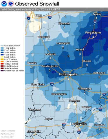
The past week brought the latest snowfall for Indiana since the white stuff flew in May of 1989. It was the second highest snowfall on or after April 20. The two inch total was just behind the 2.4 inches received on May 2, 1897. We also set a record low temperature for April 21 of 26 degrees. The old record was 28 degrees set in 1907. Here’s a chart showing the snow, via the National Weather Service.
Never miss me! Subscribe for free. My Huge Radar has real-time weather tracking, current temperatures, and severe weather watches and warnings. Get detailed Indiana conditions by clicking here. Click here to see my central Indiana 7-Day Forecast. Follow these links to get my forecasts for Lafayette, Muncie, Hendricks County, and Hamilton County. Need a second opinion? Click here for central Indiana National Weather Service forecasts. (Some charts via WeatherBELL.)
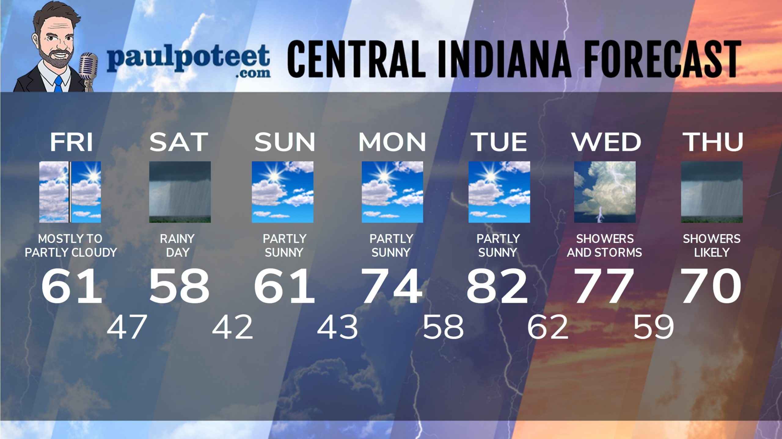
INDY SEVEN DAY FORECAST
Friday: Mostly to partly cloudy. High 61.
Friday Night: Cloudy. Showers after late evening. Low 47.
Saturday: Rainy day. High 58.
Saturday Night: Showers end early, then partly cloudy after midnight. Low 42.
Sunday: Partly sunny. High 61.
Sunday Night: Mostly clear. Low 43.
Monday: Partly sunny. High 74.
Monday Night: Partly cloudy. Low 58.
Tuesday: Partly sunny. High 82.
Tuesday Night: Clouds increase. Showers after midnight. Low 62.
Wednesday: Scattered showers and storms. High 77.
Wednesday Night: Scattered showers and storms. Low 59.
Thursday: Scattered showers. High 70.
Never miss me! Subscribe for free. My Huge Radar has real-time weather tracking, current temperatures, and severe weather watches and warnings. Get detailed Indiana conditions by clicking here. Click here to see my central Indiana 7-Day Forecast. Follow these links to get my forecasts for Lafayette, Muncie, Hendricks County, and Hamilton County. Need a second opinion? Click here for central Indiana National Weather Service forecasts. (Some charts via WeatherBELL.)


