You turned your clocks forward, but Ma Nature is turning the calendar back to the heart of Winter. Winds today will gust to 35 mph, and chills will be in the 20s all day.
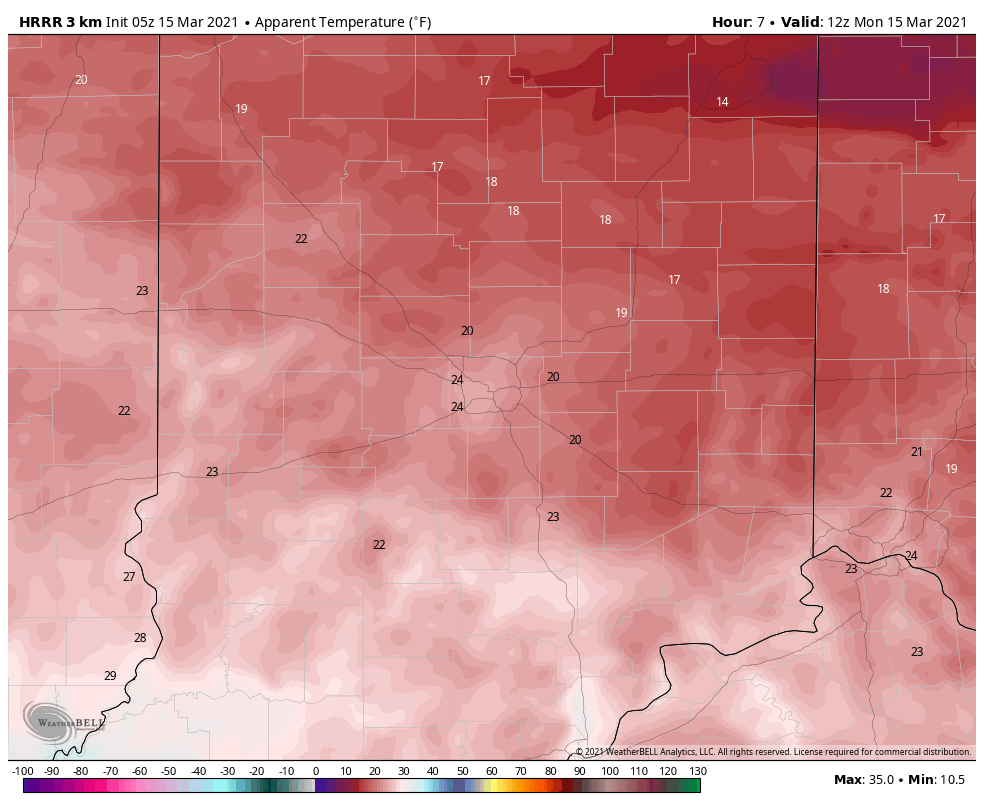
Midday and afternoon rain could mix with a little freezing rain or sleet north of Indianapolis. Little accumulation is expected, and given the mild road temps of the weekend, a major travel problem isn’t likely.
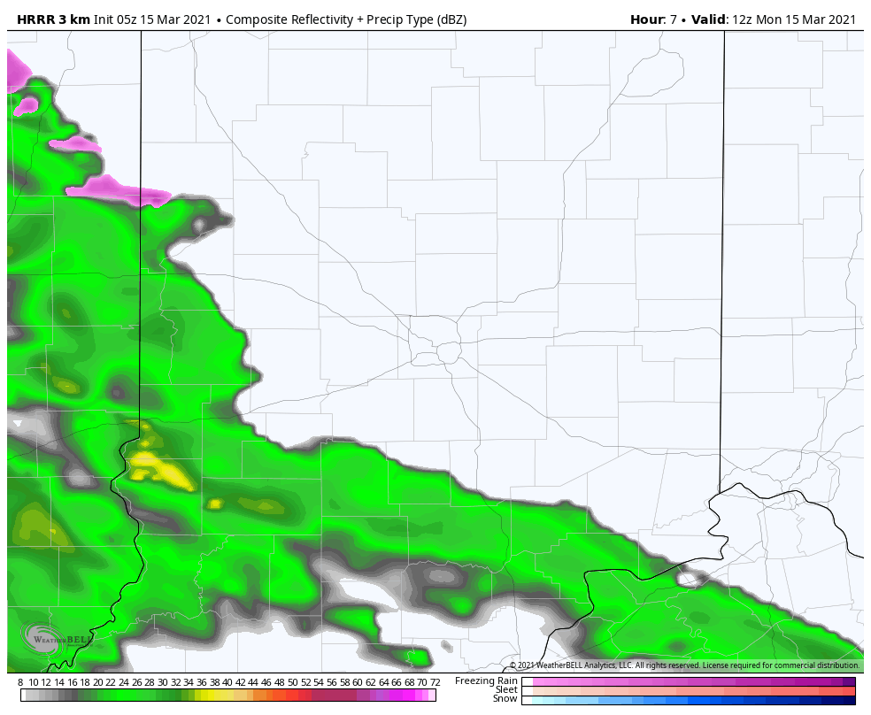
Precipitation totals should be around a half-inch. A bigger system Thursday could put down another inch of rainfall.
Never miss me! Subscribe for free. My Huge Radar has real-time weather tracking, current temperatures, and severe weather watches and warnings. Get detailed Indiana conditions by clicking here. Click here to see my central Indiana 7-Day Forecast. Follow these links to get my forecasts for Lafayette, Muncie, Hendricks County, and Hamilton County. Need a second opinion? Click here for central Indiana National Weather Service forecasts. (Some charts via WeatherBELL.)
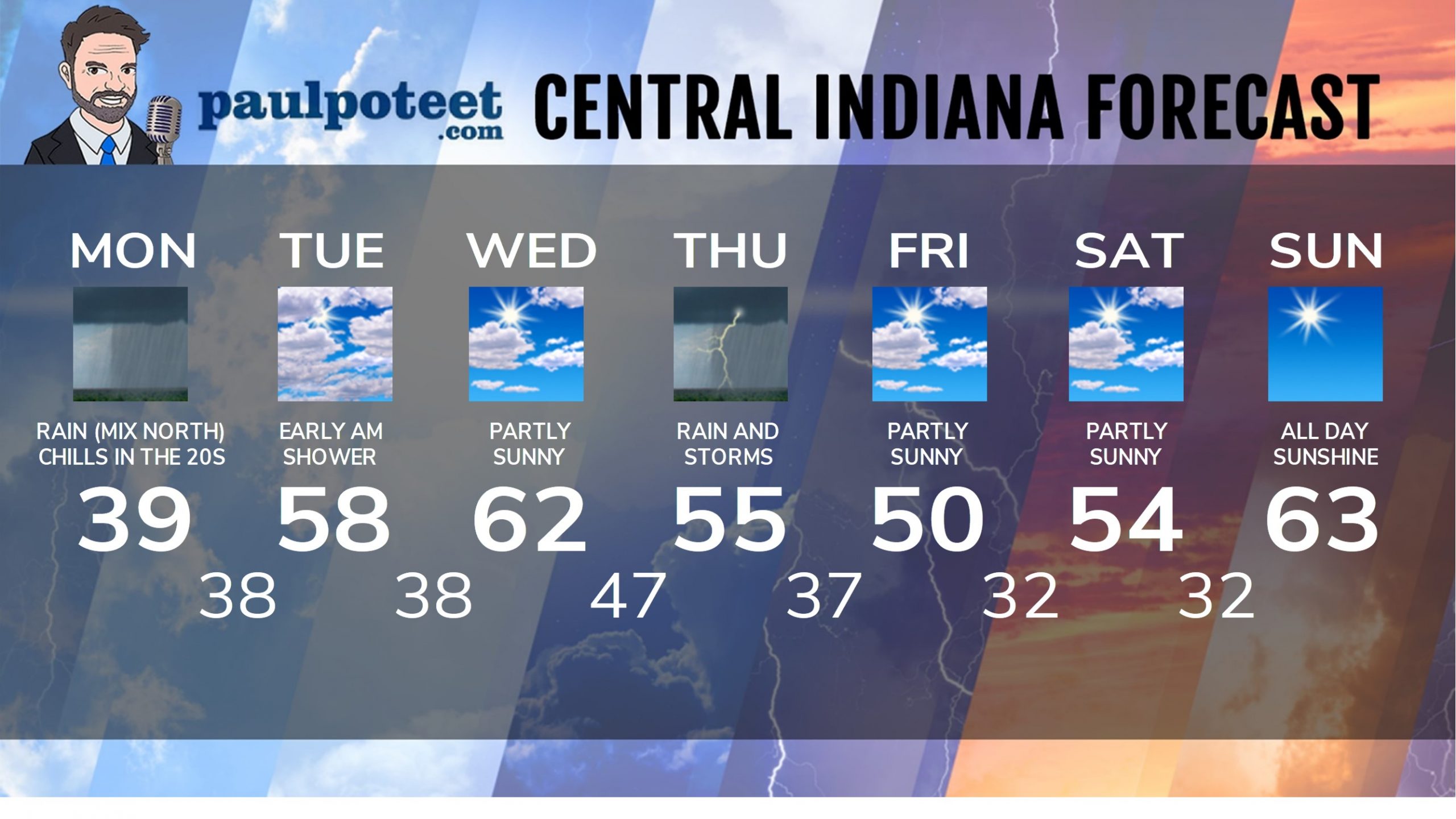
INDY SEVEN DAY FORECAST
Today: Morning showers, possibly mixed with freezing rain or sleet north of Indy. Rain in the afternoon. Wind gusts to 35 mph. Chills in the 20s! High 39.
Tonight: Scattered showers. Wind diminishes after midnight. Low 38.
Tuesday: A lingering early morning shower, then mostly cloudy. High 58.
Tuesday Night: Partly cloudy. Low 38.
Wednesday: Partly sunny. High 62.
Wednesday Night: Showers and storms late evening and overnight. Low 47.
Thursday: Periods of rain. Rumbles of thunder in the morning. High 55.
Thursday Night: Scattered showers. Low 37.
Friday: Partly sunny. High 50.
Friday Night: Partly cloudy. Low 32.
Saturday: Partly sunny. High 54.
Saturday Night: Mostly clear. Low 32.
Sunday: Sunny. High 63.
Never miss me! Subscribe for free. My Huge Radar has real-time weather tracking, current temperatures, and severe weather watches and warnings. Get detailed Indiana conditions by clicking here. Click here to see my central Indiana 7-Day Forecast. Follow these links to get my forecasts for Lafayette, Muncie, Hendricks County, and Hamilton County. Need a second opinion? Click here for central Indiana National Weather Service forecasts. (Some charts via WeatherBELL.)


