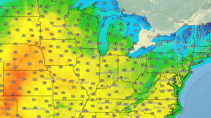
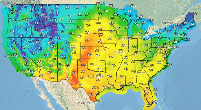
It hasn’t happened yet this year, but it will this week. Can you handle consecutive 60+ degree days in central Indiana? Highs in the Plains will get into the 70s and 80s by Tuesday!
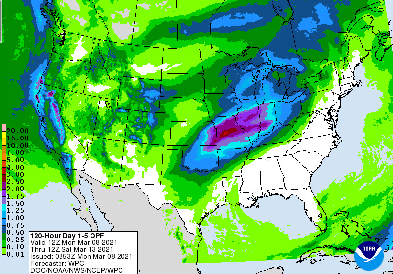
We’ve been soaked with sunshine lately, but the weather will get more active once we’ve added some Gulf Of Mexico moisture to the warm air. Most of the precipitation shown on this chart will come on Thursday and Friday. Expect around an inch in central Indiana.
Never miss me! Subscribe for free. My Huge Radar has real-time weather tracking, current temperatures, and severe weather watches and warnings. Get detailed Indiana conditions by clicking here. Click here to see my central Indiana 7-Day Forecast. Follow these links to get my forecasts for Lafayette, Muncie, Hendricks County, and Hamilton County. Need a second opinion? Click here for central Indiana National Weather Service forecasts. (Some charts via WeatherBELL.)
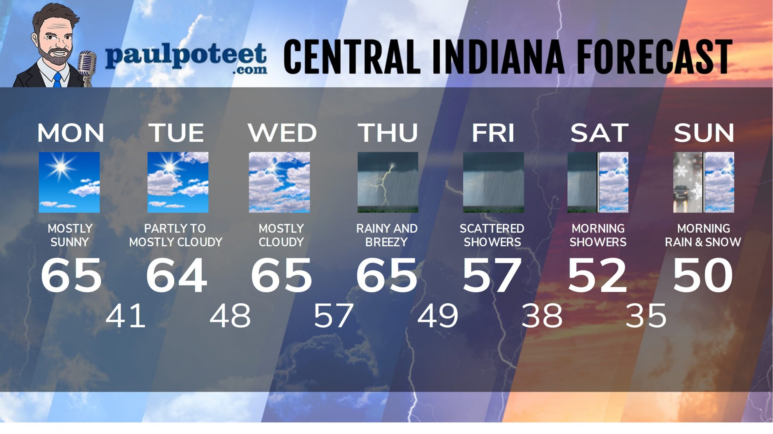
INDY SEVEN DAY FORECAST
Today: Mostly sunny. Wind gusting to 25 mph. High 65.
Tonight: Mostly clear. Low 41.
Tuesday: Partly to mostly cloudy. High 64.
Tuesday Night; Partly cloudy. Low 48.
Wednesday: Mostly cloudy. High 65.
Wednesday Night: Scattered showers. Low 57.
Thursday: Rainy day. Wind gusting to 30 mph. Thunder also possible. High 65.
Thursday Night: Rainy and breezy. Low 49.
Friday: Morning rain. Scattered afternoon showers. High 57.
Friday Night: Scattered showers. Low 38.
Saturday: Cloudy, with mainly morning scattered showers. High 52.
Saturday Night: Scattered rain and snow showers after midnight. Low 35.
Sunday: Morning rain and snow showers. Becoming partly cloudy. High 50.
Never miss me! Subscribe for free. My Huge Radar has real-time weather tracking, current temperatures, and severe weather watches and warnings. Get detailed Indiana conditions by clicking here. Click here to see my central Indiana 7-Day Forecast. Follow these links to get my forecasts for Lafayette, Muncie, Hendricks County, and Hamilton County. Need a second opinion? Click here for central Indiana National Weather Service forecasts. (Some charts via WeatherBELL.)


