Give your snow shovel the rest of the month off! Accumulating snow is not much of a threat over the next ten days, as shown below.

You can put away the shovel, but not your coat. We’ll stay below average through Saturday, although Sunday I think Indy will go above freezing for the first time in over two weeks! The last time was February 5th, when the high hit 34.
Never miss me! Subscribe for free. My Huge Radar has real-time weather tracking, current temperatures, and severe weather watches and warnings. Get detailed Indiana conditions by clicking here. Click here to see my central Indiana 7-Day Forecast. Follow these links to get my forecasts for Lafayette, Muncie, Hendricks County, and Hamilton County. Need a second opinion? Click here for central Indiana National Weather Service forecasts. (Some charts via WeatherBELL.)
INDY SEVEN DAY FORECAST
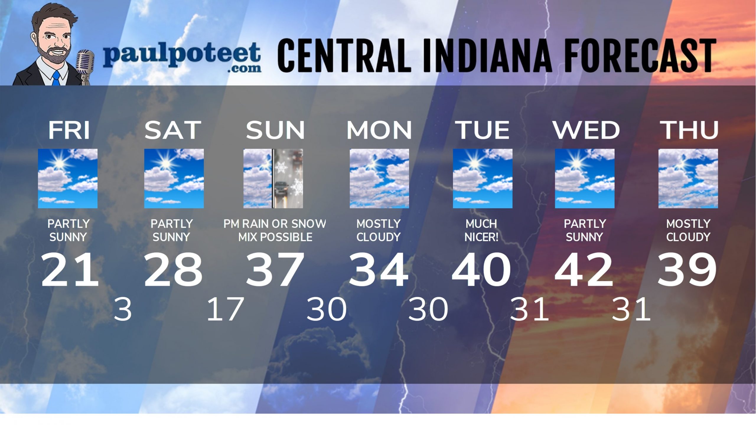
Today: Partly sunny. High 21.
Tonight: Mostly cloudy with a few flurries. Low 3.
Saturday: Partly sunny. A few flurries in the morning. High 28.
Saturday Night: Partly cloudy. Low 17.
Sunday: Mostly cloudy. Rain and snow in the afternoon. High 37.
Sunday Night: Rain, freezing rain, and snow are all possible. Low 30.
Monday: Mostly cloudy. High 34.
Monday Night: Mostly cloudy evening. Partly cloudy overnight. Low 30.
Tuesday: Partly sunny. High 40.
Tuesday Night: Partly cloudy. Low 31.
Wednesday: Partly sunny. High 42.
Wednesday Night: Mostly cloudy. Low 31.
Thursday: Mostly cloudy. High 39.
Never miss me! Subscribe for free. My Huge Radar has real-time weather tracking, current temperatures, and severe weather watches and warnings. Get detailed Indiana conditions by clicking here. Click here to see my central Indiana 7-Day Forecast. Follow these links to get my forecasts for Lafayette, Muncie, Hendricks County, and Hamilton County. Need a second opinion? Click here for central Indiana National Weather Service forecasts. (Some charts via WeatherBELL.)


