One winter weather maker exits to the east Tuesday morning, while another one is poised to pounce tomorrow.

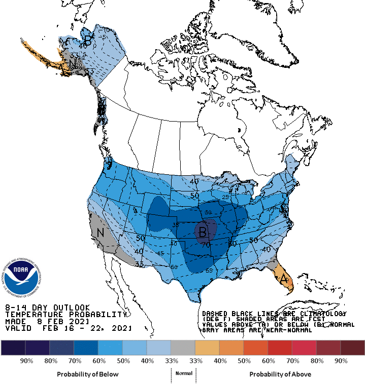
Chills will be in the teens again today, and it looks like most of the month(!) will be quite cold.
Heavy snow of 4-8 inches fell last night in the southern third of the state.
Never miss me! Subscribe for free. My Huge Radar has real-time weather tracking, current temperatures, and severe weather watches and warnings. Get detailed Indiana conditions by clicking here. Click here to see my central Indiana 7-Day Forecast. Follow these links to get my forecasts for Lafayette, Muncie, Hendricks County, and Hamilton County. Need a second opinion? Click here for central Indiana National Weather Service forecasts. (Some charts via WeatherBELL.)
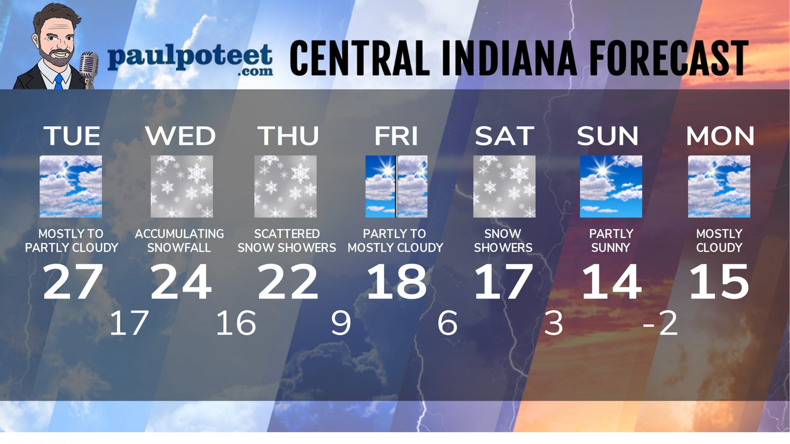
INDY SEVEN DAY FORECAST
Today: Mostly to partly cloudy. Freezing drizzle or flurries possible in the morning. High 27.
Tonight: Mostly cloudy. Low 17.
Wednesday: Accumulating snow is likely. High 24.
Wednesday Night: Snow is likely. Totals from 1-3 inches. Low 16.
Thursday: Cloudy, with scattered snow showers. High 22.
Thursday Night: Scattered snow showers. Low 9.
Friday: Partly to mostly cloudy. High 18.
Friday Night: Mostly cloudy. Low 6.
Saturday: Mostly cloudy. Snow showers possible. High 17.
Saturday Night: Snow showers. Low 3.
Sunday: Partly sunny. High 14.
Sunday Night: Partly cloudy. Low -2.
Monday: Mostly cloudy. High 15.
Never miss me! Subscribe for free. My Huge Radar has real-time weather tracking, current temperatures, and severe weather watches and warnings. Get detailed Indiana conditions by clicking here. Click here to see my central Indiana 7-Day Forecast. Follow these links to get my forecasts for Lafayette, Muncie, Hendricks County, and Hamilton County. Need a second opinion? Click here for central Indiana National Weather Service forecasts. (Some charts via WeatherBELL.)


